Related Research Articles

Pocahontas County is a county located in the U.S. state of West Virginia. As of the 2010 census, the population was 8,719. Its county seat is Marlinton. The county was established in 1821. It is named after the daughter of the Powhatan chief of the Native Americans in the United States from Jamestown, Virginia. She married an English settler and their children became ancestors of many of the First Families of Virginia.

The Allegheny Mountain Range, informally the Alleghenies and also spelled Alleghany and Allegany, is part of the vast Appalachian Mountain Range of the Eastern United States and Canada and posed a significant barrier to land travel in less developed eras. The barrier range has a northeast–southwest orientation and runs for about 400 miles (640 km) from north-central Pennsylvania, through western Maryland and eastern West Virginia, to southwestern Virginia.

The Allegheny Front is the major southeast- or east-facing escarpment in the Allegheny Mountains in southern Pennsylvania, western Maryland, and eastern West Virginia, USA. The Allegheny Front forms the boundary between the Ridge-and-Valley Appalachians to its east and the Appalachian Plateau to its west. The Front is closely associated with the Appalachian Mountains' Eastern Continental Divide, which in this area divides the waters of the Ohio/Mississippi river system, flowing to the Gulf of Mexico, from rivers flowing into Chesapeake Bay and from there into the Atlantic Ocean.

The South Branch Potomac River has its headwaters in northwestern Highland County, Virginia near Hightown along the eastern edge of the Allegheny Front. After a river distance of 139 miles (224 km), the mouth of the South Branch lies east of Green Spring in Hampshire County, West Virginia where it meets the North Branch Potomac River to form the Potomac.

The Greenbrier River is a tributary of the New River, 162 miles (261 km) long, in southeastern West Virginia, in the United States. Via the New, Kanawha and Ohio rivers, it is part of the watershed of the Mississippi River, draining an area of 1,656 square miles (4,290 km2). It is one of the longest rivers in West Virginia.
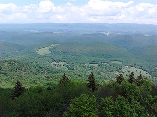
Bald Knob is the highest summit of Back Allegheny Mountain in Pocahontas County, West Virginia and is part of Cass Scenic Railroad State Park. At an altitude of 4,843 feet (1,476 m) above sea level, Bald Knob is the third-highest point in West Virginia and the Allegheny Mountains.

Cass Scenic Railroad State Park is a state park and heritage railroad located in Cass, Pocahontas County, West Virginia.
The Cherry River is a tributary of the Gauley River in southeastern West Virginia in the United States. Via the Gauley, Kanawha and Ohio rivers, it is part of the watershed of the Mississippi River. The Cherry River drains mostly rural and forested areas and flows for much of its length through the Monongahela National Forest. Throughout its entire length the Cherry goes over a series of whitewater rapids in a mountainous setting.
The Potomac Highlands of West Virginia centers on five West Virginian counties in the upper Potomac River watershed in the western portion of the state's Eastern Panhandle, bordering Maryland and Virginia. Because of geographical proximity, similar topography and landscapes, and shared culture and history, the Potomac Highlands region also includes Pocahontas, Randolph, and Tucker counties, even though they are in the Monongahela River or New River watersheds and not that of the Potomac River.
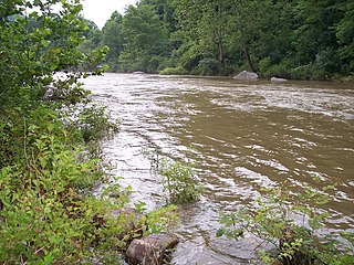
Knapp Creek is a tributary stream of the Greenbrier River in Pocahontas County, West Virginia. Its source is east of the community of Frost on Allegheny Mountain. From its headwaters, Knapp Creek slowly flows down through farmland until its confluence with Laurel Creek at Minnehaha Springs. Downstream from the confluence of the two streams, Knapp Creek flows through Huntersville. Six miles from Huntersville, Knapp Creek empties into the Greenbrier River outside Marlinton.

Cheat Mountain is an exceptionally high and rugged ridge situated in the Allegheny Mountains of eastern West Virginia, USA. It is about 50 miles (80 km) long and more than five miles (8 km) wide at its widest. Its highest point is at its southernmost end at Thorny Flat, which has an elevation of 4,848 feet (1,478 m). Several other knobs rise above 4,000 feet (1,200 m) along its length.

The Greenbrier River Trail (GRT), is a lineal state park comprising a 77.1-mile (124.1 km) rail trail between North Caldwell and Cass in eastern West Virginia.
Powell Mountain is a mountain ridge of the Ridge-and-valley Appalachians of the Appalachian Mountains. It is a long and narrow ridge, running northeast to southwest, from about Norton, Virginia to near Tazewell, Tennessee. It separates the Clinch River basin and the Powell River basin of Powell Valley. It was named for an 18th-century explorer.

Glady Fork is a 31.9-mile-long (51.3 km) river in the Allegheny Mountains of eastern West Virginia, USA. It is considered one of the five principal headwaters tributaries of the Cheat River — known as the Forks of Cheat.

Nesquehoning Creek is an east flowing 14.9-mile-long (24.0 km) tributary of the Lehigh River in northeastern Pennsylvania in the United States.

Back Allegheny Mountain is a long mountain ridge in eastern West Virginia. It is part of the Shavers Fork Mountain Complex in the Allegheny Range of the Appalachians.
Droop Mountain is a small mountain in the Allegheny Mountains on the border of Greenbrier and Pocahontas counties in southeastern West Virginia. It was the scene of one of West Virginia's most important battles during the American Civil War—the Battle of Droop Mountain.
Warren Elmer "Tweard" Blackhurst was an author and a lifelong resident of the Cass community who centered on the culture of eastern West Virginia where the higher elevations supported northern pine forests. "Riders of the Flood" which is arguably the most well-known of Blackhurst's books, for it centers on the world of the late 19th to early 20th-century logging industry in eastern West Virginia through the Greenbrier River and its tributaries.

Spruce Mountain, in eastern West Virginia, USA, is the highest ridge of the Allegheny Mountains. The "whale-backed" ridge extends for only about 16 miles (26 km), from northeast to southwest, but several of its peaks exceed 4,500 feet (1,400 m) in elevation. The summit, Spruce Knob, is celebrated as the highest point in the state as well as the range, which covers parts of four states.

The Big Draft Wilderness is a 5,144-acre (2,082 ha) U.S. Wilderness area in the Monongahela National Forest of southeast West Virginia, USA. Its name derives from the nearby Big Draft, a tributary of Anthony Creek which is a tributary of the Greenbrier River. Big Draft Wilderness occupies the southernmost acreage of the Monongahela National Forest and is located just south of the Blue Bend Recreation Area. The town White Sulphur Springs lies about 5 miles south of the Wilderness and about 15 miles northeast of Lewisburg.
References
- 1 2 U.S. Geological Survey Geographic Names Information System: Leatherbark Run
- ↑ Kenny, Hamill (1945). West Virginia Place Names: Their Origin and Meaning, Including the Nomenclature of the Streams and Mountains. Piedmont, WV: The Place Name Press. p. 365.
| | This article about a location in Pocahontas County, West Virginia is a stub. You can help Wikipedia by expanding it. |