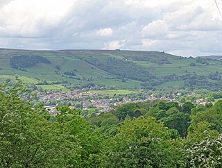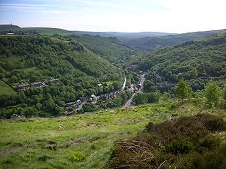
Brighouse is a town within the metropolitan borough of Calderdale, in West Yorkshire, England. Historically within the West Riding of Yorkshire, it is situated on the River Calder, 4 miles (6.4 km) east of Halifax. It is served by Junction 25 of the M62 motorway and Brighouse railway station on the Caldervale Line and Huddersfield Line. In the town centre is a mooring basin on the Calder and Hebble Navigation. The United Kingdom Census 2001 gave the Brighouse / Rastrick subdivision of the West Yorkshire Urban Area a population of 32,360. The Brighouse ward of Calderdale Council gave a population of 11,195 at the 2011 Census. Brighouse has a HD6 postcode.

Wakefield is a cathedral city in West Yorkshire, England located on the River Calder. The city had a population of 109,766 in the 2021 census, up from 99,251 in the 2011 census. The city is the administrative centre of the wider Metropolitan Borough of Wakefield, which had a 2021 population of 353,802, the 25th most populous district in England. It is part of the West Yorkshire Built-up Area and the Yorkshire and The Humber region.

Mirfield is a town and civil parish in the Metropolitan Borough of Kirklees, West Yorkshire, England. Historically part of the West Riding of Yorkshire, it is on the A644 road between Brighouse and Dewsbury. At the 2011 census it had a population of 19,563. Mirfield forms part of the Heavy Woollen District.

Mytholmroyd is a large village and former civil parish, now in the parish of Hebden Royd, in the Calderdale district, in West Yorkshire, England, 2 miles (3 km) east of Hebden Bridge. It lies in the Upper Calder Valley, 10 miles (16 km) east of Burnley and 7 miles (11 km) west of Halifax. The village, which has a population of approximately 4,000, is in the Luddendenfoot Ward of Calderdale Council.

Calderdale is a metropolitan borough of West Yorkshire, England, which had a population of 211,439. It takes its name from the River Calder, and dale, a word for valley. The name Calderdale usually refers to the borough through which the upper river flows, while the actual landform is known as the Calder Valley. Several small valleys contain tributaries of the River Calder. The main towns of the borough are Brighouse, Elland, Halifax, Hebden Bridge, Sowerby Bridge and Todmorden.

Horbury is a town in the City of Wakefield in West Yorkshire, England. Historically in the West Riding of Yorkshire, it is situated north of the River Calder about three miles (5 km) south west of Wakefield and two miles (3 km) to the south of Ossett. It includes the outlying areas of Horbury Bridge and Horbury Junction. At the 2001 census the Horbury and South Ossett ward of Wakefield Metropolitan District Council had a population of 10,002. At the 2011 census the population was 15,032. Old industries include woollens, engineering and building wagons for the railways. Horbury forms part of the Heavy Woollen District.

The Huddersfield Broad Canal or Sir John Ramsden's Canal, is a wide-locked navigable canal in West Yorkshire in northern England. The waterway is 3.75 miles (6 km) long and has 9 wide locks. It follows the valley of the River Colne and connects the Calder and Hebble Navigation at Cooper Bridge junction with the Huddersfield Narrow Canal near Aspley Basin in Huddersfield.

The Calder Valley line is a railway route in Northern England between the cities of Leeds and Manchester as well as the seaside resort of Blackpool. It is the slower of the two main rail routes between Leeds and Manchester, and the northernmost of the three main trans-Pennine routes.

Mirfield railway station serves the town of Mirfield in West Yorkshire, England. It lies on the Huddersfield Line and is managed by both Northern and Grand Central train operating companies, and is served by TransPennine Express as well. The station is 4 miles (6 km) north east from Huddersfield.

Ferrybridge is a village in West Yorkshire, England. Ferrybridge lies at a historically important crossing of the River Aire which borders the North Yorkshire village of Brotherton. It is linked to other communities by the A1, which follows the route of the Great North Road. The village falls within the Knottingley ward of Wakefield City Council.

The River Calder is a major tributary of the River Ribble in Lancashire, England, and is around 20 miles (32 km) in length.

Healey is a small village and industrial district on the east bank of the River Calder in the southwestern outskirts of Ossett, near Wakefield in West Yorkshire, England. It developed during the industrial revolution when three cloth and fulling mills were built.

The Selby Canal is a 6-mile (9.7 km) canal with 2 locks which bypasses the lower reaches of the River Aire in Yorkshire, England, from the village of West Haddlesey to the town of Selby where it joins the River Ouse. It opened in 1778, and provided the main outlet for the Aire and Calder Navigation until 1826, when it was bypassed by a new cut from Ferrybridge to Goole. Selby steadily declined after that, although traffic to York still used the canal.

The River Don Navigation was the result of early efforts to make the River Don in South Yorkshire, England, navigable between Fishlake and Sheffield. The Dutch engineer Cornelius Vermuyden had re-routed the mouth of the river in 1626, to improve drainage, and the new works included provision for navigation, but the scheme did not solve the problem of flooding, and the Dutch River was cut in 1635 to link the new channel to Goole. The first Act of Parliament to improve navigation on the river was obtained in 1726, by a group of Cutlers based in Sheffield; the Corporation of Doncaster obtained an Act in the following year for improvements to the lower river. Locks and lock cuts were built and by 1751 the river was navigable to Tinsley.

Rastrick Bridge crosses the River Calder in Brighouse, West Yorkshire, England. It was built in 1558 as a replacement for an earlier wooden bridge and rebuilt c1750.

The Chantry Chapel of St Mary the Virgin is a chantry chapel in Wakefield, West Yorkshire, England, and is designated a Grade I Listed building by English Heritage. It is located south of the city centre on the medieval Chantry Bridge over the River Calder. It is the only survivor of four chantries in Wakefield and the oldest and most ornate of the surviving bridge chapels in England. Others are at St Ives (Cambridgeshire), Rotherham, Derby and Bradford-on-Avon. The chapel has had three west fronts, the original medieval façade having been removed to Kettlethorpe Hall in 1832. The medieval bridge is a scheduled ancient monument.

The River Calder is a river in West Yorkshire, in Northern England.

The Heaton Lodge and Wortley Railway was constructed by the London and North Western Railway, to provide a duplicate route between Huddersfield and Leeds, leaving the existing line at Heaton Lodge junction, east of Huddersfield and rejoining it at Farnley junction, south west of Leeds. During construction it became known as the Leeds New Line and following nationalisation it was referred to as the Spen Line. Passenger services ceased in the 1950s with full closure in stages between 1960 and 1990.
Ledgard is a surname. Notable people with the surname include:
Mirfield is a civil parish in the metropolitan borough of Kirklees, West Yorkshire, England. It contains 47 listed buildings that are recorded in the National Heritage List for England. Of these, two are listed at Grade II*, the middle of the three grades, and the others are at Grade II, the lowest grade. The list also includes two listed buildings outside the parish but in Mirfield ward; both of these are at Grade II. The parish contains the town of Mirfield and the surrounding area. Most of the listed buildings are houses and associated structures, cottages, farmhouses and farm buildings. The Calder and Hebble Navigation and the River Calder pass through the parish, and the listed buildings associated with them are two locks, two lock keeper's cottages, a road bridge, and two railway bridges. The other listed buildings include churches and items in or near churchyards, a railway underbridge, and a war memorial.


