
The Murrumbidgee River is a major tributary of the Murray River within the Murray–Darling basin and the second longest river in Australia. It flows through the Australian state of New South Wales and the Australian Capital Territory, descending 1,500 metres (4,900 ft) over 1,485 kilometres (923 mi), generally in a west-northwesterly direction from the foot of Peppercorn Hill in the Fiery Range of the Snowy Mountains towards its confluence with the Murray River near Boundary Bend.
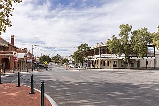
Narrandera, until around 1949 also spelled "Narandera", is a town located in the Riverina region of south-western New South Wales, Australia. The town lies on the junction of the Newell and Sturt highways, adjacent to the Murrumbidgee River, and it is considered the gateway to the Murrumbidgee Irrigation Area. At the 2016 census, Narrandera had a population of 3746 people.
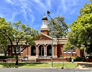
Griffith is a major regional city in the north-western Riverina region of New South Wales, known commonly as the food bowl of Australia. It is also the seat of the City of Griffith local government area. Like the Australian capital, Canberra, and extensions to the nearby town of Leeton, Griffith was designed by Walter Burley Griffin and Marion Mahony Griffin. Griffith was named after Arthur Hill Griffith, the then New South Wales Secretary for Public Works. Griffith was proclaimed a city in 1987, and at the 2021 census had a population of 20,569.

Leeton is a town located in the Riverina region of New South Wales, Australia. It is situated in the Murrumbidgee Irrigation Area. It is the administrative centre of the Leeton Shire Council local government area, which includes neighbouring suburbs, towns and localities such as Yanco, Wamoon, Whitton, Gogeldrie, Stanbridge and Murrami.

Yanco is a village with a population of 432 in Leeton Shire in south western New South Wales, Australia. Yanco is a Wiradjuri aboriginal language word meaning the sound of running water. Yanco is located 3 kilometres (1.9 mi) from Leeton along Irrigation Way. Yanco is home to the Powerhouse Museum, McCaughey Park, Murrumbidgee Rural Studies Centre and Yanco Agricultural High School. Murrumbidgee Irrigation builds the Roach’s Surge Reservoir near Yanco, holding up to 5 million tonnes of water.
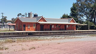
Leeton railway station is a heritage-listed former goods yard and railway station and now bus station and railway station located on the Yanco–Griffith line at Dunn Avenue in Leeton in the Leeton Shire local government area of New South Wales, Australia. It is also known as Leeton Railway Station and yard group. The property was added to the New South Wales State Heritage Register on 2 April 1999.

Leeton Shire is a local government area in the Riverina region of New South Wales, Australia. The Shire is located adjacent to the Murrumbidgee River and falls within the Murrumbidgee Irrigation Area.

Group 20 is a rugby league competition in the region of Griffith, New South Wales, Australia. The competition is played in six grades, with these being Under 16s, Under 18s, Women's League-Tag, Women's Tackle, Reserve Grade and First Grade.

The Yanco Agricultural High School, abbreviated as YAHS, is a government-funded co-educational academically selective and specialist secondary boarding school, located in Yanco in the Leeton Shire local government area, in the Riverina region of New South Wales, Australia.

Irrigation Way is a major rural road that runs approximately 85 kilometres (53 mi) through the Murrumbidgee Irrigation Area in south western New South Wales, Australia.

The Murrumbidgee Irrigation Area (MIA) is geographically located within the Riverina area of New South Wales. It was created to control and divert the flow of local river and creek systems for the purpose of food production. The main river systems feeding and fed by the area are the Murrumbidgee and the Tumut. It is one of the most diverse and productive regions in Australia contributing over A$5 billion annually to the Australian economy.
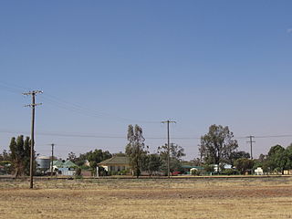
Grong Grong is a small town that is located in the Riverina region of New South Wales, Australia. The town is situated on the Newell Highway, 23 kilometres (14 mi) east of Narrandera in the Shire of Narrandera.

Whitton is a small town located in Leeton Shire in the Australian state of New South Wales and is located 23km west of the Leeton township. Founded in 1850, it is named after John Whitton (1820–98), Engineer-in-Charge of the New South Wales Government Railways. The railway reached Whitton in 1881. At the 2016 census, Whitton had a population of 496.

Murrumbidgee Irrigation Limited (MI) is one of five privately owned irrigation companies in New South Wales, Australia. It provides irrigation water and drainage services to an area known as the Murrumbidgee Irrigation Area (MIA). MI manages A$500 million of infrastructure assets, has an annual turnover of $40 million, and services over A$2.5 billion in water entitlements.

The Irrigator, formerly The Murrumbidgee Irrigator, is a weekly newspaper published in Leeton, New South Wales, Australia, since 1915.
Wooden Wicket, Berembed Weir is a heritage-listed wooden weir component at Berembed Weir, Murrumbidgee River, Matong, City of Wagga Wagga, New South Wales, Australia. It was made in 1910 at Fitzroy Dock in Sydney. It was added to the New South Wales State Heritage Register on 2 April 1999.

Berembed Weir is a heritage-listed reservoir on the Murrumbidgee River at Matong, in the Riverina region of New South Wales, Australia. It was designed by Ernest de Burgh and built from 1909 to 1910 by the New South Wales Department of Public Works. It is also known as Berembed Diversion Weir. It was added to the New South Wales State Heritage Register on 2 April 1999.

Yanco Weir is a heritage-listed weir at Yanco, Leeton Shire, New South Wales, Australia. It was built from 1928 to 1929 by WC & IC. It is also known as Yanco Weir and site. The property is owned by Department of Planning and Infrastructure, a department of the Government of New South Wales. It was added to the New South Wales State Heritage Register on 2 April 1999.

The Gogeldrie Weir is a heritage-listed former weir and now recreation area and weir at Murrumbidgee River near Narrandera, Leeton Shire, New South Wales, Australia. It was designed and built by WC & IC from 1958 to 1959. It was added to the New South Wales State Heritage Register on 2 April 1999.

The Leeton District Lands Office is a heritage-listed administration office located at Chelmsford Place, Leeton in the Leeton Shire local government area of New South Wales, Australia. It was designed by J. M. S. Woore of the Water Conservation and Irrigation Commission and built in 1937. It is also known as the Water Conservation and Irrigation Commission. The property is owned by Department of Planning and Infrastructure, a department of the Government of New South Wales. It was added to the New South Wales State Heritage Register on 2 April 1999.


