Lefagaoali'i | |
---|---|
Village | |
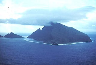
View of Lefagaoali'i from the south at Mata o le Alelo pool | |
Coordinates: 13°28′1″S172°25′16″W / 13.46694°S 172.42111°W Coordinates: 13°28′1″S172°25′16″W / 13.46694°S 172.42111°W | |
Country | |
District | Gagaifomauga |
Population (2006) | |
• Total | 469 |
Time zone | -11 |
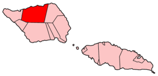
Lefagaoali'i is a village on the central north coast of Savai'i island in Samoa. [1] The village is in the electoral district of Gagaifomauga. [2]
Savaiʻi is the largest and highest island in Samoa and the Samoan Islands chain. The island is the fifth largest in Polynesia, behind the two main islands of New Zealand and the Hawaiian Islands of Hawaii and Maui.
Samoa, officially the Independent State ofSamoa and, until 4 July 1997, known as Western Samoa, is a country consisting of two main islands, Savai'i and Upolu, and four smaller islands. The capital city is Apia. The Lapita people discovered and settled the Samoan Islands around 3,500 years ago. They developed a unique Samoan language and Samoan cultural identity.
The settlement is situated on a thin spit of land with the ocean on the north side and an inland lake with mangroves on the south side which flows out to the open sea through a gap at the west end of the village. The main island road circling Savai'i passes the village at the east end at the bottom of a steep hill. At the base of the cliffs at the east end of the village, and by the sea, are freshwater springs used by the people of Lefagaoali'i and neighbouring villages.
To the east of Lefagaoali'i are the villages of Samauga and Safotu. On the south and towards the west are Safune, Faletagaloa and Sasina.
Samauga is a village on the central north coast of Savai'i island in Samoa. The village is in the electoral district of Gagaifomauga.
Safotu is a village on the central north coast of Savai'i island in Samoa. Safotu is in the district Gagaifomauga. Traditionally, it attained the status of 'Pule,' customary political authority, and has been the main centre of the Gagaifomauga district.
Safune is a traditional village district on the central north coast of Savai'i island in Samoa. It lies within the electoral constituency of Gaga'ifomauga. Safune is the birthplace of Mau leader Olaf Frederick Nelson and the filming location of Moana, one of the first documentaries made in the world. The Mata o le Alelo pool associated with the Sina and the Eel Polynesian legend is also in Safune.
There are reef breaks for surfing directly in front of the village although the waves are not for the inexperienced.
Surfing is a surface water sport in which the wave rider, referred to as a surfer, rides on the forward or deep face of a moving wave, which usually carries the surfer towards the shore. Waves suitable for surfing are primarily found in the ocean, but can also be found in lakes or rivers in the form of a standing wave or tidal bore. However, surfers can also utilize artificial waves such as those from boat wakes and the waves created in artificial wave pools.
The country of Samoa consists of the two large islands of Upolu and Savai'i and eight smaller islands located about halfway between Hawaii and New Zealand in the Polynesian region of the South Pacific Ocean. The island of Upolu is home to nearly three-quarters of Samoa's population and its capital city of Apia. Samoa occupies an almost central position within Polynesia. The climate is tropical, with a rainy season from November to April. To the east is the smaller American Samoa.
Upolu is an island in Samoa, formed by a massive basaltic shield volcano which rises from the seafloor of the western Pacific Ocean. The island is 75 kilometres long and 1,125 square kilometres in area, making it the second largest of the Samoan Islands geographically. With approximately 145,000 people, it is by far the most populated of the Samoan Islands. Upolu is situated to the southeast of Savai'i, the "big island". Apia, the capital, is in the middle of the north coast, with Faleolo International Airport at the western end of the island. The island has not had any historically recorded eruptions, although three lava flows date back only a few hundred to a few thousand years.
The Samoan Islands are an archipelago covering 3,030 km2 (1,170 sq mi) in the central South Pacific, forming part of Polynesia and the wider region of Oceania. Administratively, the archipelago comprises all of Samoa and most of American Samoa. The two Samoan jurisdictions are separated by 64 km (40 mi) of ocean.
Salelologa is a village district at the east end of Savai'i island in Samoa. It is the main entry point into the island with the only ferry terminal on Savai'i. It also serves as the main township for shopping and public amenities with a market selling fresh produce and arts and crafts.
Apolima is the smallest of the four inhabited islands of Samoa and situated in the Apolima Strait, between the country's two largest islands Upolu to the east and Savai'i to the west.
Gaga'emauga is a district on the island of Savai'i in Samoa. The district is situated on the central north side of Savai'i. The name Gaga'emauga literally means "near side of the mountain", meaning the eastern side of the mountain chain running through the centre of Savai'i Island.
Gaga'ifomauga is a political district on the island of Savai'i in Samoa. The district is situated on the northern side of the island with a population of 4,770.
Matautu is the name of different villages in Samoa. Places named Matautu are found on the two largest islands, Upolu and Savai'i.
Patamea is a village on the island of Savai'i in Samoa. While most villages on Savai'i are situated near the sea, Patamea is situated inland, away from the coast. The village is in the Gaga'emauga political district near the central north coast of the island.
Not to be confused with Fagamalo, American Samoa
Sato'alepai is a village situated on the central north coast of the island of Savai'i in Samoa. Sato'alepai is in the political district of Gaga'emauga.
Mata o le Alelo is a village pool in Samoa associated with the Polynesian legend Sina and the Eel.
Mt Matavanu is an active volcano on the island of Savai'i in Samoa.
Tuasivi is a village situated on the north east coast of Savai'i island in Samoa. The village is in the electoral political district of Fa'asaleleaga.
Manase is a village on the central north coast of Savai'i island in Samoa in the political district of Gagaifomauga. Situated by the sea with a white sandy beach, Manase has become a popular tourist destination since the 1990s with low budget and locally owned beach fale accommodation.
Asau is situated on the north west coast of Savai'i island in Samoa. It is the capital village of the Vaisigano political district and serves as the main business centre at the west end of the island.
Archaeology of Samoa began with the first systematic survey of archaeological remains on Savai'i island by Jack Golson in 1957. Since then, surveys and studies in the rest of Samoa have uncovered major findings of settlements, stone and earth mounds including star mounds, Lapita pottery remains and pre-historic artifacts.
This article about a geographical location in Samoa is a stub. You can help Wikipedia by expanding it. |