
Leffinge, sometimes Leffingen in English, is a historic village in Belgium, now part of the municipality of Middelkerke, province of West Flanders.

Leffinge, sometimes Leffingen in English, is a historic village in Belgium, now part of the municipality of Middelkerke, province of West Flanders.

In 1137 the castellan of Saint-Omer confirmed the gift of the church in Leffinge to the Knights Templar. The medieval church was damaged in 1488, repaired around 1500, and demolished in 1857. The current neo-Gothic church was built 1877-1879 and restored in 1983. [1]
A preliminary action of the Battle of Nieuwpoort (1600) was fought in Leffinge, in which Scottish mercenaries in Dutch service particularly distinguished themselves. [2]

Italy is located in southern Europe and comprises the long, boot-shaped Italian Peninsula, the southern side of Alps, the large plain of the Po Valley and some islands including Sicily and Sardinia. Corsica, although belonging to the Italian geographical region, has been a part of France since 1769. Italy is part of the Northern Hemisphere.

Maasbracht is a town in the southeastern Netherlands. It was a separate municipality until January 1, 2007, when it became a part of the new municipality of Maasgouw. Football player Mark van Bommel was born in Maasbracht.
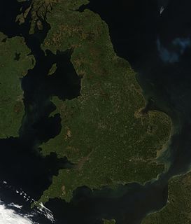
England comprises most of the central and southern two-thirds of the island of Great Britain, in addition to a number of small islands of which the largest is the Isle of Wight. England is bordered to the north by Scotland and to the west by Wales. It is closer to continental Europe than any other part of mainland Britain, divided from France only by a 33 km (21 mi) sea gap, the English Channel. The 50 km (31 mi) Channel Tunnel, near Folkestone, directly links England to mainland Europe. The English/French border is halfway along the tunnel.
Berezovo or Beryozovo (Берёзово) is the name of several inhabited localities in Russia. The name is derived from the Russian береза (bereza), "birch."
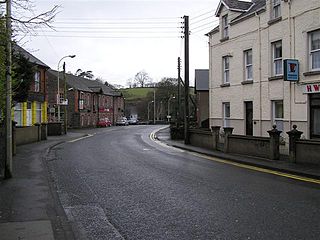
Cullybackey or Cullybacky is a village in County Antrim, Northern Ireland. It lies 3 miles north-west of Ballymena, on the banks of the River Main, and is part of Mid and East Antrim district. It is a predominantly Protestant area. It had a population of 2,569 people in the 2011 Census.

Rumpt is a village in the Betuwe region in the Netherlands. It is a part of the municipality of Geldermalsen, and is situated about halfway between Utrecht and Den Bosch, on the Linge river.
John Douglas was Archbishop of St. Andrews from 1572 to 1574. As was tradition from the fifteenth to the seventeenth centuries, the Archbishop would take on the role of Chancellor of the University of St Andrews, as the University had strong links with the Pre-Reformation church.

Ożegów is a village in the administrative district of Gmina Siemkowice, within Pajęczno County, Łódź Voivodeship, in central Poland. It lies approximately 3 kilometres (2 mi) south-west of Siemkowice, 9 km (6 mi) north-west of Pajęczno, and 78 km (48 mi) south-west of the regional capital Łódź.
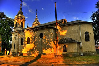
Chorzęcin is a village in the administrative district of Gmina Tomaszów Mazowiecki, within Tomaszów Mazowiecki County, Łódź Voivodeship, in central Poland. It lies approximately 10 kilometres (6 mi) west of Tomaszów Mazowiecki and 40 km (25 mi) south-east of the regional capital Łódź.

Złotniki Wielkie is a village in the administrative district of Gmina Żelazków, within Kalisz County, Greater Poland Voivodeship, in west-central Poland. It lies approximately 16 kilometres (10 mi) north-east of Kalisz and 104 km (65 mi) south-east of the regional capital Poznań.

Darnowiec is a village in the administrative district of Gmina Rychtal, within Kępno County, Greater Poland Voivodeship, in west-central Poland. It lies approximately 5 kilometres (3 mi) north-east of Rychtal, 14 km (9 mi) south-west of Kępno, and 151 km (94 mi) south-east of the regional capital Poznań.
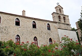
Krupa monastery is a Serbian Orthodox monastery on the Krupa River in Croatia. It is the oldest Orthodox monastery in Croatia.
Mujum is a town and jamoat in north-west Tajikistan. It is located in Ghonchi District in Sughd province. The jamoat has a total population of 18,194.
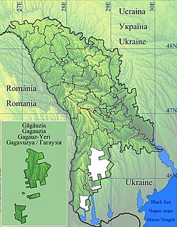
Joltai is a commune and village in the Gagauz Autonomous Territorial Unit of the Republic of Moldova. The 2004 census listed the commune as having a population of 2,278 people. Gagauz total 2,187. Minorities included 158 Moldovans, 67 Russians, 33 Ukrainians, 14 Bulgarians, 2 Poles and 1 Jew.
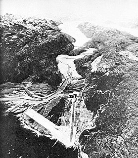
Bluie was the United States military code name for Greenland during World War II. It is remembered by the numbered sequence of base locations identified by the 1941 United States Coast Guard South Greenland Survey Expedition, and subsequently used in radio communications by airmen unfamiliar with pronunciation of the Inuit and Old Norse names of those locations. These were typically spoken BLUIE (direction) (number), with direction being east or west along the Greenland coast from Cape Farewell.
Katlakalns is a neighbourhood of Riga, the capital of Latvia. It is linked to Ķengarags and Maskavas forštate by the Southern Bridge erected in 2004-2008 and opened on November 17, 2008.
Maslovsky, Maslovskaya, or Maslovskoye is the name of several rural localities in Russia.
Felsőpetény is a village in Nógrád County, Hungary with 768 inhabitants (2001).
| Wikimedia Commons has media related to Leffinge . |