Leichhardt, born in Prussia in 1813, was a student of philosophy, languages and natural sciences. He journeyed to Sydney in 1841–1842 with the expressed intention of exploring the interior of Australia, and studied the geology and botany of the Sydney district before undertaking exploratory journeys between Newcastle and the Moreton Bay district in 1843–44. By mid-1844 Leichhardt was hoping to join a planned official New South Wales Government expedition from Sydney to Port Essington, but impatient with government delay and uncertain as to whether such an expensive expedition would be given official approval, Leichhardt mounted his own expedition, funded by squatter subscriptions.[1]
Leichhardt and 5 volunteers sailed from Sydney for Moreton Bay, where they were joined by 2 more men, and by another 2 on the Darling Downs. The party left Jimbour Station, on the edge of the settled district of the northern Darling Downs, on 1 October 1844. By early November they had reached Juandah (now Wandoan), where Leichhardt decided to reduce the party by two, these men returning to Jimbour. Continuing north, Leichhardt reached the Dawson River (named by Leichhardt in honour of a Hunter Valley settler), crossing it where the town of Taroom now stands. Of the Dawson Valley, John Gilbert, a naturalist in Leichhardt's party, wrote:[1]
"One of the most beautifully picturesque and extensive scenes met our anxious gaze. The immediate vicinity of the hills was like park scenery - clear undulating hills, with here and there small clumps of brigalo [sic], while the sides of many of the hills were dotted with single scrubs, as if picked out by hand. Beyond this to the westward, and round as far as we could see to the E.S.E was a carpet of evergreens for six or seven miles and then the high ranges rose up and formed a beautiful background to the most pleasing natural picture we have seen."
It is thought that Leichhardt camped on the southern side of the upper Dawson, where Pemberton Hodgson, tracing Leichhardt's track in mid-1845, found 3 large gum trees blazed with the letter "L". The coolibah surviving in Yaldwyn Street, Taroom - with the blaze LL.1844 once visible - may have been one of these trees. In 1916 one L and part of the year 1844 was still discernible, but bark had grown over part of the date and the second L. In the mid-1970s the blaze was just discernible although unreadable, but it is no longer visible.[1]
Leichhardt crossed the Dawson River and stayed at Palm Tree Creek for several days before continuing westwards to Robinson's Creek, then crossed the Ruined Castle Creek area and the Expedition Range to the northwest. In late June 1845, John Gilbert was killed in an attack on the camp by Aborigines, but the remainder of the party survived and reached Port Essington, near Darwin, on 17 December 1845, completing an overland journey of nearly 3,000 miles (4,800km). They returned to Sydney by ship in March 1846.[1]
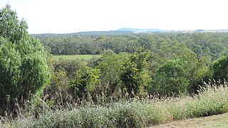
Leichhardt's journey, and the explorations of Pemberton Hodgson in 1845, did much to open the way to further non-indigenous settlement in southeastern Queensland. Even before Leichhardt's journal of the expedition was published in 1847, word had spread of the rich pastures of the Dawson River district, encouraging squatters such the Archer brothers (1850) to explore the area more closely. By November 1845, Taroom Station had been taken up, and by the time the Leichhardt pastoral district of 40,000 acres (16,000ha) was proclaimed in 1854, most of the country had been taken up for pastoral purposes. The township of Taroom developed at the Dawson River crossing at the junction of several squatter tracks - one south to Juandah and crossing the Fitzroy - Murray-Darling watershed to the Darling Downs, one through the Auburn Range to Gayndah, and one southwest to Roma, and developed slowly as a staging post between Roma and Rockhampton. A post office was established at Taroom in 1853, a courtroom gazetted there in 1857, and the town was officially surveyed in 1860.[1]
At least two other blazes have been marked on the Leichhardt Tree. In 1893 the Dawson River flooded, reaching to the base of the Leichhardt Tree in Taroom. This level was marked on the tree, but is no longer visible; also a surveyor's blaze had been marked on the tree by August 1916. In 1925 the Irrigation and Water Supply Department surveyed the area for a proposed dam site, at which point another blaze supposedly was inscribed on the tree - again no longer visible.[1]
By the mid-1970s, the tree had been heavily lopped and was suffering severe insect damage. In 1979 several cavities caused by previous lopping and breakage were plugged and sealed to prevent further rotting, and the tree has successfully regenerated.[1]
On 23 October 1988, a monument was erected by the local historical society and tourism association to celebrate the Bicentenary of Australia and Leichhardt's 175th birthday.[2]
Description
Leichhardt Tree, circa 1914
The town of Taroom is located where the Leichhardt Highway crosses the Dawson River, and the Leichhardt Tree is located about 150 metres (490ft) up a steadily inclining slope from the bed of the Dawson River, on the west side of Yaldwyn Street reserve in Taroom, between Dawson and Kelman Streets. Yaldwyn Street forms part of the Leichhardt Highway, connecting Roma and Rockhampton, and is the main road in and out of Taroom. Although the tree's root system is largely covered by bitumen road, footpath paving and nearby commercial buildings, the tree appears to be in good condition.[1]
The tree is a mature coolibah (Eucalyptus microtheca), indigenous to the Dawson River district. It has a height of about 14 metres (46ft), and a canopy spread of about 13 metres (43ft). Its age is estimated to be at least 300 years.[1]
A sign placed in the branches of the tree reads LEICHHARDT TREE, but all blazes have been overgrown by the bark.[1]
Leichhardt, the explorer, passed over this track and marked this Tree in 1844.
At the foot of the tree, facing east to the street, is a small concrete block with a metal plaque attached, on which is inscribed:[1]
THE LEICHHARDT TREE THE EXPLORER LUDWIG LEICHHART MARKED THIS TREE IN 1844 "LL.1844" DURING HIS OVERLAND JOURNEY FROM JIMBOUR QUEENSLAND TO PORT ESSINGTON NORTHERN TERRITORY THIS SETTING PROVIDED BY TAROOM LIONS CLUB
Heritage listing
Leichhardt Tree was listed on the Queensland Heritage Register on 21 October 1992 having satisfied the following criteria.[1]
The place is important in demonstrating the evolution or pattern of Queensland's history.
Leichhardt's exploration of the Dawson River area paved the way for rapid pastoral expansion in the Leichhardt district from the mid-1840s to the early 1850s.[1]
The place is important because of its aesthetic significance.
Estimated to be around 300 years old, the Leichhardt Tree is a familiar landmark in the town of Taroom, making a significant contribution to the streetscape of the town, well-known to all residents and often photographed by travellers.[1]
The place has a strong or special association with a particular community or cultural group for social, cultural or spiritual reasons.
Estimated to be around 300 years old, the Leichhardt Tree is a familiar landmark in the town of Taroom, making a significant contribution to the streetscape of the town, well-known to all residents and often photographed by travellers.[1]
The place has a special association with the life or work of a particular person, group or organisation of importance in Queensland's history.
The Leichhardt Tree at Taroom is important for its association with Prussian explorer FW Ludwig Leichhardt, who played an important role in early non-indigenous exploration of the Australian interior, particularly with his epic journey from the Darling Downs to Port Essington, which contributed significantly to European knowledge of the Queensland landscape.[1]
Related Research Articles
Friedrich Wilhelm Ludwig Leichhardt, known as Ludwig Leichhardt, was a German explorer and naturalist, most famous for his exploration of northern and central Australia.
The Darling Downs is a farming region on the western slopes of the Great Dividing Range in southern Queensland, Australia. The Downs are to the west of South East Queensland and are one of the major regions of Queensland. The name was generally applied to an area approximating to that of the Condamine River catchment upstream of Condamine township but is now applied to a wider region comprising the Southern Downs, Western Downs, Toowoomba and Goondiwindi local authority areas. The name Darling Downs was given in 1827 by Allan Cunningham, the first European explorer to reach the area and recognises the then Governor of New South Wales, Ralph Darling.
John Gilbert was an English naturalist and explorer. Gilbert is often cited in the earliest descriptions of many Australian animals, many of which were unrecorded in European literature, and some of these are named for him by those authors. Gilbert was sent to the newly founded Swan River Colony and made collections and notes on the unique birds and mammals of the surrounding region. He later joined expeditions to remote parts the country, continuing to make records and collections until he was killed during a violent altercation at Mitchell River (Queensland) on the Cape York Peninsula.
Port Essington is an inlet and historic site located on the Cobourg Peninsula in the Garig Gunak Barlu National Park in Australia's Northern Territory. It was the site of an early attempt at British settlement, but now exists only as a remote series of ruins.
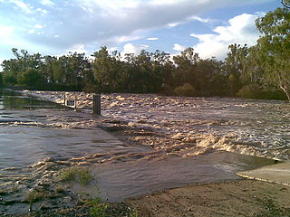
The Dawson River is a river located in Central Queensland, Australia.
Taroom is a town in the Shire of Banana and locality split between the Shire of Banana and the Western Downs Region in Queensland, Australia. At the 2016 census, Taroom had a population of 869 people.
The Shire of Taroom was a local government area in the Darling Downs region of Queensland, Australia, along the Leichhardt Highway to the north of Miles. The shire covered an area of 18,644.5 square kilometres (7,198.7 sq mi), and existed as a local government area from 1879 until 2008, when it was dissolved and split between the new Western Downs Region and the Shire of Banana.
The following lists events that happened during 1844 in Australia.
The following lists events that happened during 1845 in Australia.
The Hornet Bank massacre involves the killing of eleven Settlers and one Aboriginal station-hand, by a group of Iman Aboriginal Australians. The massacre occurred at about one or two o'clock in the morning of 27 October 1857 at Hornet Bank station on the upper Dawson River near Eurombah in central Queensland, Australia. It has been moderately estimated that 150 Aboriginal people succumbed in subsequent punitive missions conducted by Native Police, private settler militias, and by William Fraser in or around Eurombah district. Indiscriminate shootings of "over 300" Aboriginal men, women, and children, however, were reportedly conducted by private punitive expedition some 400 kilometres eastward at various stations in the Wide Bay district alone. The result was the believed extermination of the entire Iman tribe and language group by 1858; this claim was disputed, however, and descendants of this group have recently been recognised by the High Court of Australia to be the original custodians of the land surrounding the town of Taroom.
The Suttor River is a river in Central Queensland, Australia. The Belyando River is its main tributary. The river has its origins in the Leichhardt Range, north west of Glenden. It flows into Lake Dalrymple, becoming a tributary of the Burdekin River.
The Wandoan Branch is a 70 km railway line in the Darling Downs region Queensland, Australia. It links the towns of Miles and Wandoan. It was approved to extend to Taroom, but construction halted during World War I and never recommenced.
Valley of Lagoons Station is a pastoral lease that currently operates as a cattle station in Queensland.
The Isaac River is a river and anabranch located in Central Queensland, Australia.
The Glebe Homestead is a heritage-listed homestead at Taroom-Cracow Road, Glebe near Taroom, Shire of Banana, Queensland, Australia. It was designed by Florence Mary Rigby and built c. 1920. It is also known as Broadwater. It was added to the Queensland Heritage Register on 23 March 2007.
The Fraser family grave site and memorial at Hornet Bank is a heritage-listed cemetery and memorial at Hornet Bank Station, Hornet Bank Road, Eurombah near Taroom, Shire of Banana, Queensland, Australia. It was added to the Queensland Heritage Register on 18 September 2008.
Taroom Aboriginal Settlement is a heritage-listed Aboriginal reserve at Bundulla, Taroom, Shire of Banana, Queensland, Australia. It was added to the Queensland Heritage Register on 13 May 2011. It is also known as Taroom Aboriginal Reserve and Taroom Aboriginal Mission.
Landsborough's Blazed Tree is a heritage-listed blazed tree at Mitchell Highway, Bakers Bend, Shire of Murweh, Queensland, Australia. It was marked by William Landsborough. It was added to the Queensland Heritage Register on 18 June 2009.
Landsborough's Blazed Tree is a heritage-listed tree at Mitchell Highway, Charleville, Shire of Murweh, Queensland, Australia. It was marked by William Landsborough. It was added to the Queensland Heritage Register on 18 June 2009.
Burke and Wills Dig Tree is a heritage-listed, blazed, eucalyptus tree at Nappa Merrie Station, Durham, Shire of Bulloo, Queensland, Australia. It was blazed on 21 April 1861. It was added to the Queensland Heritage Register on 28 February 2003.
This page is based on this Wikipedia article Text is available under the CC BY-SA 4.0 license; additional terms may apply. Images, videos and audio are available under their respective licenses.