Leimuiden | |
---|---|
Village | |
Coordinates: 52°13′N4°40′E / 52.217°N 4.667°E | |
Country | Netherlands |
Province | South Holland |
Municipality | Kaag en Braassem |
Area | |
• Total | 12.26 km2 (4.73 sq mi) |
Elevation | −0.5 m (−1.6 ft) |
Population (2021) [1] | |
• Total | 4,500 |
• Density | 370/km2 (950/sq mi) |
Time zone | UTC+1 (CET) |
• Summer (DST) | UTC+2 (CEST) |
Postal code | 2451 [1] |
Dialing code | 0172 |
Major roads | N207 |
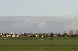
Leimuiden is a Dutch village in the South Holland municipality of Kaag en Braassem. Leimuiden is located between the Braassemermeer, the Westeinderplassen and the Ringvaart. Leimuiden is located north of Alphen aan den Rijn.
The village was first mentioned in the first half of the 11th century as Letthemutha, and means "mouth of the Leiden river". [3] Leimuiden is a peat excavation settlement from the Middle Ages. [4]
The Dutch Reformed church is an aisleless church with built-in tower with needle spire. It was built in 1805 as a replacement of the 1555 church. It was restored between 1963 and 1965, and a consistory was added. [4]
Leimuiden was home to 551 people in 1840. [5] It was a separate municipality until 1991, when it became part of Jacobswoude. The village was part of North Holland until 1865. [6] The village was bombed on 2 August 1940 by the Royal Air Force, because the Germans had established a local headquarters in Leimuiden. [5] In 2009, it became part of the municipality of Kaag en Braassem. [5]
The highest level surface of Leimuiden is located on provincial road N207, approximately level with NAP. The village "on the hill" (Noordeinde-Dokter Stapenséastraat-Burgemeester Bakhuizenlaan-Dorpsstraat) is approximately 0.5 meters below NAP. The depoldered areas are between 4.0 and 4.5 meters below NAP.
Jacobswoude is a former municipality in the western Netherlands, in the province of South Holland, now part of municipality Kaag en Braassem. Before the merger with Alkemade, the municipality covered an area of 41.37 km² of which 4.88 km² is water, mainly the lakes Braassemermeer and Wijde Aa. It consisted of the communities Bilderdam, Hoogmade, Leimuiden, Rijnsaterwoude, and Woubrugge, all located around the above-mentioned lakes. It had a population of 10,692 on 1 January 2004.
Zevenhuizen is a common name for places in the Netherlands, meaning seven houses.
Oude-TongeEnglish:Old Toungue is a village in the Dutch province of South Holland. It is a part of the municipality of Goeree-Overflakkee, and lies about 16 km south of Hellevoetsluis.
Hoogmade is a village in the Dutch province of South Holland. It is located about 7 km east of Leiden, in the municipality of Kaag en Braassem.
Rijpwetering is a village in the Dutch province of South Holland. It is a part of the municipality of Kaag en Braassem, and lies about 8 kilometres (5.0 mi) east of Leiden.
Sambeek is a village in the southern Netherlands. It is located in the former municipality of Boxmeer, North Brabant. Since 2022 it has been part of the new municipality of Land van Cuijk.
Oud Ade is a village in the Dutch province of South Holland. It is a part of the municipality of Kaag en Braassem, and lies about 7 km east of Leiden.
Kaag is a village in the Dutch province of South Holland. It is a part of the municipality of Kaag en Braassem, and lies about 8 kilometres northeast of Leiden.
Nieuwe Wetering is a village in the Dutch province of South Holland. It is a part of the municipality of Kaag en Braassem, and lies about 10 km east of Leiden.
Bath is a small village and a former municipality in the Dutch province of Zeeland, lying on the north shore of the Western Scheldt. It is now located in the municipality of Reimerswaal, about 10 km southwest of Bergen op Zoom.
Lierop is a village in the Dutch province of North Brabant. It is located in the municipality of Someren, about 7 km south of Helmond.
Nieuwenhoorn is a village in the Dutch province of South Holland. It is located in the municipality of Voorne aan Zee, about 3 km north of Hellevoetsluis city centre.
Rijnsaterwoude is a village in the Dutch province of South Holland. It is located about 6 km north of the town of Alphen aan den Rijn, in the municipality of Kaag en Braassem.
Woubrugge is a village in the Dutch province of South Holland. It is located about 10 km east of the city of Leiden, in the municipality of Kaag en Braassem.
Oude Wetering is a village in the Dutch province of South Holland. It is located in the municipality of Kaag en Braassem, east of the town of Roelofarendsveen.
Tzum is a village in Waadhoeke municipality in the province of Friesland, the Netherlands. It had a population of around 1,164 in January 2014. Tzum is known for its 72 metre tall church tower.
The Kagerplassen is a small lake system in South Holland located to the northeast of Leiden. The Kaag Lakes are a popular area for boating, watersports, fishing, camping and walking. Windmills, waterfront pasture land (weilanden) with grazing animals, quaint Dutch boats and buildings and flower fields are all part of the charm of boating and walking in this area.
Kaag en Braassem is a municipality in the western Netherlands, in the province of South Holland. It was formed on 1 January 2009, through the merger of Alkemade and Jacobswoude.
Buikslotermeer is a neighborhood and a polder of Amsterdam, Netherlands. The Buikslotermeer is a reclaimed lake, now largely located within the city of Amsterdam-Noord. Nowadays, the name 'Buikslotermeer' is used to refer to the entire Buikslotermeerpolder of the similarly named neighborhood, located in the south-east of the polder.
Meerewijck is the name of a recreation and living quarter of Leimuiden in the Dutch province of South Holland. It is a part of the municipality of Kaag en Braassem, and is situated about 12 km south-west of Amsterdam.