Hoogmade

Last updated • 1 min readFrom Wikipedia, The Free Encyclopedia
Hoogmade
Village
Netherlands, Zuid-Holland, Hoogmade (1).JPG
View on Hoogmade
P08-ZH-positiekaart2-gemlabels.png
Red pog.svg
Hoogmade
Location in the province of South Holland in the Netherlands
Netherlands location map.svg
Red pog.svg
Hoogmade
Location in the Netherlands
Coordinates: 52°10′N4°35′E / 52.167°N 4.583°E / 52.167; 4.583
Country Netherlands
Province South Holland
Municipality Kaag en Braassem
Area
[1]
  Total1.07 km2 (0.41 sq mi)
Elevation
[2]
−1.0 m (−3.3 ft)
Population
 (2021) [1]
  Total1,460
  Density1,400/km2 (3,500/sq mi)
Time zone UTC+1 (CET)
  Summer (DST) UTC+2 (CEST)
Postal code
2355 [1]
Dialing code 071
Major roads A4 N446

Hoogmade is a village in the Dutch province of South Holland. It is located about 7 km east of Leiden, in the municipality of Kaag en Braassem.

Contents

History

The village was first mentioned between 1280 and 1287 as "Hoghe made", and means "elevated hay land". [3] Hoogmade is a peat excavation settlement which developed in the Middle Ages. [4]

The Dutch Reformed church is an aisleless church with open wooden tower built between 1729 and 1730 as a replacement of the medieval church. The Catholic Onze-Lieve-Vrouw-Geboorte church is an aisleless church with built-in tower with needle spire. It was built between 1931 and 1932 to replace the 1875 church which had collapsed. [4] On 4 November 2019, the Onze-Lieve-Vrouw-Geboorte church was severely damaged by fire. [5] With the help of many volunteers to raise money, three years after this fire the rebuilding of the church has started [6]

The polder mill Doesmolen was built around 1636. It was in service until 1953. In 1965, it was restored and functions on a voluntary basis. [7]

Hoogmade was home to 311 people in 1840. [8] It was a separate municipality between 1817 and 1855, when it merged with Woubrugge. [9] In 2009, it became part of the municipality of Kaag en Braassem. [8]

Related Research Articles

<span class="mw-page-title-main">IJzendijke</span> Small city in Zeeland, Netherlands

IJzendijke is a city in the municipality of Sluis, about 10 km east of Oostburg, in the Dutch province of Zeeland.

<span class="mw-page-title-main">Rijpwetering</span> Village in South Holland, Netherlands

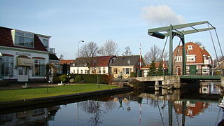
Rijpwetering is a village in the Dutch province of South Holland. It is a part of the municipality of Kaag en Braassem, and lies about 8 kilometres (5.0 mi) east of Leiden.

<span class="mw-page-title-main">Blitterswijck</span> Village in Limburg, Netherlands

Blitterswijck is a village in the Dutch province of Limburg. It is a part of the municipality of Venray, and lies about 20 km north of Venlo.

<span class="mw-page-title-main">Beltrum</span> Village in Gelderland, Netherlands

Beltrum is a village in the region called Achterhoek in the province of Gelderland in the Netherlands.

<span class="mw-page-title-main">Hoek, Zeeland</span> Village in Zeeland, Netherlands

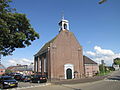
Hoek is a village in the Dutch province of Zeeland. It is a part of the municipality of Terneuzen, and lies about 22 km south-east of Vlissingen.

<span class="mw-page-title-main">Nieuw-Beijerland</span> Village in South Holland, Netherlands

Nieuw-Beijerland is a village in the Dutch province of South Holland. It is a part of the municipality of Hoeksche Waard, and lies about 3 km south of Spijkenisse.

<span class="mw-page-title-main">Piershil</span> Village in South Holland, Netherlands

Piershil is a village in the Dutch province of South Holland. It is a part of the municipality of Hoeksche Waard, and lies about 5 km south of Spijkenisse.

<span class="mw-page-title-main">Ursem</span> Village in North Holland, Netherlands

Ursem is a village in the Dutch province of North Holland. It is a part of the municipality of Koggenland, and lies about 7 kilometres (4.3 mi) east of Alkmaar and 30 kilometres (19 mi) north of Amsterdam and 10 kilometres (6.2 mi) west from Hoorn. A part of the village is located in the municipality of Alkmaar.

<span class="mw-page-title-main">Zegge</span> Village in North Brabant, Netherlands

Zegge is a village located in the municipality of Rucphen, North Brabant in the Netherlands. On 1 January 2020, the village had 2,045 inhabitants. Viewed from the four other villages in the municipality of Rucphen, Zegge is located on the other side of the A58 motorway. This combined with its small size, makes it so that much of the daily life of its inhabitants centers around the nearby city of Roosendaal.

<span class="mw-page-title-main">Ohé en Laak</span> Village in Limburg, Netherlands

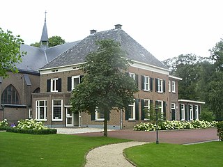
Ohé en Laak is a village in the province of Limburg, Netherlands, which has been subsumed into the municipality of Maasgouw. The village used to be home to several castles, one of which is Hasseltholt which is popularly called "Het Geudje". The other was the castle of Walburg. This castle was ruined and is fully removed now. The soccer team is called Walburgia. Furthermore, there is a renovated windmill called "De Hompesche molen". In the past this windmill was used for milling wheat and corn flour. The village of Ohé en Laak has got a nice yacht harbour at the river Maas and currently there are three campsites. The majority of the inhabitants are Roman Catholics, there is a church called "Onze Lieve Vrouw Geboorte" and a chapel called "Sint Anna-kapel".

<span class="mw-page-title-main">Bergharen</span> Village in Gelderland, Netherlands

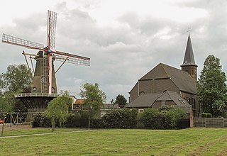
Bergharen is a village in the Netherlands, in the municipality of Wijchen. It was a separate municipality until 1984. There is a windmill, De Verrekijker, which has been converted to a holiday cottage.

Velp is a Dutch village located east of Arnhem within the municipality of Rheden, between Arnhem, Rozendaal, and the town of Rheden.

<span class="mw-page-title-main">Leimuiden</span> Village in South Holland, Netherlands

Leimuiden is a Dutch village in the South Holland municipality of Kaag en Braassem. Leimuiden is located between the Braassemermeer, the Westeinderplassen and the Ringvaart. Leimuiden is located north of Alphen aan den Rijn.

<span class="mw-page-title-main">Rijnsaterwoude</span> Village in South Holland, Netherlands

Rijnsaterwoude is a village in the Dutch province of South Holland. It is located about 6 km north of the town of Alphen aan den Rijn, in the municipality of Kaag en Braassem.

<span class="mw-page-title-main">Woubrugge</span> Village in South Holland, Netherlands

Woubrugge is a village in the Dutch province of South Holland. It is located about 10 km east of the city of Leiden, in the municipality of Kaag en Braassem.

<span class="mw-page-title-main">Kaag en Braassem</span> Municipality in South Holland, Netherlands

Kaag en Braassem is a municipality in the western Netherlands, in the province of South Holland. It was formed on 1 January 2009, through the merger of Alkemade and Jacobswoude.

<span class="mw-page-title-main">Bellem</span> Village in East Flanders, Belgium

Bellem is a village and deelgemeente (sub-municipality) in the municipality of Aalter in the Belgian province of East Flanders. The village was originally called Bethlehem. Bellem is located about 16 kilometres (9.9 mi) west of Ghent.

<span class="mw-page-title-main">Kluizen</span> Village in Flemish Region

Kluizen is a village in the municipalities of Evergem and Ghent in the province of East Flanders, Belgium. Large parts of the original municipality have become part of the Port of Ghent.

<span class="mw-page-title-main">Wortegem</span> Village in Flemish Region

Wortegem is a village and seat of the municipality of Wortegem-Petegem in the Belgian province of East Flanders. It is located about 17 kilometres (11 mi) east of Kortrijk.

<span class="mw-page-title-main">Overslag, Belgium</span> Village in East Flanders, Belgium

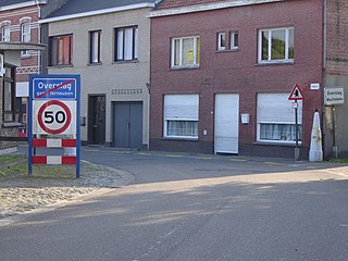
Overslag is a village in the municipality of Wachtebeke in the province of East Flanders in Belgium. The original village was cut in two by the Belgium–Netherlands border. The eponymous village in the Netherlands is part of the municipality of Terneuzen.

References

  1. 1 2 3 "Kerncijfers wijken en buurten 2021". Central Bureau of Statistics. Retrieved 4 May 2022.
  2. "Postcodetool for 2355AA". Actueel Hoogtebestand Nederland (in Dutch). Het Waterschapshuis. Archived from the original on 21 September 2013. Retrieved 4 May 2022.
  3. "Hoogmade - (geografische naam)". Etymologiebank (in Dutch). Retrieved 4 May 2022.
  4. 1 2 Ronald Stenvert & Sabine Broekhoven (2004). "Hoogmade" (in Dutch). Zwolle: Waanders. ISBN   90-400-9034-3 . Retrieved 4 May 2022.
  5. Pieters, Janene. "Videos: Church burns down in Zuid-Holland village; locals devastated". Netherlands Times. Retrieved 5 November 2019.
  6. https://www.rodi.nl/alphenaandenrijn/nieuws/316459/drie-jaar-na-brand-wordt-de-olv-geboortekerk-in-hoogmade-herbouwd [ bare URL ]
  7. "Doesmolen". Molen database (in Dutch). Retrieved 4 May 2022.
  8. 1 2 "Hoogmade". Plaatsengids (in Dutch). Retrieved 4 May 2022.
  9. Ad van der Meer and Onno Boonstra, "Repertorium van Nederlandse gemeenten", KNAW, 2006. "KNAW > Publicaties > Detailpagina". Archived from the original on 20 February 2007. Retrieved 3 December 2009.