Aldansky District is an administrative and municipal district, one of the thirty-four in the Sakha Republic, Russia. It is located in the south of the republic on the right bank of the Lena River near the mouth of the Aldan River and borders with Khangalassky and Amginsky Districts in the north, Ust-Maysky District in the northeast, Khabarovsk Krai in the east, Neryungrinsky District in the south, and with Olyokminsky District in the west and southwest. The area of the district is 156,800 square kilometers (60,500 sq mi). Its area is larger than the country of Bangladesh. Its administrative center is the town of Aldan. As of the 2010 Census, the total population of the district was 42,632, with the population of Aldan accounting for 49.9% of that number.

Anabarsky District is an administrative and municipal district, one of the thirty-four in the Sakha Republic, Russia. It is located in the northwest of the republic and borders with Bulunsky District in the east, Olenyoksky District in the south, and with Taymyrsky Dolgano-Nenetsky District of Krasnoyarsk Krai in the west. The area of the district is 55,600 square kilometers (21,500 sq mi). Its administrative center is the rural locality of Saskylakh. As of the 2010 Census, the total population of the district was 3,501, with the population of Saskylakh accounting for 66.2% of that number.

Gorny District is an administrative and municipal district, one of the thirty-four in the Sakha Republic, Russia. It is located in the center of the republic and borders Vilyuysky and Kobyaysky Districts in the north, Namsky District and the territory of the city of republic significance of Yakutsk in the east, Khangalassky District in the south, Olyokminsky District in the southwest, and Verkhnevilyuysky District in the west. The area of the district is 45,600 square kilometers (17,600 sq mi). Its administrative center is the rural locality of Berdigestyakh. As of the 2010 Census, the total population of the district was 11,706, with the population of Berdigestyakh accounting for 55.2% of that number.

Namsky District is an administrative and municipal district, one of the thirty-four in the Sakha Republic, Russia. The district is located in the center of the republic and borders Ust-Aldansky District in the east, Megino-Kangalassky District in the southeast, the territory of the city of republic significance of Yakutsk in the south, Gorny District in the west, and Kobyaysky District in the north. The area of the district is 11,900 square kilometers (4,600 sq mi). Its administrative center is the rural locality of Namtsy. As of the 2010 Census, the total population of the district was 23,198, with the population of Namtsy accounting for 38.3% of that number.

Suntarsky District is an administrative and municipal district, one of the thirty-four in the Sakha Republic, Russia. It is located in the western central part of the republic and borders with Nyurbinsky District in the north and northeast, Verkhnevilyuysky District in the east, Olyokminsky District in the southeast, Lensky District in the southwest, and with Mirninsky District in the west. The area of the district is 57,800 square kilometers (22,300 sq mi). Its administrative center is the rural locality of Suntar. Population: 25,140 (2010 Census); 25,485 ; 26,035 (1989 Census). The population of Suntar accounts for 39.9% of the district's total population.

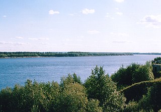
Olyokminsky District is an administrative and municipal district, one of the thirty-four in the Sakha Republic, Russia. It is located in the southwest of the republic and borders with Verkhnevilyuysky District in the north, Gorny and Khangalassky Districts in the northeast, Aldansky District in the east, Neryungrinsky District in the southeast, Zabaykalsky Krai in the southwest, Irkutsk Oblast and Lensky District in the west, and with Suntarsky District in the northwest. The area of the district is 160,800 square kilometers (62,100 sq mi). Its administrative center is the town of Olyokminsk. Population: 26,785 (2010 Census); 27,563 ; 30,938 (1989 Census). The population of Olyokminsk accounts for 35.4% of the district's total population.

Oymyakonsky District is an administrative and municipal district, one of the thirty-four in the Sakha Republic, Russia. It is located in the east of the republic and borders with Ust-Maysky District in the southwest, Tomponsky District in the west, Momsky District in the north, Magadan Oblast in the east, and with Khabarovsk Krai in the south. The area of the district is 92,300 square kilometers (35,600 sq mi). Its administrative center is the urban locality of Ust-Nera. Population: 10,109 (2010 Census); 14,670 ; 31,078 (1989 Census). The population of Ust-Nera accounts for 63.9% of the district's total population.
Srednekolymsky District is an administrative and municipal district, one of the thirty-four in the Sakha Republic, Russia. It is located in the north of the republic and borders with Verkhnekolymsky District in the south, Abyysky District in the west, Allaikhovsky District in the northwest, Nizhnekolymsky District in the north, Chukotka Autonomous Okrug in the east, and with Magadan Oblast in the southeast. The area of the district is 125,200 square kilometers (48,300 sq mi). Its administrative center is the town of Srednekolymsk. Population: 7,897 (2010 Census); 8,353 ; 9,441 (1989 Census). The population of Srednekolymsk accounts for 44.6% of the district's total population.

Neryungrinsky District is an administrative and municipal district, one of the thirty-four in the Sakha Republic, Russia. It is the southernmost district of Sakha and borders Aldansky District in the north, Olyokminsky District in the west and northwest, Amur Oblast and a small area of Zabaykalsky Krai in the south, and Khabarovsk Krai in the east. The area of the district is 98,900 square kilometers (38,200 sq mi). Its administrative center is the town of Neryungri. Population : 21,019 (2010 Census).
Mirny Urban Settlement is the name of several municipal formations in Russia.
Berdigestyakh is a rural locality and the administrative center of Gorny District in the Sakha Republic, Russia. Its population as of the 2010 Census was 6,462, up from 6,149 recorded during the 2002 Census.

Namtsy is a rural locality, the administrative center of Namsky District and the only inhabited locality, as well as the administrative center, of Lensky Rural Okrug of Namsky District in the Sakha Republic, Russia. Its population as of the 2010 Census was 8,890, up from 8,249 recorded during the 2002 Census.
Natora is a rural locality, the only inhabited locality, and the administrative center of Natorsky Rural Okrug of Lensky District in the Sakha Republic, Russia, located 102 kilometers (63 mi) from Lensk, the administrative center of the district. Its population as of the 2010 Census was 441, up from 400 recorded during the 2002 Census.
Orto-Nakhara is a rural locality and the administrative center of Orto-Nakharinsky Rural Okrug of Lensky District in the Sakha Republic, Russia, located 67 kilometers (42 mi) from Lensk, the administrative center of the district. Its population as of the 2002 Census was 379.
Tolon is a rural locality, the administrative centre of and one of three settlements, in addition to Alysardakh and Innyaly, in Tolonsky Rural Okrug of Lensky District in the Sakha Republic, Russia. It is located 306 kilometers (190 mi) from Lensk, the administrative center of the district. Its population as of the 2002 Census was 250.
Alysardakh is a rural locality in Tolonsky Rural Okrug of Lensky District of the Sakha Republic, Russia, located 275 kilometers (171 mi) from Lensk, the administrative center of the district and 35 kilometers (22 mi) from Tolon, the administrative center of the rural okrug. Its population as of the 2002 Census was 41.
Innyaly is a rural locality in Tolonsky Rural Okrug of Lensky District in the Sakha Republic, Russia, located 336 kilometers (209 mi) from Lensk, the administrative center of the district and 30 kilometers (19 mi) from Tolon, the administrative center of the rural okrug. Its population as of the 2002 Census was 169.
Yaroslavsky is a rural locality and the administrative center of Yaroslavsky Rural Okrug of Lensky District in the Sakha Republic, Russia, located 103 kilometers (64 mi) from Lensk, the administrative center of the district. Its population as of the 2002 Census was 457.
Khamra is a rural locality in Yaroslavsky Rural Okrug of Lensky District in the Sakha Republic, Russia, located 85 kilometers (53 mi) from Lensk, the administrative center of the district, and 18 kilometers (11 mi) from Yaroslavsky, the administrative center of the rural okrug. Its population as of the 2002 Census was 182.