Lensky District, Arkhangelsk Oblast

Last updated • 3 min readFrom Wikipedia, The Free Encyclopedia
Lensky District
Ленский район
VytchegdaRiver.jpg
Vychegda River, near the village of Irta
Flag of Lensky rayon (Arkhangelsk oblast).png
RUS Lenskii raion COA.gif
Lensky District, Arkhangelsk Oblast
Location of Lensky District in Arkhangelsk Oblast
Coordinates: 61°33′N45°56′E / 61.550°N 45.933°E / 61.550; 45.933
CountryRussia
Federal subject Arkhangelsk Oblast [1]
EstablishedJune 1, 1924 [2]
Administrative center Yarensk [3]
Area
[4]
  Total10,700 km2 (4,100 sq mi)
Population
  Total13,362
  Density1.2/km2 (3.2/sq mi)
   Urban
34.3%
   Rural
65.7%
Administrative structure
   Administrative divisions 1 Urban-type settlements with jurisdictional territory, 9 Selsoviets
   Inhabited localities [3] 1 Urban-type settlements [6] , 146 rural localities
Municipal structure
   Municipally incorporated asLensky Municipal District [7]
   Municipal divisions [7] 1 urban settlements, 3 rural settlements
Time zone UTC+3 (MSK   OOjs UI icon edit-ltr-progressive.svg [8] )
OKTMO ID11635000
Website http://www.yarensk.ru/

Lensky District (Russian : Ле́нский райо́н) is an administrative district (raion), one of the twenty-one in Arkhangelsk Oblast, Russia. [1] As a municipal division, it is incorporated as Lensky Municipal District. [7] It is located in the southeast of the oblast and borders with Udorsky District of the Komi Republic in the north, Syktyvdinsky, Ust-Vymsky, and Sysolsky Districts, also of the Komi Republic, in the east, Vilegodsky District in the south, and with Kotlassky and Krasnoborsky Districts in the west. The area of the district is 10,700 square kilometers (4,100 sq mi). [4] Its administrative center is the rural locality (a selo ) of Yarensk. [3] Population: 13,362(2010 Census); [5] 16,071(2002 Census); [9] 20,488(1989 Soviet census). [10] The population of Yarensk accounts for 27.4% of the district's total population. [5]

Contents

Etymology

The name of the district originates from the selo of Lena, which at the formation of the district in 1924 was intended to be the administrative center. While the plans to move the administrative center to Lena had never been realized, the name remained unchanged. [11]

History

The area was populated by speakers of Uralic languages and then colonized by the Novgorod Republic. After the fall of Novgorod, the area became a part of the Grand Duchy of Moscow. Yarensk is first mentioned in the chronicles (as Yerensky Gorodok) in 1374. In 1606, Yarensky Uyezd was formed, and Yarensk became one of the most important towns in the North of Russia.

In the course of the administrative reform carried out in 1708 by Peter the Great, the area was included into Siberia Governorate, and in 1719 transferred to Archangelgorod Governorate. [12] In 1780, the governorate was abolished and transformed into Vologda Viceroyalty. At the same time, Yarensk was granted town rights. In 1918, Yarensky Uyezd was transferred to the newly formed Northern Dvina Governorate, and in 1924 the uyezds were abolished in favor of the new divisions, the districts (raions). Lensky District was formed on June 1, 1924. The idea was to move the administrative center of the district from Yarensk to the selo of Lena, but the logistics came out to be too difficult, and the administration remained in Yarensk. [11]

In the following years, the district remained within the same borders, but the first-level administrative division of Russia kept changing. In 1929, Northern Dvina Governorate was merged into Northern Krai, which in 1936 was transformed into Northern Oblast. In 1937, Northern Oblast was split into Arkhangelsk and Vologda Oblasts. Lensky District remained in Arkhangelsk Oblast ever since.

Geography

The Vychegda River in the work settlement of Urdoma Urdoma vid na vitshegdu.jpg
The Vychegda River in the work settlement of Urdoma

The district is located on both banks of the Vychegda and belongs almost exclusively to the basins of the Vychegda and its major tributaries. The main (right-hand) Northern Dvina tributary which flows through the district is the Yarenga. Minor parts of the district belong to the basins of a tributary of the Northern Dvina, the Uftyuga (west), and the Vashka River, a tributary of the Mezen River (northwest). The source of the Pinega is in fact located in Krasnoborsky District. The whole area of the district drains into the White Sea.

Almost the whole of the district is covered by coniferous forests (taiga).

Divisions

Administrative divisions

As an administrative division, the district is divided into nine selsoviets and one urban-type settlement with jurisdictional territory (Urdoma). [3] The following selsoviets have been established (the administrative centers are given in parentheses): [3]

Municipal divisions

As a municipal division, the district is divided into one urban settlement and three rural settlements (the administrative centers are given in parentheses): [7]

Economy

Industry

The basis of the economy of the district is timber industry, which in 2007 was responsible for 85% of the district's total industrial production. [11]

Transportation

The Vychegda is navigable and there is regular passenger navigation downstream from the settlement of Soyga (connecting it to Kotlas).

There is a railway connecting Kotlas and Vorkuta which passes through the district, in particular, through Urdoma, the only urban-type settlement in the district.

Urdoma has an oil-pumping station in the Baltic Pipeline System. [11]

Culture and recreation

Yarensk, the Transfiguration Cathedral, built between 1745 and 1775 Yarensk cathedral.jpg
Yarensk, the Transfiguration Cathedral, built between 1745 and 1775

The district contains fifteen objects classified as cultural and historical heritage. [13] Most of these are churches and wooden rural houses built prior to 1917.

The only museum in the district is the Yarensk District Museum. [14]

Related Research Articles

<span class="mw-page-title-main">Yemtsa</span> Rural locality in Arkhangelsk Oblast, Russia

Yemtsa is a rural locality in Plesetsky District of Arkhangelsk Oblast, Russia, located 42 kilometers (26 mi) north of Plesetsk and 172 kilometers (107 mi) south of Arkhangelsk. Within the framework of municipal divisions, it serves as the administrative center of Yemtsovskoye Rural Settlement, one of the thirteen rural settlements in the district. Population: 1,067 (2010 Census); 1,498 (2002 Census); 2,266 (1989 Soviet census)..

<span class="mw-page-title-main">Solvychegodsk</span> Town in Arkhangelsk Oblast, Russia

Solvychegodsk is a town in Kotlassky District of Arkhangelsk Oblast, Russia, located on the right-hand bank of the Vychegda River, about 25 kilometers (16 mi) northeast of Kotlas, the administrative center of the district. Population: 2,460 (2010 Census); 2,843 (2002 Census); 4,004 (1989 Soviet census).

<span class="mw-page-title-main">Kotlas</span> Town in Arkhangelsk Oblast, Russia

Kotlas is a town in Arkhangelsk Oblast, Russia, located at the confluence of the Northern Dvina and Vychegda Rivers. Population: 60,562 (2010 Census); 60,647 (2002 Census); 68,021 (1989 Soviet census).

<span class="mw-page-title-main">Novodvinsk</span> Town in Arkhangelsk Oblast, Russia

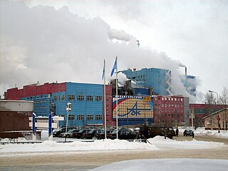
Novodvinsk is a town in the north of Arkhangelsk Oblast, Russia, located on the left bank of the Northern Dvina, 20 kilometers (12 mi) south of Arkhangelsk. Population: 40,615 (2010 Census); 43,383 (2002 Census); 50,183 (1989 Soviet census).

<span class="mw-page-title-main">Kotlassky District</span> District in Arkhangelsk Oblast, Russia

Kotlassky District is an administrative district (raion), one of the twenty-one in Arkhangelsk Oblast, Russia. As a municipal division, it is incorporated as Kotlassky Municipal District. It is located in the southeast of the oblast and borders with Krasnoborsky District in the north, Lensky District in the northeast, Vilegodsky District in the east, Luzsky District of Kirov Oblast and Velikoustyugsky District of Vologda Oblast in the south, and with Ustyansky District in the west. The area of the district is 6,300 square kilometers (2,400 sq mi). Its administrative center is the town of Kotlas. Population: 21,005 (2010 Census); 24,964 (2002 Census); 32,800 (1989 Soviet census).

<span class="mw-page-title-main">Kholmogorsky District</span> District in Arkhangelsk Oblast, Russia

Kholmogorsky District is an administrative district (raion), one of the twenty-one in Arkhangelsk Oblast, Russia. Municipally, it is incorporated as Kholmogorsky Municipal District. It is located in the center of the oblast and borders with Pinezhsky District in the east, Vinogradovsky District in the southeast, the territory of the town of oblast significance of Mirny in the south, Plesetsky District in the southwest, and with Primorsky District in the northwest. The area of the district is 16,827 square kilometers (6,497 sq mi). Its administrative center is the rural locality of Kholmogory. District's population: 25,061 (2010 Census); 30,797 (2002 Census); 35,891 (1989 Soviet census). The population of Kholmogory accounts for 16.6% of the district's total population.

<span class="mw-page-title-main">Solovetsky District</span> District in Arkhangelsk Oblast, Russia

Solovetsky District is an administrative district (raion), one of the twenty-one in Arkhangelsk Oblast, Russia. It is located on the Solovetsky Islands archipelago in the White Sea. Its administrative center is the rural locality of Solovetsky. District's population: 861 (2010 Census); 968 (2002 Census); 1,317 (1989 Soviet census).

Maloshuyka is an urban locality in Onezhsky District of Arkhangelsk Oblast, Russia, located on the Maloshuyka River 7 kilometers (4.3 mi) off the White Sea coast and 40 kilometers (25 mi) southwest of the town of Onega. Municipally, it is the administrative center of Maloshuyskoye Urban Settlement, one of the two urban settlements in the district. Population: 2,886 (2010 Census); 3,164 (2002 Census); 3,972 (1989 Soviet census)..

Bereznik, also known as Dvinskoy Bereznik, is an rural locality and the administrative center of Vinogradovsky District of Arkhangelsk Oblast, Russia, located on the left bank of the Northern Dvina River, 192 kilometers (119 mi) southeast of Kholmogorskaya railway station and 276 kilometers (171 mi) from Arkhangelsk. Within the framework of municipal divisions, it serves as the administrative center of Bereznikovskoye Urban Settlement, the only urban settlement in the district. Population: 6,018 (2010 Census); 6,464 (2002 Census); 7,006 (1989 Soviet census); ~4,000 (1968).

Shipitsyno is an urban locality in Kotlassky District of Arkhangelsk Oblast, Russia, located on the left bank of the Northern Dvina River 7 kilometers (4.3 mi) from Kotlas. Municipally, it is the administrative center of Shipitsynskoye Urban Settlement, one of the three urban settlements in the district. Population: 3,452 (2010 Census); 3,930 (2002 Census); 4,795 (1989 Soviet census)..

Privodino is an urban locality in Kotlassky District of Arkhangelsk Oblast, Russia, located on the left bank of the Northern Dvina River 23 kilometers (14 mi) from Kotlas. Municipally, it is the administrative center of Privodinskoye Urban Settlement, one of the three urban settlements in the municipal district. Population: 3,161 (2010 Census); 3,264 (2002 Census); 3,154 (1989 Soviet census).

<span class="mw-page-title-main">Urdoma, Lensky District, Arkhangelsk Oblast</span> Urban-type settlement in Arkhangelsk Oblast, Russia

Urdoma is an urban locality in Lensky District of Arkhangelsk Oblast, Russia, located on the Verkhnyaya Lupya River, a tributary of the Vychegda. Municipally, it is the administrative center of Urdomskoye Urban Settlement, the only urban settlement in the district. Population: 4,577 (2010 Census); 4,637 (2002 Census); 4,998 (1989 Soviet census)..

<span class="mw-page-title-main">Ustyansky District</span> District in Arkhangelsk Oblast, Russia

Ustyansky District is an administrative district (raion), one of the twenty-one in Arkhangelsk Oblast, Russia. As a municipal division, it is incorporated as Ustyansky Municipal District. It is located in the south of the oblast and borders with Verkhnetoyemsky District in the northeast, Krasnoborsky and Kotlassky Districts in the east, Velikoustyugsky, Nyuksensky, Tarnogsky, and Verkhovazhsky Districts, all of Vologda Oblast, in the south, Velsky District in the west, and with Shenkursky District in the northwest. The area of the district is 10,700 square kilometers (4,100 sq mi). Its administrative center is the urban locality of Oktyabrsky. Population: 30,581 (2010 Census); 37,131 (2002 Census); 45,352 (1989 Soviet census). The population of Oktyabrsky accounts for 30.4% of the district's total population.

<span class="mw-page-title-main">Krasnoborsky District</span> District in Arkhangelsk Oblast, Russia

Krasnoborsky District is an administrative district (raion), one of the twenty-one in Arkhangelsk Oblast, Russia. Municipally, it is incorporated as Krasnoborsky Municipal District. It is located in the southeast of the oblast and borders with Verkhnetoyemsky District in the north, Udorsky District of the Komi Republic in the northeast, Lensky District in the east, Kotlassky District in the south, and with Ustyansky District in the west. Its administrative center is the rural locality of Krasnoborsk. District's population: 13,815 (2010 Census); 17,144 (2002 Census); 20,491 (1989 Soviet census). The population of Krasnoborsk accounts for 34.5% of the district's total population.

<span class="mw-page-title-main">Vilegodsky District</span> District in Arkhangelsk Oblast, Russia

Vilegodsky District is an administrative district (raion), one of the twenty-one in Arkhangelsk Oblast, Russia. Municipally, it is incorporated as Vilegodsky Municipal District. It is located in the southeast of the oblast and borders with Lensky District in the north, Sysolsky and Priluzsky Districts of the Komi Republic in the east, Luzsky District of Kirov Oblast in the south, and with Kotlassky District in the west. Its administrative center is the rural locality of Ilyinsko-Podomskoye. District's population: 11,158 (2010 Census); 13,241 (2002 Census); 16,616 (1989 Soviet census). The population of Ilyinsko-Podomskoye accounts for 33.0% of the district's total population.

Krasnoborsk is a rural locality and the administrative center of Krasnoborsky District, Arkhangelsk Oblast, Russia, located on the left bank of the Northern Dvina. It also serves as the administrative center of Alexeyevsky Selsoviet, one of the ten selsoviets into which the district is administratively divided. Municipally, it is the administrative center of Alexeyevskoye Rural Settlement in Krasnoborsky Municipal District. Population: 4,771 (2010 Census); 5,030 (2002 Census); 5,110 (1989 Soviet census).

<span class="mw-page-title-main">Verkhnetoyemsky District</span> District in Arkhangelsk Oblast, Russia

Verkhnetoyemsky District is an administrative district (raion), one of the twenty-one in Arkhangelsk Oblast, Russia. Municipally, it is incorporated as Verkhnetoyemsky Municipal District. It is located in the southeast of the oblast and borders with Pinezhsky District in the north, Udorsky District of the Komi Republic in the east, Krasnoborsky and Ustyansky Districts in the south, Shenkursky District in the west, and with Vinogradovsky District in the northwest. Its administrative center is the rural locality of Verkhnyaya Toyma. District's population: 17,060 (2010 Census); 22,630 (2002 Census); 27,989 (1989 Soviet census). The population of Verkhnyaya Toyma accounts for 20.3% of the district's total population.

Verkhnyaya Toyma is a rural locality and the administrative center of Verkhnetoyemsky District, Arkhangelsk Oblast, Russia, located on the right bank of the Northern Dvina River. It also serves as the administrative center of Verkhnetoyemsky Selsoviet, one of the fourteen selsoviets into which the district is administratively divided. Municipally, it is the administrative center of Verkhnetoyemskoye Rural Settlement. Population: 3,462 (2010 Census); 3,940 (2002 Census); 4,430 (1989 Soviet census). It is served by Verkhnyaya Toyma Airport.

<span class="mw-page-title-main">Vinogradovsky District</span> District in Arkhangelsk Oblast, Russia

Vinogradovsky District is an administrative district (raion), one of the twenty-one in Arkhangelsk Oblast, Russia. As a municipal division, it is incorporated as Vinogradovsky Municipal District. It is located in the center of the oblast and borders with Pinezhsky District in the northeast, Verkhnetoyemsky District in the southeast, Shenkursky District in the south, Plesetsky District in the southwest, the town of oblast significance of Mirny in the west, and with Kholmogorsky District in the northwest. The area of the district is 12,600 square kilometers (4,900 sq mi). Its administrative center is the urban locality of Bereznik. Population: 16,753 (2010 Census); 20,862 (2002 Census); 24,834 (1989 Soviet census). The population of Bereznik accounts for 35.9% of the district's total population.

<span class="mw-page-title-main">Obozersky</span> Urban-type settlement in Arkhangelsk Oblast, Russia

Obozersky is an urban locality in Plesetsky District of Arkhangelsk Oblast, Russia, located on the upper Vaymuga River, a tributary of the Yemtsa River in the Northern Dvina basin. Obozersky lies 133 kilometers (83 mi) south of Arkhangelsk. The name of the settlement originates from Lake Obozero, located south of Obozersky. Military airfield Letneozyorsk is located 3 kilometers (1.9 mi) southeast of the settlement. Municipally, Obozersky is the administrative center of Obozerskoye Urban Settlement, one of the eight urban settlements in the district. Population: 3,620 (2010 Census); 3,725 (2002 Census); 5,837 (1989 Soviet census)..

References

Notes

  1. 1 2 Law #65-5-OZ
  2. Справка об изменениях административно-территориального устройства и сети партийных и комсомольских органов на территории Вологодской области (1917-1991) (in Russian). Архивы России. Archived from the original on September 17, 2011. Retrieved May 29, 2011.
  3. 1 2 3 4 5 Государственный комитет Российской Федерации по статистике. Комитет Российской Федерации по стандартизации, метрологии и сертификации. №ОК 019-95 1 января 1997 г. «Общероссийский классификатор объектов административно-территориального деления. Код 11 235», в ред. изменения №278/2015 от 1 января 2016 г.. (State Statistics Committee of the Russian Federation. Committee of the Russian Federation on Standardization, Metrology, and Certification. #OK 019-95 January 1, 1997 Russian Classification of Objects of Administrative Division (OKATO). Code 11 235 , as amended by the Amendment #278/2015 of January 1, 2016. ).
  4. 1 2 Ленский район (in Russian). Двина-Информ. Retrieved August 4, 2011.
  5. 1 2 3 Russian Federal State Statistics Service (2011). Всероссийская перепись населения 2010 года. Том 1 [2010 All-Russian Population Census, vol. 1]. Всероссийская перепись населения 2010 года [2010 All-Russia Population Census] (in Russian). Federal State Statistics Service.
  6. The count of urban-type settlements may include the work settlements, the resort settlements, the suburban (dacha) settlements, as well as urban-type settlements proper.
  7. 1 2 3 4 Law #258-vneoch.-OZ
  8. "Об исчислении времени". Официальный интернет-портал правовой информации (in Russian). June 3, 2011. Retrieved January 19, 2019.
  9. Federal State Statistics Service (May 21, 2004). Численность населения России, субъектов Российской Федерации в составе федеральных округов, районов, городских поселений, сельских населённых пунктов – районных центров и сельских населённых пунктов с населением 3 тысячи и более человек [Population of Russia, Its Federal Districts, Federal Subjects, Districts, Urban Localities, Rural Localities—Administrative Centers, and Rural Localities with Population of Over 3,000](XLS). Всероссийская перепись населения 2002 года [All-Russia Population Census of 2002] (in Russian).
  10. Всесоюзная перепись населения 1989 г. Численность наличного населения союзных и автономных республик, автономных областей и округов, краёв, областей, районов, городских поселений и сёл-райцентров [All Union Population Census of 1989: Present Population of Union and Autonomous Republics, Autonomous Oblasts and Okrugs, Krais, Oblasts, Districts, Urban Settlements, and Villages Serving as District Administrative Centers]. Всесоюзная перепись населения 1989 года [All-Union Population Census of 1989] (in Russian). Институт демографии Национального исследовательского университета: Высшая школа экономики [Institute of Demography at the National Research University: Higher School of Economics]. 1989 via Demoscope Weekly.
  11. 1 2 3 4 История (in Russian). Муниципальное образование Ленский район. Archived from the original on September 14, 2011. Retrieved September 9, 2011.
  12. Лукошников, В. А. (March 22, 2006). Яренский уезд. Маяк (in Russian) (22).
  13. Памятники истории и культуры народов Российской Федерации (in Russian). Russian Ministry of Culture. Retrieved June 2, 2016.
  14. Яренский районный краеведческий музей (in Russian). Российская сеть культурного наследия. Retrieved September 9, 2011.

Sources