You can help expand this article with text translated from the corresponding article in Italian. (June 2010)Click [show] for important translation instructions.
|
Leofara | |
|---|---|
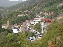 Leofara in 2004 | |
 | |
| Interactive map of Leofara | |
| Country | |
| Region | Abruzzo |
| Province | Teramo |
| Elevation | 3,600 ft (1,100 m) |
| Population (2001) | |
• Total | 26 |
| Time zone | UTC+1 (CET) |
| • Summer (DST) | UTC+2 (CEST) |
Leofara is a frazione in the Province of Teramo in the Abruzzo region of Italy.
42°44′37″N13°33′09″E / 42.74361°N 13.55250°E
| | This Abruzzo location article is a stub. You can help Wikipedia by expanding it. |