Leopard Creek

Last updated
The creek and Colorado State Highway 62 Leopard Creek.JPG
The creek and Colorado State Highway 62

Leopard Creek is a stream located entirely within San Miguel County, Colorado. [1]

Stream A body of surface water flowing down a channel

A stream is a body of water with surface water flowing within the bed and banks of a channel. The stream encompasses surface and groundwater fluxes that respond to geological, geomorphological, hydrological and biotic controls.

San Miguel County, Colorado County in the United States

San Miguel County is one of the 64 counties of the U.S. state of Colorado. As of the 2010 census, the population was 7,359. The county seat is Telluride. The county is named for the San Miguel River.

Colorado State of the United States of America

Colorado is a state of the Western United States encompassing most of the southern Rocky Mountains as well as the northeastern portion of the Colorado Plateau and the western edge of the Great Plains. It is the 8th most extensive and 21st most populous U.S. state. The estimated population of Colorado was 5,695,564 on July 1, 2018, an increase of 13.25% since the 2010 United States Census.

According to tradition, the sighting of a leopard near the creek accounts for the name. [2]

See also

Related Research Articles

Uravan, Colorado human settlement in Colorado, United States of America

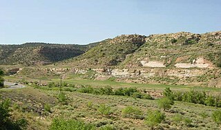
Uravan is an abandoned uranium mining town in western Montrose County, Colorado, United States, that is now a Superfund site. The town was a company town established by U. S. Vanadium Corporation in 1936 to extract the rich vanadium ore in the region. As a byproduct of vanadium extraction, small amounts of uranium were also produced, at the time mostly used as a yellow pigment.

Conejos, Colorado Census-designated place in State of Colorado, United States

Conejos is a census-designated place, a U.S. Post Office, and the county seat of Conejos County, Colorado, United States. Conejos has the distinction of being the only unincorporated county seat in the state of Colorado. As of the 2010 Census, the CDP had a population of 58. The community is located in the San Luis Valley.

Placerville, Colorado Unincorporated community in Colorado, United States

Placerville is an unincorporated community and a U.S. Post Office located in San Miguel County, Colorado, United States. The Placerville Post Office has the ZIP Code 81430.

Gateway, Colorado Unincorporated community in Colorado, United States

Gateway is an unincorporated community and a U.S. Post Office located in Mesa County, Colorado, United States. The Gateway Post Office has the ZIP Code 81522.

Paradox, Colorado Unincorporated community in Colorado, United States

Paradox is an unincorporated community and a U.S. Post Office located in Montrose County, Colorado, United States. The Paradox Post Office has the ZIP Code 81429.

Caddoa, Colorado Unincorporated community in State of Colorado, United States

Caddoa is an unincorporated community in Bent County, Colorado, United States. The U.S. Post Office at Hasty now serves Caddoa postal addresses.

Wild Horse Creek is a stream in the U.S. state of Colorado.

Stoner Creek is a stream in Dolores County, Colorado, in the United States.

Howard Creek is a stream in the U.S. state of Colorado.

Alder Creek is a stream entirely within Saguache County, Colorado.

Arriola is an unincorporated community in Montezuma County, in the U.S. state of Colorado.

Caddoa Creek is a stream in the U.S. state of Colorado.

Cannibal Plateau is a summit in Hinsdale County, Colorado, in the United States. With an elevation of 12,760 feet (3,890 m), Cannibal Plateau is the 800th highest summit in the state of Colorado.

Cebolla Creek stream in Gunnison County, United States of America

Cebolla Creek is a stream in the U.S. state of Colorado, and is a tributary of the Gunnison River.

Deception Creek is a stream in the U.S. state of Colorado.

Dove Creek is a stream in the U.S. state of Colorado.

Granada Creek is a stream in the U.S. state of Colorado.

Lay Creek is a stream in the U.S. state of Colorado.

Stoner is an unincorporated community in Montezuma County, in the U.S. state of Colorado.

Timpas Creek river in the United States of America

Timpas Creek is a stream in the U.S. state of Colorado.

References

  1. U.S. Geological Survey Geographic Names Information System: Leopard Creek
  2. Dawson, John Frank. Place names in Colorado: why 700 communities were so named, 150 of Spanish or Indian origin. Denver, CO: The J. Frank Dawson Publishing Co. p. 32.

Coordinates: 38°01′12″N108°03′42″W / 38.02000°N 108.06167°W / 38.02000; -108.06167

Geographic coordinate system Coordinate system

A geographic coordinate system is a coordinate system that enables every location on Earth to be specified by a set of numbers, letters or symbols. The coordinates are often chosen such that one of the numbers represents a vertical position and two or three of the numbers represent a horizontal position; alternatively, a geographic position may be expressed in a combined three-dimensional Cartesian vector. A common choice of coordinates is latitude, longitude and elevation. To specify a location on a plane requires a map projection.