
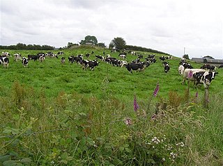
Shanmaghery or Shanmaghry is a small hamlet and townland in County Tyrone, Northern Ireland, situated three miles from Pomeroy and three miles from Galbally. It is situated in the barony of Dungannon Middle and the civil parish of Pomeroy and covers an area of 426 acres. In 1841 the population of the townland was 193 people and in 1851 it was 161 people. "Paul's Planting" was a notable landmark on top of the hill.

Evish is a small rural community area and townland in County Tyrone, Northern Ireland, 3 miles from Strabane and 7 miles from Plumbridge. It is situated in the barony of Strabane Lower and the civil parish of Camus and covers an area of 870 acres.
Ballymully Glebe is a townland in County Tyrone, Northern Ireland. It is situated in the historic barony of Dungannon Upper and the civil parish of Desertcreat and covers an area of 144 acres.

Aghalunny is a townland in County Tyrone, Northern Ireland. It is situated in the historic barony of Omagh West and the civil parish of Termonamongan and covers an area of 493 acres.
Branny is a townland in County Tyrone, Northern Ireland. It is situated in the historic barony of Dungannon Lower and the civil parish of Carnteel and covers an area of 228 acres.

Doocrock is a townland in County Tyrone, Northern Ireland. It is situated in the historic barony of Omagh East and the civil parish of Dromore and covers an area of 426 acres.

Garvaghullion is a townland in County Tyrone, Northern Ireland. It is situated in the barony of Omagh West and the civil parish of Longfield East and covers an area of 640 acres.

Glenmacoffer is a townland in County Tyrone, Northern Ireland. It is situated in the barony of Strabane Upper and the civil parish of Bodoney Lower and covers an area of 2703 acres.
Gortalowry is a townland in County Tyrone, Northern Ireland. It is situated in the barony of Dungannon Upper and the civil parish of Derryloran and covers an area of 281 acres. The townland is partly rural, but includes the southern part of the town of Cookstown.
Lisgobban is a townland in County Tyrone, Northern Ireland. It is situated in the barony of Dungannon Middle and the civil parish of Clonfeacle and covers an area of 135 acres.
Liskincon is a townland in County Tyrone, Northern Ireland. It is situated in the barony of Omagh East and the civil parish of Termonmaguirk and covers an area of 96 acres.
Mallabeny is a townland in County Tyrone, Northern Ireland. It is situated in the barony of Clogher and the civil parish of Clogher and covers an area of 328 acres.
Muntober is a townland in County Tyrone, Northern Ireland. It is situated in the barony of Dungannon Upper and the civil parish of Kildress and covers an area of 613 acres.

Oughtboy is a townland in County Tyrone, Northern Ireland. It is situated in the barony of Strabane Upper and the civil parish of Bodoney Upper and covers an area of 964 acres.

Oughtdoorish is a townland in County Tyrone, Northern Ireland. It is situated in the barony of Strabane Upper and the civil parish of Bodoney Upper and covers an area of 1848 acres.

Radergan is a townland in County Tyrone, Northern Ireland. It is situated in the barony of Omagh East and the civil parish of Clogherny and covers an area of 919 acres.

Reaghan is a townland in County Tyrone, Northern Ireland. It is situated in the barony of Strabane Upper and the civil parish of Cappagh and covers an area of 567 acres.
Tattycor is a townland in County Tyrone, Northern Ireland. It is situated in the barony of Omagh East and the civil parish of Dromore and covers an area of 355 acres.

Tonnagh More is a townland in County Tyrone, Northern Ireland. It is situated in the barony of Omagh East and the civil parish of Donacavey and covers an area of 317 acres.

Carrigans is a townland in County Tyrone, Northern Ireland. It is situated in the historic barony of Strabane Upper and the civil parish of Cappagh and covers an area of 859 acres.

