Okehampton is a town and civil parish in West Devon in the English county of Devon. It is situated at the northern edge of Dartmoor, and had a population of 5,922 at the 2011 census. Two electoral wards are based in the town. Their joint population at the same census was 7,500.
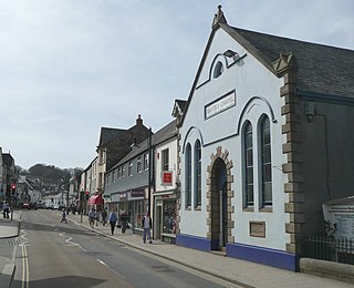
Ivybridge is a town and civil parish in the South Hams, in Devon, England. It lies about nine miles east of Plymouth. It is at the southern extremity of Dartmoor, a National Park of England and Wales and lies along the A38 "Devon Expressway" road. There are two electoral wards in Ivybridge East and Ivybridge West with a total population of 11,851.

Chagford is a market town and civil parish on the north-east edge of Dartmoor, in Devon, England, close to the River Teign and the A382, 4 miles (6 km) west of Moretonhampstead. The name is derived from chag, meaning gorse or broom, and the ford suffix indicates its importance as a crossing place. At the 2011 Census, it had a population of 1,449.

Ilsington is a village and civil parish situated on the eastern edge of Dartmoor, Devon, England. It is one of the largest parishes in the county, and includes the villages of Ilsington, Haytor Vale, Liverton and South Knighton. The parish is surrounded, clockwise from the north, by the parishes of Bovey Tracey, Teigngrace, Newton Abbot, Ogwell, Bickington, Ashburton, Widecombe-in-the-Moor and Manaton. In 2001 the population of the parish was 2,444, greatly increased from the 886 residents recorded in 1901. The parish is represented in parliament by Mel Stride, as part of the Central Devon constituency.

Poundsgate is a small village in Dartmoor, Devon, England, located on the road between Ashburton and Princetown.
Holne is a village and civil parish on the southeastern slopes of Dartmoor in Devon, England. A community has existed here since at least the 11th century, and today a population of around 250 people is served by a church and a public house, the Church House Inn.

Belstone is a small village and civil parish in the West Devon District of Devon, England. Lying on the northern side of Dartmoor, the western boundary of the parish is mostly formed by the East Okement River and the eastern by the River Taw; its highest point is Belstone Tor in the south, at 1,508 feet. The parish is surrounded, clockwise from the north, by the parishes of Sticklepath, South Tawton, Dartmoor Forest and Okehampton Hamlets. In 2001 its population was 257, relatively unchanged from the 1901 figure of 236.

Bovey Tracey is a small town and civil parish in Devon, England, on the edge of Dartmoor, its proximity to which gives rise to the "slogan" used on the town's boundary signs, "The Gateway to the Moor". It is often known locally as "Bovey". It is about 10 miles south-west of Exeter and lies on the A382 road, about halfway between Newton Abbot and Moretonhampstead. The village is at the centre of the electoral ward of Bovey. At the 2011 census the population of this ward was 7,721.

Cookbury is a village and civil parish in the local government district of Torridge, Devon, England. The parish, which lies about five miles east of the town of Holsworthy, is surrounded clockwise from the north by the parishes of Thornbury, Bradford, Ashwater, Hollacombe, and Holsworthy Hamlets. In 2001 its population was 158, little changed from the 146 residents it had in 1901.

Bickington is a village and civil parish in the Teignbridge district of Devon, England, on the east edge of the Dartmoor National Park. At the 2001 census it had a population of 311. The village is about five miles west of Newton Abbot, on the River Lemon. The church is 15th century; its lychgate has a room over it.

Newton St Cyres is a village, civil parish former manor and former ecclesiastical parish in Mid Devon, in the English county of Devon, located between Crediton and Exeter. It had a population of 562 at the 2011 Census. The village is part of the Newbrooke electoral ward. The ward population at the above census was 1,520. Almost destroyed by fire in the early 1960s, its main point of interest is the Parish Church, built in the 15th century and dedicated to the martyrs St. Cyriac and his mother St. Julitta. Most of the church is in early Perpendicular style, built of local reddish 'trap', a volcanic stone from quarries at Posbury, with the exception of the nave pillars, which are of Beer stone. It contains the monument with standing effigy of John Northcote (1570-1632) of Hayne, lord of the manor of Newton St Cyres. Newton St Cyres railway station is on the Tarka Line from Exeter to Barnstaple and the Dartmoor Line from Exeter to Okehampton, but is located approximately 0.5 miles outside the village centre, and receives an infrequent service.

Sampford Peverell is a village and civil parish in Mid-Devon, England. An old Saxon settlement, it was called Sanforda in the 1086 Doomsday Book. Its current name reflects its inclusion in the Honour of Peverel, the lands of William Peverel and his family. His great-grandson, Hugh Peverell, is buried in the village church of St John the Baptist. The parish is surrounded, clockwise from the north, by the parishes of Hockworthy, Holcombe Rogus, Burlescombe, Halberton and Uplowman.

Cheriton Bishop is a village and civil parish situated on the northern borders of Dartmoor National park between Exeter and Okehampton, in Devon, England. The population at the 2011 Census was 652. The history of the settlement can be traced back over a thousand years when the old village centre was established as a commercial centre for the local farming community.

Witheridge is a village and civil parish in the North Devon district of Devon, England. In 2001 the population of the parish was 1162, reducing slightly to 1,158 at the 2011 Census. An electoral ward with the same name exists. The population at the above census was 2,313. Its name may be derived from the Old English for "Weather Ridge", which would fit with the village's somewhat exposed situation.
Dartmoor Forest is a civil parish in Devon, England. It was formed in 1987 by the splitting of the former parish of Lydford. It covers about 56,000 acres (230 km2) entirely within Dartmoor National Park, and is the largest parish in Devon. Despite its size its population in 2001 was only 1,619. Due to its large size it is surrounded by many other parishes: these are, clockwise from the north, Belstone, South Tawton, Throwleigh, Gidleigh, Chagford, North Bovey, Manaton, Widecombe in the Moor, Holne, West Buckfastleigh, Dean Prior, South Brent, Ugborough, Harford, Cornwood, Shaugh Prior, Sheepstor, Walkhampton, Whitchurch, Peter Tavy, Lydford, land common to the parishes of Bridestowe and Sourton, and Okehampton Hamlets.

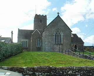
Gittisham is a village and civil parish in Devon near Honiton. The village is 3 miles (5 km) from Ottery St Mary and it has a church called St Michael. The parish is surrounded, clockwise from the north, by the parishes of Awliscombe, Honiton, Sidmouth, Ottery St Mary, Feniton and Buckerell.

North Bovey is a village and civil parish situated on the south-eastern side of Dartmoor National Park, Devon, England, about 11 miles WSW of the city of Exeter and 1.5 miles SSW of Moretonhampstead. The village lies above the eastern bank of the River Bovey from which it takes its name. In 2001 the population of the parish was 274, compared to 418 in 1901 and 519 in 1801.

Teigngrace is a civil parish centred on a hamlet that lies about two miles north of the town of Newton Abbot in Devon, England. According to the 2001 census, its population was 235, compared to 190 a century earlier. The western boundary of the parish mostly runs along the A382 road; its short northern boundary along the A38; and its eastern partly along the rivers Bovey and Teign. It comes to a point at its southern extremity, near Newton Abbot Racecourse. The parish is surrounded, clockwise from the north, by the parishes of Bovey Tracey, Kingsteignton, Newton Abbot and a small part of Ilsington.

West Buckfastleigh is a small civil parish on the eastern border of Dartmoor in Devon, England. Situated within the parish are the village of Scorriton and the hamlets of Michelcombe and Combe.

Chittlehamholt is a village and civil parish in North Devon district, Devon, England. In the 2011 census it was recorded as having a population of 169.
