Ache or Aches may refer to:

The Inn is a river in Switzerland, Austria and Germany. The 518 km (322 mi) long river is a right tributary of the Danube, being the third largest tributary of the Danube by discharge. The highest point of its drainage basin is the summit of Piz Bernina at 4,049 m (13,284 ft). The Engadine, the valley of the En, is the only Swiss valley whose waters end up in the Black Sea.

The Salzach is a river in Austria and Germany. It is 227 kilometres (141 mi) in length and is a right tributary of the Inn, which eventually joins the Danube. Its drainage basin of 6,829 km2 (2,637 sq mi) comprises large parts of the Northern Limestone and Central Eastern Alps. 83% of its drainage basin lies in Austria, the remainder in Germany (Bavaria). Its largest tributaries are Lammer, Berchtesgadener Ache, Saalach, Sur and Götzinger Achen.

The Isar is a river in Austria and in Bavaria, Germany. Its source is in the Karwendel mountain range of the Alps. The Isar river enters Germany near Mittenwald and flows through Bad Tölz, Munich, and Landshut before reaching the Danube near Deggendorf. With 295 km length, it is among the longest rivers in Bavaria. It is Germany's second most important tributary of the Danube.
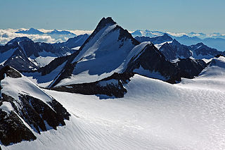
The Ötztal Alps are a mountain range in the Central Eastern Alps, in the State of Tyrol in western Austria and the Province of South Tyrol in northern Italy.

The Karwendel is the largest mountain range of the Northern Limestone Alps. It is located on the Austria–Germany border. The major part belongs to the Austrian federal state of Tyrol, while the adjacent area in the north is part of Bavaria, Germany. Four chains stretch from west to east; in addition, there are a number of fringe ranges and an extensive promontory (Vorkarwendel) in the north.

The Loisach is a river that flows through Tyrol, Austria and Bavaria, Germany. The Loisach runs through the great moors Murnauer Moos and Loisach-Kochelsee-Moore

The Amper, called the Ammer upstream of the Ammersee, through which it runs, is the largest tributary of the Isar in southern Bavaria, Germany. It flows generally north-eastward, reaching the Isar in Moosburg, about 185 kilometres (115 mi) from its source in the Ammergau Alps, with a flow of 45 m³/s. Including its tributary, Linder, it is 209.5 km (130.2 mi) long. Major tributaries are the Glonn, which rises near Augsburg; the Würm, which is the outflow of Lake Starnberg; and the Maisach.
Leutasch is a municipality in the northern part of the district Innsbruck-Land in the Austrian state of Tyrol about 30 km northwest of Innsbruck and 10 km northwest of Seefeld in Tirol

The Wetterstein mountains, colloquially called Wetterstein, is a mountain group in the Northern Limestone Alps within the Eastern Alps, crossing the Austria–Germany border. It is a comparatively compact range located between Garmisch-Partenkirchen, Mittenwald, Seefeld in Tirol and Ehrwald along the border between Germany (Bavaria) and Austria (Tyrol). Zugspitze, the highest peak is at the same time the highest mountain in Germany.
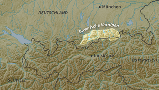
The Bavarian Prealps are a mountain range within the Northern Limestone Alps along the Austria–Germany border. They include the Bavarian Prealp region between the river Loisach to the west and the river Inn to the east; the range is about 80 kilometres (50 mi) long and 20–30 kilometres (12–19 mi) wide. The term is not defined politically, but alpine-geographically because, although the range is mostly located in Bavaria, southeast Germany, small areas of the Bavarian Prealps lie in the state of Tyrol, Austria.

The Arnspitze Group is a free-standing mountain chain in Austrian and Germany, in the states of Tyrol and Bavaria, between Seefeld in Tirol and Mittenwald, and between the Leutasch valley in the west and the Isar valley near Scharnitz in the east. In the literature, the Arnspitze Group is classed as part of the Wettersteingebirge. The majority of the group belongs to Tyrol, a northeastern part of the chain lies in Bavaria. The border between Bavaria and Tyrol runs over the summit of the Große Arnspitze.

The Mieming(er) Range, Mieminger Chain or Mieminger Mountains, is a mountain range of the Northern Limestone Alps in the Eastern Alps. It is located entirely in Austria within the state of Tyrol. This sub-group is somewhat in the shadows of its more famous neighbour, the Wetterstein to the north. Whilst the region around the Coburger Hut and the lakes of Seebensee and Drachensee in the west and the Hohe Munde in the extreme east receive large numbers of visitors, the less developed central area remains very quiet. The Hohe Munde is also a popular and challenging ski touring destination.
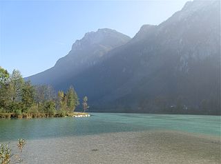
Kieferbach is a river of Tyrol, Austria and Bavaria, Germany. It is a left tributary of the Inn and flows into it near Kiefersfelden.
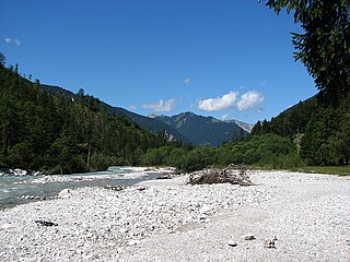
Rißbach is a river of Tyrol, Austria and Bavaria, Germany. Its source is in the Karwendel mountains in Austria. It passes through the valley Rißtal, and flows into the Isar in Vorderriß, Lenggries, Germany.

The Scharnitz Pass is a narrow section of the upper Isar valley in the Northern Limestone Alps. It lies at a height of about 955 m on the Austro-German border between the states of Bavaria and Tyrol. Its name derives from the village of Scharnitz immediately to the south.

The Porta Claudia is a former fortification at the Scharnitz Pass, where the valley of the River Isar narrows near the village of Scharnitz, on the Bavarian border near Mittenwald. The Porta Claudia – or more precisely the Scharnitz Pass – is the start of the present federal highways, the B 2 (Germany) and the B 177 (Austria).
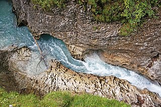
The Leutasch Gorge is a gorge near Mittenwald and Unterleutasch in the Bavarian-Tyrolean border area through which the Leutascher Ache river flows. It is very steep-sided and was not opened to tourists until 2006. To do this a 1.4 million euro, EU-supported, Austro-German project was undertaken to build steel walkways and bridges over a distance of 970 metres. With a total length of 1,650 metres it is the longest accessible gorge in the Eastern Limestone Alps. The gorge was opened on 24 May 2006.

The border between the modern states of Austria and Germany has a length of 815.9 km (507.0 mi), or 815.0 km (506.4 mi) respectively. It is the longest international border of Austria and the second longest border of Germany with another country.


