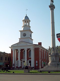
Mifflin County is a county in the U.S. state of Pennsylvania. As of the 2010 United States Census, the population was 46,682. Its county seat is Lewistown. The county was created on September 19, 1789, from parts of Cumberland County and Northumberland County. It was named for Thomas Mifflin, the first Governor of Pennsylvania.
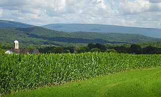
Huntingdon County is a county located in the center of the U.S. state of Pennsylvania. As of the 2010 census, the population was 45,913. Its county seat is Huntingdon. The county was created on September 20, 1787, mainly from the north part of Bedford County, plus an addition of territory on the east from Cumberland County.
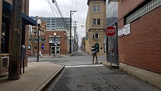
State College is a home rule municipality in Centre County in the Commonwealth of Pennsylvania. It is a college town, dominated economically and demographically by the presence of the University Park campus of the Pennsylvania State University.

Lewistown is a borough in and the county seat of Mifflin County, Pennsylvania, United States. It is the principal city of the Lewistown, PA Micropolitan Statistical Area, which encompasses all of Mifflin County. It lies along the Juniata River, 61 miles (98 km) northwest of Harrisburg. The number of people living in the borough in 1900 was 4,451; in 1910, 8,166; in 1940, 13,017; and in 2000, 8,998. The population was 8,338 at the 2010 census. Of the four communities in the United States named "Lewistown", this borough is the largest.

Reedsville is a census-designated place (CDP) in the Kishacoquillas Valley of Mifflin County, Pennsylvania, United States. The population was 641 at the 2010 census. Reedsville has a high Amish population.

The Juniata River is a tributary of the Susquehanna River, approximately 104 miles (167 km) long, in central Pennsylvania in the United States. The river is considered scenic along much of its route, having a broad and shallow course passing through several mountain ridges and steeply-lined water gaps. It formed an early 18th-century frontier region in Pennsylvania and was the site of Native American attacks against white settlements during the French and Indian War. The watershed of the river encompasses an area of approximately 3,400 square miles (8,800 km2), approximately one-eighth of the drainage area of the Susquehanna. Approximately two-thirds of the watershed is forested. It is the second largest tributary of the Susquehanna after the West Branch Susquehanna.

The Mifflin County School District is a midsized, rural public school district located in the Commonwealth of Pennsylvania. The district boundaries coincide with the boundaries of Mifflin County, minus the southwestern municipalities of Kistler and Newton Hamilton boroughs and Wayne Township, which are part of the Mount Union Area School District. Mifflin County School District encompasses approximately 362.3 square miles. According to 2000 federal census data, it served a resident population of 46,486. Based on 2010 federal census data, the district's resident population grew to 46,682. The educational attainment levels for the Mifflin County School District population were 81.4% high school graduates and 11.1% college graduates.

Rothrock State Forest is a Pennsylvania state forest in Pennsylvania Bureau of Forestry District #5. The main offices are located in Huntingdon in Huntingdon County, Pennsylvania in the United States.

Bald Eagle State Forest is a Pennsylvania state forest in Pennsylvania Bureau of Forestry District #7. The main office is located in Laurelton in Union County, Pennsylvania, in the United States. The forest is found in Centre, Clinton, Mifflin, Snyder, and Union Counties. Bald Eagle shares a common border on its western extent with Rothrock State Forest and on its northern extent with Tiadaghton State Forest.

The Altoona Area School District is a large, urban, public school district based in Altoona, Pennsylvania. The school district encompasses 59.6 square miles (154 km2) which includes all of Altoona, Logan Township and a small portion of Tyrone Township. According to 2000 federal census data, it serves a resident population of 63,248. Per District officials, in school year 2007-08 the Altoona Area School District provided basic educational services to 7,946 pupils. The District employed 569 teachers, 557 full-time and part-time support personnel, and 36 administrators. Altoona Area School District had a student body of approximately 8,000 in 2000, it was the 18th largest school district in Pennsylvania. It is one of the largest employers in Blair County with a staff of over 1,500. In 2002, the Altoona Area School District achieved its long-term goal of becoming ISO 9001 certified. It was the fifth school district in the United States to achieve this designation. AASD received more than $51.7 million in state funding in school year 2007-08.

Pennsylvania Route 103 is a 30.8-mile (49.57 km) long north–south designated state route in the Commonwealth of Pennsylvania. Its primary course is along the south/east side of the Juniata River, while U.S. Route 522 runs along the opposite side. PA 103's southern terminus is an at-grade intersection with US 522 at Allenport in Shirley Township, a bit south of US 522's bridge across the Juniata River in Mount Union. Its northern terminus is an intersection with US 22 Business in Lewistown. It intersects the northern terminus of PA 333 just south of Juniata Terrace.
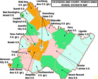
The Penn-Trafford School District is a public school district that serves western Westmoreland County, Pennsylvania and a small portion of Allegheny County, Pennsylvania. The district is governed by a locally elected, nine member school board who serve, staggered four-year terms, the Pennsylvania General Assembly and the Pennsylvania Department of Education. The district neighbors 7 other school districts: Franklin Regional, Greensburg-Salem, Hempfield Area, Jeannette City, Norwin, Gateway, and East Allegheny. The district mascot is the Warrior.

For other educational establishments with a similar name please see William Penn School

Pennsylvania Route 305 is a 29-mile-long (47 km) state highway located in Huntingdon and Mifflin Counties in Pennsylvania. The western terminus is at US 22 in Alexandria. The eastern terminus is at PA 655 in Belleville. The route crosses the Stone Mountain ridge following a valley along a fault line at 40°37′46″N77°45′31″W near Greenwood Furnace State Park.
Kishacoquillas Creek is a 24.0-mile-long (38.6 km) tributary of the Juniata River in Mifflin County, Pennsylvania in the United States.

West Mifflin Area School District is a suburban, public school district in the Commonwealth of Pennsylvania. It is located in the south hills of Allegheny County. It serves the boroughs of West Mifflin, and Whitaker. As of 2007, the district also serves some students from the neighboring City of Duquesne. West Mifflin Area School District encompasses approximately 15 square miles. According to 2000 federal census data, it serves a resident population of 22,802. In 2009, the district residents' per capita income was $18,240, while the median family income was $45,660. Per District officials, in school year 2005–06, the West Mifflin Area School District provided basic educational services to 3,273 pupils through the employment of 199 teachers, 111 full-time and part-time support personnel, and 18 administrators. In 2009, the school districts served 3,149 students.

Penn-Trafford High School is a public high school located in Harrison City, Pennsylvania in Westmoreland County, and is the secondary school serving the Penn-Trafford School District. It is the result of several mergers of smaller school districts and entities. It is the successor of Penn Joint High School and Trafford High School. The school colors are green and gold. The different government entities that are incorporated into this school district are, in size order, Penn Township, Trafford Borough, Manor Borough (part), and Penn Borough. The school district is mainly in Westmoreland County, Pennsylvania with a small part of Trafford Borough in Allegheny County, Pennsylvania.
Highlands High School is a suburban, public secondary school in the Natrona Heights neighborhood of Harrison Township in the U.S. state of Pennsylvania. It is part of the Highlands School District and has a current enrollment of about 800 students in grades nine through twelve.
Logan's Path was the name of two major Native American trails in the U.S. State of Pennsylvania that ran from two locations on the West Branch Susquehanna River in what is now Clinton County to the native village of Kishacoquillas on the Juniata River. One branch ran from the Great Island along Bald Eagle Creek and Fishing Creek then overland to Penns Creek. The other branch started at the village of Tishimingo near the mouth of Chatam Run then overland south to Kishacoquillas in modern Mifflin County.

Mifflin County High School, is a mid sized, rural public high school. It is the sole high school operated by the Mifflin County School District. The school was established in 2011 by the merging of the district's two former high schools. This move was due to budget cuts and aging facilities in the other schools. Construction of Mifflin County High School cost $64 million in 2011. Local public debt was used to finance the building. The 251,088 square foot building was built by Hayes Large Architects, LLP.


