"Lambert of Saint-Omer" redirects here. For the chronicler and abbot, see Lambert of Saint-Bertin.
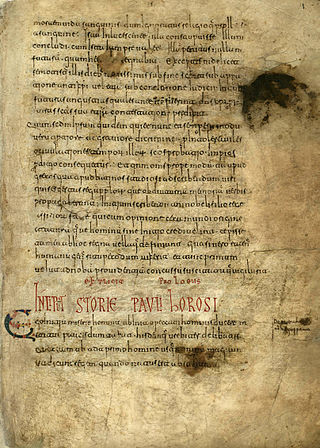
Lambert at work. Excerpt from the manuscript "Liber Floridus". Preserved in the Ghent University Library.Lambert, Canon of St. Omer, Liber Floridus (Lille and Ninove, 1460)
Liber Floridus ("Book of Flowers") is a medieval encyclopedia that was compiled between 1090 and 1120 by Lambert, Canon of Saint-Omer.[2] The text compiles extracts from some 192 or so different works.[3]
Lambert's medieval encyclopedia contains a universal history, a chronological record of events to the year 1119. These are of Biblical, astronomical, geographical, philosophical and natural history subjects. Lambert wrote Liber Floridus originally in Latin, and later it was translated into French as Le Livre fleurissant en fleurs. A detailed description is in the Historia comitum Normannorum, comitum Flandriae.[4]
The Liber Floridus was the first of the encyclopedias of the High Middle Ages that slowly superseded the work of Isidore of Seville.[5] The original manuscript, completed in 1120 and dedicated to Saint Omer by Lambert, has been preserved in the Ghent University Library,[1] though its latter portion has not survived.[6] A copy is in the Bibliothèque Nationale, Paris.[7] There is also a copy in the Herzog August Bibliothek, Wolfenbüttel, Germany.[3] There may be as many as six additional extant manuscript copies, dating from the twelfth to the sixteenth centuries and produced in France or Flanders.[8]Liber Floridus has the reputation of being one of the most famous encyclopedias of the Middle Ages.[9]
Liber Floridus includes various maps including a mappa mundi. The Ghent manuscript, being the oldest of the known copies and dating from earlier than 1125, includes a map of parts of Europe and two climate-zone drawings based on the Macrobian model as an attempt to make a complete world map. The parts of the European map sketch show interesting and odd representations. This manuscript and the associated maps are believed to have been done personally by Lambert.[3]
World map of 12th century
The Wolfenbüttel and Paris copies with their European "mappa mundi" date from somewhere around 1150. Historians do not believe these were done by Lambert. R. Uhden points out[10] that the world map in the Wolfenbüttel copy has a legend saying the original source was from Martianus Capella (fl. 410 - 439). This reference has been backed up by information found in various other inscriptions on the map that are passages from Martianus' Satyricon, also known as De Nuptiis Philologiae et Mercurii.[3]
Lambert collected his material from such sources as Isidore's Etymologiae, the Historia Brittonum, and the crusade chronicle of Bartolf of Nangis. Lambert frequently mentions crusaders from Saint-Omer and elsewhere, whom he presumably met when they returned home.[11] In 1968 Albert Derolez published a copy of the Ghent manuscript, with historical and palaeographical introductions. It included a number of photographs of the original manuscript pages.[12]
The Liber has sometimes been incorrectly attributed to Lambert of St-Bertin, a monk at the Abbey of Saint Bertin. The compiler of the Liber was a canon at the nearby church of Our Lady of Saint-Omer. His father, Onulfus, had also been a canon at the same church.[13]
↑ Albert Derolez, The autograph manuscript of the Liber Floridus: a key to the encyclopedia of Lambert of Saint-Omer, 1998. See more recently A. Derolez, The Making and Meaning of the Liber Floridus. A Study of the Original Manuscript, Ghent, University Library, MS 92 (= Studies in Medieval and Early Renaissance Art History 76), Turnhout: Harvey Miller, 2015 ( ISBN978-1-909400-22-1)
↑ Its contents were fully listed and summarized by L. Delisle, "Notice sur les MSS du 'Liber Floridus' composé en 1120 par Lambert, chânoine de Saint-Omer", Notices et extraits des MSS du Bibliothèque Nationale, 38.2 (Paris, 1903), pp 577-791.
↑ Penelope C. Mayo, "The crusaders under the palm: allegorical plants and cosmic kingship in the 'Liber Floridus'" (Dumbarton Oaks Papers 27, 1973), pg. 39.
↑ Derolez, Lamberti S. Audomari Canonici Liber Floridus: Codex Autographus Bibliothecae Universitatis Gandavensis (Ghent, 1968).
Herbermann, Charles George, The Catholic Encyclopedia: An International Work of Reference on the Constitution, Doctrine, Discipline, and History of the Catholic Church, Encyclopedia Press, 1913
External links
- a website from the Ghent University Library on the history of the manuscript, its contents, and its creator, including many more images from the Liber Floridus
Bartholomaeus Anglicus, also known as Bartholomew the Englishman and Berthelet, was an early 13th-century Scholastic of Paris, a member of the Franciscan order. He was the author of the compendium De proprietatibus rerum, dated c.1240, an early forerunner of the encyclopedia and a widely cited book in the Middle Ages. Bartholomew also held senior positions within the church and was appointed Bishop of Łuków in what is now Poland, although he was not consecrated to that position.
Saint-Omer is a commune and sub-prefecture of the Pas-de-Calais department in France.
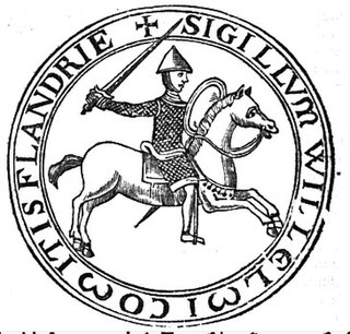
William Clito was a member of the House of Normandy who ruled the County of Flanders from 1127 until his death and unsuccessfully claimed the Duchy of Normandy. As the son of Robert Curthose, the eldest son of William the Conqueror, William Clito was seen as a candidate to succeed his uncle King Henry I of England. Henry viewed him as a rival, however, and William allied himself with King Louis VI of France. Louis installed him as the new count of Flanders upon the assassination of Charles the Good, but the Flemings soon revolted and William died in the struggle against another claimant to Flanders, Thierry of Alsace.
A mappa mundi is any medieval European map of the world. Such maps range in size and complexity from simple schematic maps 25 millimetres or less across to elaborate wall maps, the largest of which to survive to modern times, the Ebstorf map, was around 3.5 m in diameter. The term derives from the Medieval Latin words mappa and mundus (world).
A T and O map or O–T or T–O map, also known as an Isidoran map, is a type of early world map that represents world geography as first described by the 7th-century scholar Isidore of Seville (c. 560–636) in his De Natura Rerum and later his Etymologiae (c. 625)
The Hereford Mappa Mundi is the largest medieval map still known to exist, depicting the known world. It is a religious rather than literal depiction, featuring heaven, hell and the path to salvation. The map is drawn in a form deriving from the T and O pattern, dating from c. 1300. It is displayed at Hereford Cathedral in Hereford, England. The map was created with the intent of its being appreciated as an intricate work of art rather than as a navigational tool. Sources for the information presented on the map include the Alexander tradition, medieval bestiaries and Monstrous races tradition, as well as the Bible.
Roger Vacarius (1120–1200?) was an Italian authority in civil and canon law who was known to author the Liber pauperum which between the years 1190-1220 influenced the development of legal studies in the University of Oxford. According to Gervase of Canterbury, Vacarius became the first known teacher of Roman law in England.
The earliest known world maps date to classical antiquity, the oldest examples of the 6th to 5th centuries BCE still based on the flat Earth paradigm. World maps assuming a spherical Earth first appear in the Hellenistic period. The developments of Greek geography during this time, notably by Eratosthenes and Posidonius culminated in the Roman era, with Ptolemy's world map, which would remain authoritative throughout the Middle Ages. Since Ptolemy, knowledge of the approximate size of the Earth allowed cartographers to estimate the extent of their geographical knowledge, and to indicate parts of the planet known to exist but not yet explored as terra incognita.
The Códice de Roda or Códice de Meyá is a medieval manuscript that represents a unique primary source for details of the 9th- and early 10th-century Kingdom of Navarre and neighbouring principalities. It is currently held in Madrid as Real Academia de la Historia MS 78.
Lambert of Saint-Bertin was a French Benedictine chronicler and abbot.
Henry, in German Heinrich, was the archbishop of Mainz from September 1142 until his deposition in June 1153.
Goscelin of Saint-Bertin was a Benedictine hagiographical writer. He was a Fleming or Brabantian by birth and became a monk of St Bertin's at Saint-Omer before travelling to England to take up a position in the household of Herman, Bishop of Ramsbury in Wiltshire (1058–78). During his time in England, he stayed at many monasteries and wherever he went collected materials for his numerous hagiographies of English saints.
Pietro Vesconte was a Genoese cartographer and geographer. A pioneer of the field of the portolan chart, he influenced Italian and Catalan mapmaking throughout the fourteenth and fifteenth centuries. He appears to have been the first professional mapmaker to sign and date his works regularly.
The Worksop Bestiary, also known as the Morgan Bestiary, most likely from Lincoln or York, England, is an illuminated manuscript created around 1185, containing a bestiary and other compiled medieval Latin texts on natural history. The manuscript has influenced many other bestiaries throughout the medieval world and is possibly part of the same group as the Aberdeen Bestiary, Alnwick Bestiary, St.Petersburg Bestiary, and other similar Bestiaries. Now residing in the Morgan Library & Museum in New York, the manuscript has had a long history of church, royal, government, and scholarly ownership.
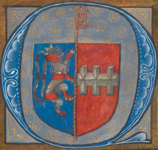
The Genealogia comitum Flandrensium, also called the Genealogia Bertiniana, is a short text containing a genealogy of the counts of Flanders. It exists today in three versions, all based on an archetype produced probably at Saint Peter's Abbey in Ghent shortly after the death of Count Baldwin V in 1067. The three versions are all identical up to the 1067, thereafter they diverge. The first version, 204 words in length, continues the genealogy to the death of Robert II (1111); the second, 243 words, to that of Baldwin VII (1119); and the third, 337 words, to that of Theoderic (1168). The complete, 337-word text with variants was edited by Ludwig Bethmann and published in the Monumenta Germaniae Historica. It was published under the title Genealogia comitum Flandriae Bertiniana because Bethmann mistakenly believed it to originate in the Abbey of Saint-Bertin.
The Sawley map, formerly known as the 'Henry of Mainz' map, is the earliest surviving mappa mundi made in England. It was made between about 1180 and the early 13th century. The map is the frontispiece of a copy of the Imago mundi of Honorius of Autun. It is oriented with east at the top and the island of Delos at the centre.
The V-in-squaremap is a highly schematic type of mappa mundi in use in Europe during the Middle Ages. It is based on and usually found in conjunction with the Etymologiae of Isidore of Seville.
Paolino Veneto was an Italian Franciscan inquisitor, diplomat and historian. He served as an ambassador for the Republic of Venice and the Papacy. From 1324 until his death, he was the bishop of Pozzuoli. He simultaneously served as a member of the royal council of King Robert of Naples. He wrote three universal chronicles in Latin–the Epithoma, Compendium and Satirica–and a mirror for princes in Venetian.
Raphael de Mercatellis, also known as Raphael of Burgundy, was a church official, imperial counsellor and bibliophile. He was the illegitimate son of Duke Philip the Good of Burgundy and a woman of Venetian origins, the wife of a merchant. He was born in Bruges. While pursuing a career within the Catholic church, and particularly after becoming abbot of Saint Bavo's Abbey in Ghent, he assembled a collection of lavish illuminated and decorated manuscripts. The library he created is of historical importance as the earliest library in the Low Countries containing a significant number of Renaissance humanist books. Sixty-five books from his library have been traced to collections worldwide, making it an unusually intact medieval book collection attributable to a single owner.
This page is based on this Wikipedia article Text is available under the CC BY-SA 4.0 license; additional terms may apply. Images, videos and audio are available under their respective licenses.


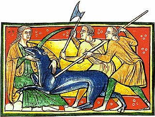
 Depicted: The Beast, Apocalypse
 Page scan B, three unclean spirits, a beast and a false prophet
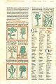 Page scan C, "Plants and Flowers"
 Liber Floridus explains how the world will end.