Glinnik is a village in the administrative district of Gmina Lubochnia, within Tomaszów Mazowiecki County, Łódź Voivodeship, in central Poland. It lies approximately 7 kilometres (4 mi) south-east of Lubochnia, 9 km (6 mi) north-east of Tomaszów Mazowiecki, and 51 km (32 mi) south-east of the regional capital Łódź.

Spała is a village in the administrative district of Gmina Inowłódz, within Tomaszów Mazowiecki County, Łódź Voivodeship, in central Poland. It lies on the Pilica River, approximately 6 kilometres (4 mi) west of Inowłódz, 9 km (6 mi) east of Tomaszów Mazowiecki, and 54 km (34 mi) south-east of the regional capital Łódź. The village has a population of 400. It gives its name to the protected area called Spała Landscape Park.
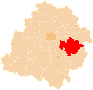
Spała Landscape Park is a protected area in central Poland, established in 1995, covering an area of 128.75 square kilometres (49.71 sq mi). It takes its name from the village of Spała.
Dąbrówka is a village in the administrative district of Gmina Czerniewice, within Tomaszów Mazowiecki County, Łódź Voivodeship, in central Poland. It lies approximately 3 kilometres (2 mi) south of Czerniewice, 16 km (10 mi) north-east of Tomaszów Mazowiecki, and 50 km (31 mi) east of the regional capital Łódź.
Gaj is a village in the administrative district of Gmina Czerniewice, within Tomaszów Mazowiecki County, Łódź Voivodeship, in central Poland. It lies approximately 6 kilometres (4 mi) south-east of Czerniewice, 18 km (11 mi) north-east of Tomaszów Mazowiecki, and 55 km (34 mi) east of the regional capital Łódź.
Krzemienica is a village in the administrative district of Gmina Czerniewice, within Tomaszów Mazowiecki County, Łódź Voivodeship, in central Poland. It lies approximately 5 kilometres (3 mi) north-east of Czerniewice, 23 km (14 mi) north-east of Tomaszów Mazowiecki, and 53 km (33 mi) east of the regional capital Łódź.
Podkonice Duże is a village in the administrative district of Gmina Czerniewice, within Tomaszów Mazowiecki County, Łódź Voivodeship, in central Poland. It lies approximately 8 kilometres (5 mi) north-east of Czerniewice, 27 km (17 mi) north-east of Tomaszów Mazowiecki, and 53 km (33 mi) east of the regional capital Łódź.
Podkonice Małe is a village in the administrative district of Gmina Czerniewice, within Tomaszów Mazowiecki County, Łódź Voivodeship, in central Poland. It lies approximately 6 kilometres (4 mi) north-east of Czerniewice, 24 km (15 mi) north-east of Tomaszów Mazowiecki, and 52 km (32 mi) east of the regional capital Łódź.
Brzustów is a village in the administrative district of Gmina Inowłódz, within Tomaszów Mazowiecki County, Łódź Voivodeship, in central Poland. It lies approximately 6 kilometres (4 mi) south-west of Inowłódz, 11 km (7 mi) east of Tomaszów Mazowiecki, and 58 km (36 mi) south-east of the regional capital Łódź.
Dąbrowa is a village in the administrative district of Gmina Inowłódz, within Tomaszów Mazowiecki County, Łódź Voivodeship, in central Poland. It lies approximately 7 kilometres (4 mi) south-west of Inowłódz, 10 km (6 mi) east of Tomaszów Mazowiecki, and 58 km (36 mi) south-east of the regional capital Łódź.
Konewka is a village in the administrative district of Gmina Inowłódz, within Tomaszów Mazowiecki County, Łódź Voivodeship, in central Poland. It lies approximately 7 kilometres (4 mi) north-west of Inowłódz, 9 km (6 mi) north-east of Tomaszów Mazowiecki, and 53 km (33 mi) south-east of the regional capital Łódź.
Królowa Wola is a village in the administrative district of Gmina Inowłódz, within Tomaszów Mazowiecki County, Łódź Voivodeship, in central Poland. It lies approximately 5 kilometres (3 mi) north-west of Inowłódz, 12 km (7 mi) east of Tomaszów Mazowiecki, and 56 km (35 mi) south-east of the regional capital Łódź.
Poświętne is a village in the administrative district of Gmina Inowłódz, within Tomaszów Mazowiecki County, Łódź Voivodeship, in central Poland. It lies approximately 3 kilometres (2 mi) north of Inowłódz, 15 km (9 mi) east of Tomaszów Mazowiecki, and 58 km (36 mi) south-east of the regional capital Łódź.
Teofilów is a village in the administrative district of Gmina Inowłódz, within Tomaszów Mazowiecki County, Łódź Voivodeship, in central Poland. It lies approximately 3 kilometres (2 mi) north-west of Inowłódz, 13 km (8 mi) east of Tomaszów Mazowiecki, and 57 km (35 mi) south-east of the regional capital Łódź.
Żądłowice is a village in the administrative district of Gmina Inowłódz, within Tomaszów Mazowiecki County, Łódź Voivodeship, in central Poland. It lies approximately 5 kilometres (3 mi) north-east of Inowłódz, 18 km (11 mi) east of Tomaszów Mazowiecki, and 62 km (39 mi) south-east of the regional capital Łódź.
Zakościele is a village in the administrative district of Gmina Inowłódz, within Tomaszów Mazowiecki County, Łódź Voivodeship, in central Poland. It lies approximately 2 kilometres (1 mi) east of Inowłódz, 16 km (10 mi) east of Tomaszów Mazowiecki, and 61 km (38 mi) south-east of the regional capital Łódź.
Ciebłowice Małe is a village in the administrative district of Gmina Tomaszów Mazowiecki, within Tomaszów Mazowiecki County, Łódź Voivodeship, in central Poland. It lies approximately 6 kilometres (4 mi) east of Tomaszów Mazowiecki and 52 km (32 mi) south-east of the regional capital Łódź.
Wąwał is a village in the administrative district of Gmina Tomaszów Mazowiecki, within Tomaszów Mazowiecki County, Łódź Voivodeship, in central Poland. It lies approximately 4 kilometres (2 mi) south-east of Tomaszów Mazowiecki and 53 km (33 mi) south-east of the regional capital Łódź.
Czerwonka is a village in the administrative district of Gmina Żelechlinek, within Tomaszów Mazowiecki County, Łódź Voivodeship, in central Poland. It lies approximately 8 kilometres (5 mi) east of Żelechlinek, 22 km (14 mi) north of Tomaszów Mazowiecki, and 47 km (29 mi) east of the regional capital Łódź.