
Greene County is a county located on the eastern border of the U.S. state of Tennessee. As of the 2020 census, the population was 70,152. Its county seat is Greeneville. Greene County comprises the Greeneville, TN Micropolitan Statistical Area.

Baileyton is a town in northern Greene County, Tennessee, United States. The population was 431 at the 2010 census, down from 504 at the 2000 census. Baileyton is located 13 miles (21 km) north of Greeneville and 18 miles (29 km) southeast of Rogersville.
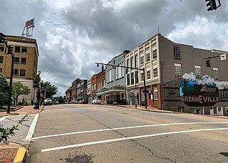
Greeneville is a town in and the county seat of Greene County, Tennessee, United States. The population as of the 2020 census was 15,479. The town was named in honor of Revolutionary War hero Nathanael Greene, and it is the second oldest town in Tennessee. It is the only town with this spelling in the United States, although there are numerous U.S. towns named Greenville. The town was the capital of the short-lived State of Franklin in the 18th-century history of East Tennessee.

Mosheim is a town in Greene County, Tennessee, United States. The population was 2,479 at the 2020 census.

The Nolichucky River is a 115-mile (185 km) river that flows through western North Carolina and East Tennessee in the southeastern United States. Traversing the Pisgah National Forest and the Cherokee National Forest in the Blue Ridge Mountains, the river's watershed includes some of the highest mountains in the Appalachians, including Mount Mitchell in North Carolina, the highest point in the eastern United States. The river is a tributary of the French Broad River and is impounded by Nolichucky Dam near Greeneville, Tennessee.
The Battle of Bulls Gap took place during the American Civil War from November 11 to November 13, 1864, in Hamblen County and Greene County, Tennessee.

U.S. Route 11E (US 11E) is a divided highway of US 11 in the U.S. states of Tennessee and Virginia. The United States Numbered Highway, which is complemented by US 11W to the north and west, runs 120.94 miles (194.63 km) from US 11, US 11W, and US 70 in Knoxville, Tennessee, north and east to US 11, US 11W, US 19, and US 421 in Bristol, Virginia. US 11E connects Knoxville and the twin cities of Bristol, Virginia, and Bristol, Tennessee, with the East Tennessee communities of Morristown, Greeneville, and Johnson City. The U.S. Highway runs concurrently with US 70 and US 25W east of Knoxville, US 321 from Greeneville and Johnson City, and both US 19W and US 19 between Johnson City and Bristol. US 11E also has an unsigned concurrency with State Route 34 (SR 34) for almost all of its course in Tennessee.
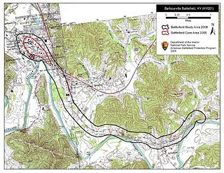
The Battle of Barbourville was one of the early engagements of the American Civil War. It took place on September 19, 1861, in Knox County, Kentucky during the campaign known as the Kentucky Confederate Offensive. The battle is considered the first Confederate victory in the commonwealth, and threw a scare into Federal commanders, who rushed troops to central Kentucky to try to repel the invasion, which was finally stopped at the Battle of Camp Wildcat in October.
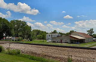
Mohawk is an unincorporated community in western Greene County, eastern Tennessee, located 15 miles (24 km) west of the town of Greeneville. Its post office has the zip code 37810.

Strawberry Plains is an unincorporated community and census-designated place (CDP) in Jefferson, Knox, and Sevier counties in the State of Tennessee, United States. Before 2010, it was treated by the United States Census Bureau as a census county division. It is included in both the Knoxville Metropolitan Statistical Area and the Morristown Metropolitan Statistical Area.

Bledsoe Creek State Park is a state park in Sumner County, Tennessee, in the southeastern United States. The park consists of 169 acres (0.68 km2) managed by the Tennessee Department of Environment and Conservation. The park spans much of the west shore of the Bledsoe Creek embayment of Old Hickory Lake, an impoundment of the Cumberland River created with the completion of Old Hickory Dam by the U.S. Army Corps of Engineers in 1954.

The East Tennessee Convention was an assembly of Southern Unionist delegates primarily from East Tennessee that met on three occasions during the Civil War. The Convention most notably declared the secessionist actions taken by the Tennessee state government on the eve of the war unconstitutional, and requested that East Tennessee, where Union support remained strong, be allowed to form a separate state that would remain part of the United States split from the rest of Confederate Tennessee. The state legislature denied this request, and the Confederate Army occupied the region in late 1861.

John Baxter was an American attorney and jurist who served as a United States circuit judge of the United States Circuit Courts for the Sixth Circuit from 1877 to 1886. Initially a Whig, he had previously served several terms in the North Carolina House of Commons, including one term as Speaker, before moving to Knoxville, Tennessee to practice law.

State Route 107 is a 78.77-mile (126.77 km) state highway in eastern Tennessee, United States. It begins at an intersection with Round Mountain Road south of Del Rio and ends at the North Carolina state line east of Unicoi, where it becomes NC 226.

Samuel Milligan was a justice of the Tennessee Supreme Court and a judge of the Court of Claims. He was a close friend and confidant of President Andrew Johnson.
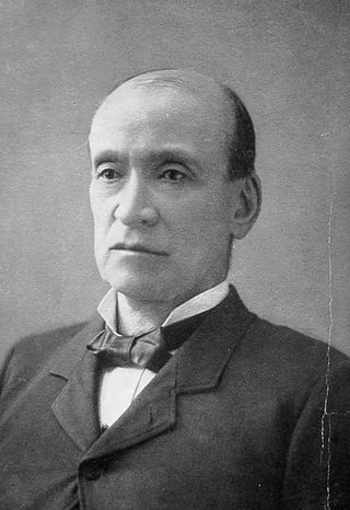
Oliver Perry Temple was an American attorney, author, judge, and economic promoter active primarily in East Tennessee in the latter half of the 19th century. During the months leading up to the Civil War, Temple played a pivotal role in organizing East Tennessee's Unionists. In June 1861, he drafted the final resolutions of the pro-Union East Tennessee Convention, and spent much of the first half of the war providing legal defense for Unionists who had been charged with treason by Confederate authorities.
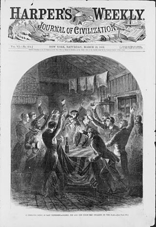
The East Tennessee bridge burnings were a series of guerrilla operations carried out during the American Civil War by Union sympathizers in Confederate-held East Tennessee in 1861. The operations, planned by Carter County minister William B. Carter and authorized by President Abraham Lincoln, called for the destruction of nine strategic railroad bridges, followed by an invasion of the area by Union Army forces then in southeastern Kentucky. The conspirators managed to destroy five of the nine targeted bridges, but the Union Army failed to move, and would not invade East Tennessee until 1863, nearly two years after the incident.

Afton is an unincorporated community in Greene County, Tennessee.

Christopher Alexander "Alex" Haun was a potter from Greene County, Tennessee, regarded as one of the most notable and skilled of the antebellum period. During the American Civil War, he was executed by the Confederate States of America for participation in the East Tennessee bridge-burning conspiracy.
Foxfire Mountain is in Sevierville, Tennessee, United States in the foothills of the Great Smoky Mountains National Park. Foxfire Mountain occupies an area known as Pearl Valley near Dunne's Creek. The area known as Foxfire Mountain is a 150-acre parcel of land that is rich in history.


