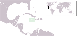
This article talks about transportation in the Bahamas, a North American archipelagic state in the Atlantic Ocean.

Oranjestad is the capital and largest city of Aruba, a constituent country of the Kingdom of the Netherlands. It is located on the southern coast near the western end of the island country. In the local language, Papiamento, Oranjestad is often referred to as "Playa". In 2010, the population of the capital was 28,294.
Sud (French) or Sid is one of the ten departments of Haiti and located in southern Haiti. It has an area of 2,653.60 square kilometres (1,024.56 sq mi) and a population of 774,976. Its capital is Les Cayes.

Bajo Nuevo Bank, also known as the Petrel Islands, is a small, uninhabited reef with some small grass-covered islets, located in the western Caribbean Sea at 15°53′N78°38′W, with a lighthouse on Low Cay at 15°51′N78°38′W. The closest neighbouring land feature is Serranilla Bank, located 110 kilometres to the west.

Rum Cay is an island and district of the Bahamas. It measures 30 square miles (78 km2) in area, it is located at Lat.: N23 42' 30" - Long.: W 74 50' 00". It has many rolling hills that rise to about 120 feet.

Saint Thomas, once known as Saint Thomas in the East, is a suburban parish situated at the south eastern end of Jamaica, within the county of Surrey. It is the birthplace of the Right Honourable Paul Bogle, designated in 1969 as one of Jamaica's seven National Heroes. Morant Bay, its chief town and capital, is the site of the Morant Bay Rebellion in 1865, of which Bogle was a leader.

Portland, with its capital town Port Antonio, is a parish located on Jamaica's northeast coast. It is situated to the north of St Thomas and to the east of St Mary in Surrey County. It is one of the rural areas of Jamaica, containing part of the Blue Mountains, where the Jamaican Maroon communities of Moore Town and Charles Town are located.

Disney's Caribbean Beach Resort is a resort located within the Walt Disney World Resort. It is located in the Epcot Resort Area of Walt Disney World, close to the waterpark Typhoon Lagoon and is classified as a moderately priced resort. The resort started operating on October 1, 1988 and is owned and operated by Disney Parks, Experiences and Products.
Pedro Bank is a large bank of sand and coral, partially covered with seagrass, about 80 km south and southwest of Jamaica, rising steeply from a seabed of 800 metres depth. It slopes gently from the Pedro Cays to the west and north with depths from 13 to 30 metres. The total area of the bank within the 100-metre (328-foot) isobath measures 8,040 square kilometres. The area of a depth to 40 metres is triangular, 70 kilometres long east-west, and 43 kilometres wide. 2,400 square kilometres are less than 20 metres deep. With its islets, cays and rocks, a total land area of 270,000 m2 (2,906,256 sq ft), it is the location of one of the two offshore island groups of Jamaica, the other one being the Morant Cays. The bank is centered at 17°06′N78°20′W.

The Morant Cays is an offshore island group 51 km SSE off Morant Point, Jamaica. It is one of two offshore island groups belonging to Jamaica, the other one is the Pedro Cays. They are located at 17°24′N75°59′W and consist of four small islets grouped closely together along the southeastern rim of Morant Bank a comparatively extensive crescent-shaped bank of coral, over 7 km long, rising from 1000 m. The area of Morant Bank is about 100 km2. The aggregate land area of the four cays is only 16.0 hectares or 39.5 acres. The Morant Cays are low-lying, mostly uninhabited, seasonally visited by fishermen, and fronted by highly exposed reefs over which the sea constantly breaks.

Cay Sal Bank is the third largest and the westernmost of the Bahama Banks. It is located between 23º27'N - 24º10'N and 079º25'W – 080º35'W. In a geographical sense, it is separate from the Bahamas proper as it is much closer to Cuba than to the closest Bahamian island. It is separated by Santaren Channel from the Great Bahama Bank, the western rim of which is 50 km (31 mi) to the east. The Straits of Florida separate it from the United States mainland and the Florida Keys.

The Port Royal Cays is a small group of uninhabited islands or cays off Port Royal, Jamaica, located at 17°55′06.36″N76°49′11.96″W and arranged in the shape of an atoll with a diameter between 4 and 5 km, and a total area of 12 km². The land area is about 0.03 km². There are eight named cays, including South Cay Rock which is sometimes subsumed with South Cay.

The Miskito Cays are an archipelago with an area of 27 km2 located off shore in the northeastern Caribbean coast of Nicaragua, part of the North Caribbean Coast Autonomous Region. The Miskito Cays are composed of 76 formations that include estuaries, coral reefs, cays, seagrass beds, and islets, of which 12 of the formations are covered with vegetation and consequently form islands which are lined with white sand beaches.

Princess Cays is a tourist resort at the southern end of the island of Eleuthera, Bahamas. It is owned by Carnival Corporation, which owns Princess Cruises, among others. Carnival Corporation also owns nearby Half Moon Cay. Contrary to the implication of its name, it is located on Eleuthera, rather than on separate islands.
The following is an alphabetical list of topics related to the nation of Jamaica.

San Andrés is a coral island in the Caribbean Sea. Politically part of Colombia, and historically tied to the United Kingdom, San Andrés and the nearby islands of Providencia and Santa Catalina form the department of San Andrés, Providencia and Santa Catalina. San Andrés, in the southern group of islands, is the largest of Colombia. The official languages of the department are Spanish, English, and San Andrés–Providencia Creole.
Great Goat Island is a cay located less than a mile off the coast of Jamaica, southwest of the Hellshire Hills. It is part of Saint Catherine Parish. Along with Little Goat Island located northwest of it, these two cays make up the Goat Islands, which are within the Portland Bight Protected Area.


