| Limestone Creek | |
|---|---|
| Location | |
| Country | United States |
| State | Kansas |
| Counties | Mitchell, Jewell |
| Physical characteristics | |
| Source | |
| • coordinates | 39°50′20″N98°17′11″W / 39.8389017°N 98.2864415°W [1] |
| Mouth | Solomon River |
• coordinates | 39°29′35″N98°17′49″W / 39.4930656°N 98.2969996°W [1] |
• elevation | 1,404 ft (428 m) [1] |
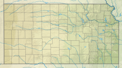
Limestone Creek is a river in Mitchell County and Jewell County in the U.S. State of Kansas. Limestone Creek flows into the Solomon River.

