Limestone Creek (Solomon River tributary)

Last updated
Limestone Creek
USA Kansas location map.svg
Red pog.svg
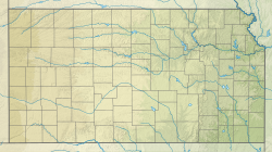
Location of the mouth of Limestone Creek
Usa edcp relief location map.png
Red pog.svg
Limestone Creek (Solomon River tributary) (the United States)
Location
Country United States
State Kansas
Counties Mitchell, Jewell
Physical characteristics
Source 
  coordinates 39°50′20″N98°17′11″W / 39.8389017°N 98.2864415°W / 39.8389017; -98.2864415 [1]
Mouth Solomon River
  coordinates
39°29′35″N98°17′49″W / 39.4930656°N 98.2969996°W / 39.4930656; -98.2969996 Coordinates: 39°29′35″N98°17′49″W / 39.4930656°N 98.2969996°W / 39.4930656; -98.2969996 [1]
  elevation
1,404 ft (428 m) [1]

Limestone Creek is a river in Mitchell County and Jewell County in the U.S. State of Kansas. Limestone Creek flows into the Solomon River.

Related Research Articles

Limestone County, Alabama U.S. county in Alabama

Limestone County is a county of the U.S. state of Alabama. As of the 2010 census, the county's population was 82,782. Its county seat is Athens. Its name comes from Limestone Creek, a local stream.

Tulpehocken Creek (Pennsylvania) creek in southeastern Pennsylvania, United States

Tulpehocken Creek is a 39.5-mile-long (63.6 km) tributary of the Schuylkill River in southeastern Pennsylvania in the United States, and during the American Canal Age, once provided nearly half the length of the Union Canal linking the port of Philadelphia, the largest American city and the other communities of Delaware Valley with the Susquehanna basin and the Pennsylvania Canal System connecting the Eastern seaboard to Lake Erie and the new settlements of the Northwest Territory via the Allegheny}, Monongahela. and Ohio Rivers at Pittsburgh.

Shenandoah River river in Virginia and West Virginia, United States

The Shenandoah River is a tributary of the Potomac River, 55.6 miles (89.5 km) long with two forks approximately 100 miles (160 km) long each, in the U.S. states of Virginia and West Virginia. The principal tributary of the Potomac, the river and its tributaries drain the central and lower Shenandoah Valley and the Page Valley in the Appalachians on the west side of the Blue Ridge Mountains, in northwestern Virginia and the Eastern Panhandle of West Virginia.

Natural Bridge (Virginia) United States historic place

Natural Bridge is a geological formation in Rockbridge County, Virginia, comprising a 215-foot-high (66 m) natural arch with a span of 90 feet (27 m). It is situated within a gorge carved from the surrounding mountainous limestone terrain by Cedar Creek, a small tributary of the James River. Consisting of horizontal limestone strata, Natural Bridge is the remains of the roof of a cave or tunnel through which the Cedar Creek once flowed.

Canoe Creek State Park

Canoe Creek State Park is a 911.91-acre (369.04 ha) Pennsylvania state park in Frankstown Township in Blair County, Pennsylvania. It is 12 miles east of Altoona, the nearest city. Canoe Lake, at 155 acres (63 ha), is the focus of recreation at the park and is open for fishing year-round. Canoe Creek State Park is a half mile off U.S. Route 22 near the small town of Canoe Creek. The park was opened to the public in 1979 and was developed as part of an expansion effort in the 1970s to improve the state park system in Pennsylvania.

Limestone Run is a 4.6-mile-long (7.4 km) stream that lies to the east of New Creek Mountain in Mineral County, West Virginia. It is a tributary of the North Branch Potomac River.

Decatur metropolitan area, Alabama Statistical Area in Alabama

The Decatur, Alabama Metropolitan Statistical Area is a moderately urban region of North-Central Alabama. The 2008 estimate population is 150,125, one-third of which resides within the boundaries of its core city, Decatur, Alabama. It is also considered to be part of the North, Northwest, and North-Central regions of Alabama.

Monocacy Creek (Lehigh River tributary) river in the United States of America

Monocacy Creek is a tributary of the Lehigh River in Northampton County, Pennsylvania, in the United States.

Penns Creek tributary of the Susquehanna River in Pennsylvania

Penns Creek is a 67.1-mile-long (108.0 km) tributary of the Susquehanna River in central Pennsylvania in the United States.

Chillisquaque Creek river in Pennsylvania

Chillisquaque Creek is a tributary of the West Branch Susquehanna River in Montour County and Northumberland County, in Pennsylvania, in the United States. It is approximately 20.2 miles (32.5 km) long and flows through Derry Township, Washingtonville, and Liberty Township in Montour County and East Chillisquaque Township and West Chillisquaque Township in Northumberland County. The watershed of the creek has an area of 112 square miles (290 km2). Agricultural impacts have caused most of the streams in the watershed of the creek to be impaired. Causes of impairment include sedimentation/siltation and habitat alteration. The average annual discharge of the creek between 1980 and 2014 ranged from 48.2 to 146.0 cubic feet per second. Its watershed mainly consists of rolling agricultural land. The creek's channel flows through rock formations consisting of sandstone and shale. It is a warmwater stream.

Rauchtown Run tributary of the West Branch Susquehanna River

Rauchtown Run, named Rauchtown Creek on United States Geological Survey maps, is a tributary of the West Branch Susquehanna River in Clinton and Lycoming Counties, Pennsylvania, in the United States.

Honey Creek is a 20.3-mile-long (32.7 km) tributary of Kishacoquillas Creek in Mifflin County, Pennsylvania in the United States.

David Crockett Birthplace State Park State historical park in Greene County, Tennessee

David Crockett Birthplace State Park is a state park in Greene County, Tennessee, United States. Situated along the Nolichucky River, the park consists of 105 acres (0.42 km2) centered on the traditional birthplace of legendary Tennessee frontiersman, soldier, and politician Davy Crockett (1786-1836). The park includes a replica of Crockett's birth cabin, a museum, and a large campground.

Bow River is a 148-kilometre (92 mi) long tributary of the Ord River in the Kimberley region of northern Western Australia. The river was named by pastoralist Michael Durack in 1882 after the Bow River in his family's ancestral home of County Clare, Ireland.

Franklin Township, Bourbon County, Kansas Township in Kansas, United States

Franklin Township is a township in Bourbon County, Kansas, United States. As of the 2000 census, its population was 312.

Mahantango Creek is a 2.1-mile-long (3.4 km) tributary of the Susquehanna River in Snyder and Juniata counties, Pennsylvania, in the United States. Its name comes from a Delaware Indian word meaning "where we had plenty to eat". The creek flows along the border between Snyder County and Juniata County.

Limestone Creek river in the United States of America

Limestone Creek is 45.5 miles (73.2 km) long with a drainage area of 144.3 square miles (374 km2), and is a tributary to the Tennessee River. The river rises in Lincoln County, Tennessee, and flows south into Madison County, Alabama before flowing through Limestone County, Alabama, where most of the river's watershed is located. In fact, Limestone Creek is where Limestone County gets its name. Limestone Creek terminates in the Tennessee River at Arrowhead Landing, which is the southeastern most point of Limestone County's Wheeler National Wildlife Refuge. The land within this watershed is predominantly agricultural, but has experienced significant recent residential growth from the city of Huntsville.

Limestone Creek may refer to:

Muddy Run (West Branch Susquehanna River tributary) tributary of the West Branch Susquehanna River in Northumberland County, Pennsylvania

Muddy Run is a tributary of the West Branch Susquehanna River in Northumberland County, Pennsylvania, in the United States. It is 5.4 miles (8.7 km) in length. The creek is several miles northeast of the community of Milton. Main land uses include agricultural land and forest. The area of the creek's watershed is 11.4 square miles, most of which is agricultural land. Muddy Run is entirely within Turbot Township. Most of the rock in the watershed is shale. The most common soil series is the Berks-Weikert-Bedington series.

References

  1. 1 2 3 "Limestone Creek". Geographic Names Information System . United States Geological Survey . Retrieved 2019-08-12.