Dahod is a city on the banks of the Dudhimati River in Dahod District in the State of Gujarat, India. It is said that it has taken its name from Saint Dadhichi, who had an Ashram on the bank of Dudhumati river. This city is known for the birth place of 6th mughal emperor Aurangzeb son of 5th mughal emperor shahjahan. The city serves as District Headquarters for Dahod District. It is 214 kilometres (133 mi) from Ahmedabad and 159 kilometres (99 mi) from Vadodara. It is also known as Dohad.

Dahod district is a district of Gujarat state in western India. This largely tribal district is mostly covered by forests and hills.
Kalol is a town and a municipality (tehsil) in Panchmahal district in the Indian state of Gujarat.
Sikaryali is a town and union council of Gujrat District, in the Punjab province of Pakistan. It is part of Kharian Tehsil and is located at 32°37'0N 73°49'0E with an altitude of 223 metres.
Hunterganj, is a historic town in the Chatra subdivision of the Chatra district, Jharkhand, India.
Dudhnoi is a town in Goalpara district, Assam, India.
Piplod is a village turns town in Dahod district, Gujarat, India.
Charihan is a village and union council of Murree Tehsil in the Murree District of Punjab, Pakistan. It is located in the east of the tehsil at 33°49'0N 73°28'0E and is bounded to the north by Mussiari, to the north by Ghel, to the north-west by Murree city, to the west by Mussiari, to the south by Ban and to the south and east by Kotli Sattian.
Sahlian Maldialan is a village in Bagh District, Azad Kashmir, Pakistan. It is named Sahlian Maldialan after a person named Sahli Khan. The total population of Sahlian Maldialan is almost 10,000.

The Irtysh–Karaganda Canal is an irrigation canal in Kazakhstan. It connects the Irtysh River with Karaganda (Qaraghandy), a major industrial center in north-central Kazakhstan. After Kazakhstan's independence, the canal was officially renamed as the Kanysh Satpayev Canal after the Kazakh geologist Kanysh Satpayev.

Jasvantsinh Sumanbhai Bhabhor is a former Minister of State for Tribal affairs in the Government of India, an Indian politician, and a member of parliament to the 16th Lok Sabha and the 17th Lok Sabha from Dahod, Gujarat. He won the 2014 Indian general election, being a Bharatiya Janata Party candidate.

The Baria State, also known as Bariya State, was one of the princely states of India during the period of the British Raj. It was under the Rewa Kantha Agency of the Bombay Presidency and had its capital in Devgadh Baria town of present-day Dahod district in Gujarat state. The Baria State was ruled by Koli chieftains of Baria clan (Gotra) of Gujarat, who later claimed to be kshatriya.
Jhalod Taluka, also known as Zalod Taluka, is a Taluka located in Dahod District in North Gujarat. The city of Jhalod is the Taluka's administrative headquarters. Jhalod Taluka is the largest taluka by population and area in Dahod District. Jhalod is a large town of historical and commercial importance and serves as administrative headquarters of Jhalod Taluka in Dahod District, Gujarat, India. It is situated on the eastern border of the Gujarat State, 5 km far from Kushalgarh Tehsil in Banswara District of Rajasthan State border near the Titodi River. It was one of the original "five mahals" of the Panchmahal District within the Bombay Province during the British Raj in India. The Taluka was made up by joining the territories of Sanjeli State and Jhalod Mahal together.
Morva Hadaf is one of the 182 Legislative Assembly constituencies of Gujarat state in India. It is part of Panchmahal district and is reserved for candidates belonging to the Scheduled Tribes. The seat was formed after the delimitation exercise of 2008 and is a part of Panchmahal Lok Sabha constituency.
Limkheda is one of the 182 Legislative Assembly constituencies of Gujarat state in India. It is part of Dahod district and is reserved for candidates belonging to the Scheduled Tribes.
Devgadhbariya is one of the 182 Legislative Assembly constituencies of Gujarat state in India. It is part of Dahod district.
National Highway 47 is a primary National Highway in India. It starts from Bamanbore in Gujarat and terminates at Nagpur in Maharashtra. This national highway is about 1,006 km (625 mi) long. Before renumbering of national highways in 2010, NH-47 was variously numbered as old national highways 8A, 59, 59A & 69.

The Mathura–Vadodara section is a railway line connecting Mathura and Vadodara. This section is part of Delhi–Mumbai line. This section includes Jaipur–Sawai Madhopur, Ajmer–Ratlam and Udaipur–Kota for branching and connectivity to this section.

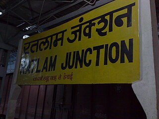
Ratlam railway division is one of the six railway divisions under Western Railway zone of Indian Railways. This railway division was formed on 1 April 1952 and its headquarter is located at Ratlam in the state of Madhya Pradesh of India.
Limkheda railway station is a railway station in Dahod district of Gujarat State of India. It is under Ratlam railway division of Western Railway Zone of Indian Railways. It is located on New Delhi–Mumbai main line of the Indian Railways. Passenger, MEMU and Express trains halt here.


