Limpopo railway

Last updated

Limpopo railway
Ponte rodo-ferroviaria de Magude.jpg
Overview
StatusOperational
Termini
Service
Type Cape gauge
Operator(s)CFM and NRZ
History
Opened1914
Technical
Line length900 km (560 mi)
Track gauge 1,067 mm (3 ft 6 in)

Limpopo Railway, also called Gweru-Maputo railway, [1] is a railway that connects the city of Maputo, Mozambique, to the city from Somabhula, in Zimbabwe. It is 900 km long, in a 1067 mm gauge. [2] [3]

Contents

On the Mozambican stretch, between Maputo and Chicualacuala, the managing company is Mozambique Ports and Railways (CFM); [1] on the Zimbabwean stretch, between the cities of Nyangambe (Sango-Nyala) and Somabhula, the administration is done by the company National Railways of Zimbabwe (NRZ). [4]

Its main maritime logistics facility is the port of Maputo. [1]

History

The construction of a railway line that was to run parallel to the valleys of the Incomati and Limpopo rivers began in the 1910s, initially connecting the city of Moamba, Magude and Ungubana, reaching the village of Xinavane. This stretch was completed and entered into operations in 1914. [5] [6]

In May 1953, works on the line were resumed, [5] connecting Ungubana (the Ungubana-Xinavane link became a railway branch) to Chócue and Canicado, then heading north, reaching Chicualacuala (formerly Malvernia) in 1955. [6]

The second stage of the line was inaugurated at a ceremony held on 1 August 1955, [5] where Mozambican-Portuguese and Nyasaland-British colonial authorities were present. The Mozambican stretch initially connected Moamba and Chicualacuala, using the stretch of the Ressano Garcia railway between Moamba and Maputo to access the port of Maputo. [7]

In the 1960s the government of Rhodesia completed the extension of the railway from Chicualacuala/Nyangambe, passing through Rutenga, until reaching the Somabhula junction station. [8]

The Mozambican Civil War interrupted railroad traffic, causing, due to attacks and sabotages, the almost total degradation of the Mozambican section of the line. [9]

The Limpopo Railway was restored in the 1990s, but had to be practically rebuilt in 2004 after the damage caused by the floods in 2000 in the Limpopo and Incomati river valleys. [3]

After the reopening, it changed its route definitively, starting from Maputo and not from Moamba, going directly to Manhiça and Chócue; [2] however, they have been operating well below cargo capacity, due to weak demand from Zimbabwe and other neighboring countries. [3]

Railway branches

The Limpopo railway has two important branches:

Railway connections

In Rutenga, the Limpopo line connects with the Rutenga-Beitbridge railway. [11]

In Somabhula, the Limpopo line connects with the Beira-Bulawayo railway. [12]

In Maputo, the Limpopo line connects with the Pretoria-Maputo railway [12] and the Goba railway.

Main railway stations

Limpopo railway map (red line); railways with junction (in green); other railway routes (in blue). Caminho de Ferro do Limpopo.png
Limpopo railway map (red line); railways with junction (in green); other railway routes (in blue).

The main railway stations of the Limpopo railway are:

Related Research Articles

<span class="mw-page-title-main">Transport in Mozambique</span>

Modes of transport in Mozambique include rail, road, water, and air. There are rail links serving principal cities and connecting the country with Malawi, Zimbabwe and South Africa. There are over 30,000km of roads, but much of the network is unpaved.

<span class="mw-page-title-main">Maputo Province</span> Province of Mozambique

Maputo Province is a province of Mozambique; the province excludes the city of Maputo. The province has an area of 22,693 km2 (8,762 sq mi) and a population of 1,968,906. Its capital is the city of Matola.

<span class="mw-page-title-main">Gaza Province</span> Province of Mozambique

Gaza is a province of Mozambique. It has an area of 75,709 km2 and a population of 1,422,460, which is the least populous of all the provinces of Mozambique.

<span class="mw-page-title-main">Zvishavane</span> Town in Midlands, Zimbabwe

Zvishavane, formerly known as Shabani, is a mining town in Midlands Province, Zimbabwe. Surrounded by low hills, it lies 97 kilometres (60 mi) west of Masvingo, on the main Bulawayo-Masvingo road. Other roads lead from Zvishavane to Gweru, 121 kilometres (75 mi) north, and Mberengwa, 27 kilometres (17 mi) south-west. It is also on direct rail links to Gweru and Beit Bridge which then link up with Harare and Bulawayo in Zimbabwe and to Maputo in Mozambique, and Pretoria in South Africa. It has a private airport serving the city.

<span class="mw-page-title-main">Cape to Cairo Railway</span> Proposed but never completed railway connecting British colonies in eastern Africa

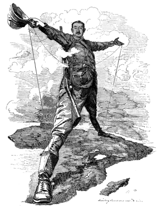
The Cape to Cairo Railway was an unfinished project to create a railway line crossing Africa from south to north. It would have been the largest and most important railway of that continent. It was planned as a link between Cape Town in South Africa and Port Said in Egypt.

The Beira Railroad Corporation, or CCFB, was a joint venture railway company that was responsible for operating the railway lines in central Mozambique. It was formed to reform the railway lines that run from the Port of Beira, Mozambique, originally linking to Zimbabwe, although it later also linked to Malawi.

Chicualacuala is a town located in the province of Gaza in Mozambique. The town is better known by this unofficial name than by its official toponym Vila Eduardo Mondlane.

Sango, also known as Nyala and Nyangambe, is a village and ward (commune) in Masvingo Province, Zimbabwe on the Mozambique border. The village supports the border post lying at the southern end of the Gonarezhou National Park.

Rutenga, is an important village in the province of Masvingo Province in Zimbabwe. It is the de facto capital of Mwenezi (District).

<span class="mw-page-title-main">Mozambique Ports and Railways</span> Railway system of Mozambique and its connected ports

Portos e Caminhos de Ferro de Moçambique is a state-owned company that oversees the railway system of Mozambique and its connected ports.

<span class="mw-page-title-main">Mapai, Mozambique</span> Place in Gaza Province, Mozambique

Mapai is a small town in southern Mozambique. It is a semi-arid region, with a dry climate and vegetation dominated by mopane and galleries of ironwood.

<span class="mw-page-title-main">Moamba District</span> District in Maputo, Mozambique

Moamba District is a district of Maputo Province in southern Mozambique. Its main town is Moamba. The district is located in the western part of the province, and borders with Magude District in the north, Manhiça and Marracuene Districts in the east, the city of Matola in the southeast, Boane District and Namaacha District in the south, and with Mpumalanga Province of South Africa, in the west. The area of the district is 4,628 square kilometres (1,787 sq mi). It has a population of 56,335 as of 2007.

Railway stations in Mozambique include:

Railway station in Beitbridge include:

<span class="mw-page-title-main">History of rail transport in Mozambique</span>

The history of rail transport in Mozambique began in the latter years of the nineteenth century.

<span class="mw-page-title-main">Pretoria–Maputo railway</span> Railway line in southern Africa

Pretoria–Maputo railway, also called Delagoa Bay railway, Iron railway and Eastern railway, is a railway that connects the city of Maputo, Mozambique, to the city of Pretoria, in South Africa. It is 567 km long, in 1067 mm gauge. The Mozambican section, between Maputo and Ressano Garcia, is managed by the state-owned Mozambique Ports and Railways (CFM) company, and it is officially known in Mozambique as the Ressano Garcia Line; in turn, on the South African stretch, between the town of Komatipoort and city of Pretoria, the administration is done by the company Transnet Freight Rail.

<span class="mw-page-title-main">Beira–Bulawayo railway</span> Railway line in southern Africa

Beira-Bulawayo railway, also called Machipanda railway, Beira-Harare-Bulawayo railway and Beira railway, is a railway that connects the city of Beira, Mozambique, to the city of Bulawayo, in Zimbabwe. It is 850 km long, in a 1067 mm gauge.

<span class="mw-page-title-main">Sena railway</span> Railway line in Africa

Sena railway, also called Shire Highlands railway, Dondo-Malawi railway and North-South Malawi railway, is a railway that connects Dondo, Mozambique, to Chipata, in Zambia. It is c. 1000 km long, in a 1067 mm gauge.

<span class="mw-page-title-main">Goba railway</span>

Goba railway, also called Swaziland-Maputo railway and Matsapha-Maputo railway, is a railway that connects the city of Maputo, Mozambique, to the city from Matsapha, in Eswatini. It is 466.8 km long, in a 1067 mm gauge.

References

  1. 1 2 3 "Linha do Limpopo" (HTML). CFM. Retrieved 5 February 2020.
  2. 1 2 Mozambique Logistics Infrastructure: Mozambique Railway Assessment. Atlassian Confluence. 10 December 2018.
  3. 1 2 3 Zimbabwe: Railway Lines Underused. All Africa. 28 August 2018.
  4. Network System: System Map. National Railways Of Zimbabwe. 2017.
  5. 1 2 3 D'Ornellas, Carlos. Caminho de Ferro de Limpopo. Gazeta dos Caminhos de Ferro. 16 October 1955. pg. 372 and 410
  6. 1 2 Fernandes, José Manuel. Gaza, Moçambique: Enquadramento Histórico e Urbanismo. Heritage of Portuguese Influence / Património de Influência Portuguesa — HPIP. 4 June 2021
  7. United States. Bureau of Foreign Commerce. World Trade Information Service: Utilities abroad. Volume 1, Parte 1. 1955.
  8. Revamping the Regional Railway Systems in Eastern and Southern Africa WTO. 31 January 2011
  9. Jane Perlez, Special To the New York Times. Beira Journal; Road to Prosperity Has a Special Hazard: Rebels. The New York Times. 21 February 1989.
  10. NRZ rehabilitates Chiredzi railway line. The Herald. 8 Dec 2017.
  11. Additional information’s, comments and other contributions to the history of 1 BN (Photos, documentation, comments, personal stories and experiences by former soldiers of the unit). 1 Battalion Guard Force. 2013.
  12. 1 2 Two empires, two railway projects. United World. 8 November 2021.