
Gaza is a province of Mozambique. It has an area of 75,709 km2 and a population of 1,422,460.

Mutare is the fourth largest city in Zimbabwe, with an urban population of approximately 188,243 and rural population of approximately 260,567. It is the capital of Manicaland province.

Beira is the capital and largest city of Sofala Province, where the Pungwe River meets the Indian Ocean, in the central region of Mozambique. It is the fourth-largest city by population in Mozambique, after Maputo, Matola and Nampula. Beira had a population of 397,368 in 1997, which grew to 530,604 in 2019. A coastal city, it holds the regionally significant Port of Beira, which acts as a gateway for both the central interior portion of the country as well as the land-locked nations of Zimbabwe, Zambia and Malawi.

Zvishavane is a mining town in Midlands Province, Zimbabwe. Surrounded by low hills, it lies 97 kilometres (60 mi) west of Masvingo, on the main Bulawayo-Masvingo road. Other roads lead from Zvishavane to Gweru, 121 kilometres (75 mi) north, and Mberengwa, 27 kilometres (17 mi) south-west. It is also on direct rail links to Gweru and Beit Bridge which then link up with Harare and Bulawayo in Zimbabwe and to Maputo in Mozambique, and Pretoria in South Africa. It has a private airport serving the city.
Hwange is a town in Zimbabwe, located in Hwange District, in Matabeleland North Province, in northwestern Zimbabwe, close to the international borders with Botswana and Zambia. It lies approximately 100 kilometres (62 mi), by road, southeast of Victoria Falls, the nearest large town. The town lies on the railway line from Bulawayo, Zimbabwe's second-largest city, to Victoria Falls. Hwange sits at an elevation of 770 metres (2,530 ft), above sea level.

The Limpopo National Park was born when the status of Coutada 16 Wildlife Utilisation Area in Gaza Province, Mozambique, was changed from a hunting concession to a protected area. It forms part of the Great Limpopo Transfrontier Park with the Kruger National Park in South Africa and the Gonarezhou National Park in Zimbabwe.

Komatipoort is a town situated at the confluence of the Crocodile and Komati Rivers in Mpumalanga province, South Africa. The town is 8 km from the Crocodile Bridge Gate into the Kruger Park, and just 5 km from the Mozambique border and 65 km from the Eswatini border.
The Beira Railroad Corporation (CCFB) is a railway company formed by a lease from the Mozambique Ports and Railways (CFM) to the Indian Rites and Ircon International consortium to operate a railroad that originates from the port of Beira, Mozambique as a terminal. The 1,067 mmCape gauge Beira line is important as it provides port access for landlocked states such as Zimbabwe, Malawi, Zambia, and the Democratic Republic of the Congo's Katanga Province.

Chicualacuala is a town located in the province of Gaza in Mozambique. The town is better known by this unofficial name than by its official toponym Vila Eduardo Mondlane.
Chókwè District is a district of Gaza Province in south-western Mozambique. Its principal town is Chokwe. The district is located in the south of the province, and borders with Mabalane District in the north, Guijá District in the east, Chibuto, Xai-Xai, and Bilene Macia Districts in the southeast, Magude District of Maputo Province in the south, and with Massingir District in the west. The area of the district is 2,466 square kilometres (952 sq mi). It has a population of 187,422 (2007).
Mapai is a small town in southern Mozambique. It is a semi-arid region, with a dry climate and vegetation dominated by mopane and galleries of ironwood.

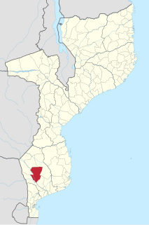
Chicualacuala District is a district of Gaza Province in south-western Mozambique. It has a population of 41,638 (2011) and covers 18,155 square kilometres (7,010 sq mi). The population density of Chicualacuala District 2.1 residents per square kilometers, significantly lower than the average of 17.5 in Gaza Province.
Mabalane District is a district of Gaza Province in south-western Mozambique. The administrative center of the district is Mabalane. The district is located at the center of the province, and borders with Chicualacuala District in the north, Chigubo District in the east, Guijá District in the southeast, Chókwè District in the south, and with Massingir District in the west. The area of the district is 9,107 square kilometres (3,516 sq mi). It has a population of 32,040 (2007).

Massangena District is a district of Gaza Province in south-western Mozambique. The administrative center of the district is Massangena. The district is located in the north of the province, and borders with Machaze District of Manica Province in the north, Mabote District of Inhambane Province in the east, Chigubo District in the southeast, Chicualacuala District in the south, and with Chiredzi District of Zimbabwe in the west. The area of the district is 7,481 square kilometres (2,888 sq mi). It has a population of 15,637 (2007).

Mwenezi River is a major tributary of the Limpopo River. The Mwenezi River starts up in south central Zimbabwe and flows south-east along what is known as the Mwenezi River Valley that bisects the district into two sectors. The river is found in both Zimbabwe and Mozambique. In Zimbabwe it has been known as the Nuanetsi or Nuanetzi River in the past, a name it retains in Mozambique.
Railway stations in Mozambique include:
Machipanda is a town in Manica District, in the middle of Manica Province, Mozambique, near the border with Zimbabwe.
Railway stations in Zimbabwe include:

Beira-Bulawayo railway, also called Machipanda railway, Beira-Harare-Bulawayo railway and Beira railway, is a railway that connects the city of Beira, Mozambique, to the city from Bulawayo, in Zimbabwe. It is 850 km long, in a 1067 mm gauge.

Limpopo railway, also called Gweru-Maputo railway, is a railway that connects the city of Maputo, Mozambique, to the city from Somabhula, in Zimbabwe. It is 900 km long, in a 1067 mm gauge.
