
Ladybower Reservoir is a large Y-shaped, artificial reservoir, the lowest of three in the Upper Derwent Valley in Derbyshire, England. The River Ashop flows into the reservoir from the west; the River Derwent flows south, initially through Howden Reservoir, then Derwent Reservoir, and finally through Ladybower Reservoir. The reservoir is owned by Severn Trent.

Severn Trent plc is a water company based in Coventry, England. It supplies 4.6 million households and business across the Midlands and Wales.

Bartley Reservoir is a reservoir for drinking water in Birmingham, England, operated by Severn Trent Water. It covers 460,000 square metres (5,000,000 sq ft).

Ogston Reservoir is a reservoir operated by Severn Trent Water in Derbyshire. It is near the villages of Brackenfield and Ashover and the town of Clay Cross.

Perry Barr Reservoir is a covered drinking water reservoir, in north Birmingham, England, operated by Severn Trent Water. Built for the then Birmingham Corporation Water Department, on the site of the former Perry Barr Farm, it is not, despite its name, in the modern Perry Barr area, but nearby Kingstanding, at grid reference SP083951.

Yorkshire Water is a water supply and treatment utility company servicing West Yorkshire, South Yorkshire, the East Riding of Yorkshire, part of North Lincolnshire, most of North Yorkshire and part of Derbyshire, in England. The company has its origins in the Yorkshire Water Authority, one of ten regional water authorities created by the Water Act 1973, and privatised under the terms of the Water Act 1989, when Yorkshire Water plc, the parent company of the Yorkshire Water business, was floated on the London Stock Exchange. The parent company was Kelda Group in 1999. In February 2008, Kelda Group was bought by a consortium of infrastructure funds.

The Clywedog Reservoir is a reservoir near Llanidloes, Wales on the head-waters of the River Severn. The construction of the reservoir was enabled by an Act of Parliament which asserted that "At certain times the flow of water in the river is inadequate ... unless that flow were regulated so as to ensure that at those times water in addition to the natural flow will flow down the river."

The Knight Reservoir is a large pumped storage reservoir located in the Borough of Elmbridge in Surrey. It was inaugurated in 1907 and stores up to 2,180 million litres of raw water abstracted from the River Thames prior to its treatment and supply to London and north Surrey. It is located south of the River Thames, west of West Molesey, and between Hurst Road (A3050) and Walton Road (B369). It is adjacent to, and west of, its twin Bessborough Reservoir.

Hanningfield Reservoir is a large 25,500-million-litre (900,000,000 cu ft) pumped storage reservoir located between Billericay and Chelmsford in Essex. It has a surface area of 352 hectares and is owned and operated by Essex and Suffolk Water.
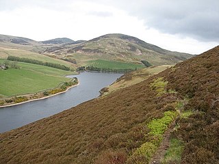
Glencorse Reservoir is a reservoir in Midlothian, Scotland, two miles west of Glencorse, in the Pentland Hills.
Severn Trent Water Authority was one of ten regional water authorities established in 1974. Its area of operation was the catchments of the River Trent and River Severn. It assumed the powers and responsibilities of existing water supply authorities in those catchment areas, the Severn River Authority, the Trent River Authority and the sewage and sewage disposal responsibilities of the councils within its area.

The City of Nottingham Water Department (1912–1974), formerly the Nottingham Corporation Water Department (1880–1912), was responsible for the supply of water to Nottingham from 1880 to 1974. The first water supply company in the town was the Nottingham Waterworks Company, established in 1696, which took water from the River Leen, and later from springs at Scotholme, when the river became polluted. Other companies were set up in the late 18th century and in 1824, while in 1826 the Trent Water Company was established. They employed Thomas Hawksley as their engineer, who became one of the great water engineers of the period, and Nottingham had the first constant pressurised water supply system in the country. The various companies amalgamated in 1845, and Hawksley remained as the consulting engineer until 1879.

Fernilee Reservoir is a drinking-water reservoir fed by the River Goyt in the Peak District National Park, within the county of Derbyshire and very close to the boundary with Cheshire. The village of Fernliee sits at the north end of the reservoir, with Goyt's Moss to the south and between Hoo Moor to the west and Combs Moss to the east.

Lumsdale Valley is a steep-sided wooded gorge in the Peak District near Matlock, Derbyshire, in England. It is the location of a series of historic water-powered mills.

Greenfield Valley is a river valley through Saddleworth Moor in England's Peak District National Park. Historically this area of the South Pennines was part of Yorkshire but since 1974 it has been within the eastern edge of the county of Greater Manchester.

This is a list of scheduled monuments in the district of North East Derbyshire in the English county of Derbyshire.

Kinder Reservoir is a public water storage reservoir on the western edge of Kinder Scout plateau in Derbyshire. The reservoir lies at the head of the Kinder Valley, 278 metres (912 ft) above sea level and 3 kilometres (1.9 mi) to the north east of the village of Hayfield. It is owned by United Utilities Group PLC.

The Slade Reservoirs are twin reservoirs in the North Devon town of Ilfracombe, England. They are owned by South West Water, and leased to South West Lakes Trust. While no longer used for water supply, they are used as fisheries. The waterworks has since been demolished, Ilfracombe's main waterworks is now Hore Down Works on the outskirts of the town. Higher and Lower Slade Reservoirs were originally impounded for potable water supply but local knowledge suggests this reservoir is no longer used. The reservoir has a 6 acre mixed fishery managed by SW Lakes Trust..

Brampton is a civil parish in North East Derbyshire, England, with a population of 1,201 in 2011. Lying 130 miles (210 km) north west of London, 20 miles (32 km) north of Derby, and 2 miles (3.2 km) west of the market town of Chesterfield, Brampton encompasses part of the Peak District national park to the west, and shares a border with the Borough of Chesterfield, Barlow, Baslow and Bubnell, Beeley, and Holymoorside and Walton. The parish does not include the nearby built-up suburb of Brampton which is now within the Chesterfield unparished area.


