
Marcinkowo is a village in the administrative district of Gmina Inowrocław, within Inowrocław County, Kuyavian-Pomeranian Voivodeship, in north-central Poland. It lies approximately 8 kilometres (5 mi) east of Inowrocław, 31 km (19 mi) south-west of Toruń, and 43 km (27 mi) south-east of Bydgoszcz.
Gorajowice is a village in the administrative district of Gmina Jasło, within Jasło County, Subcarpathian Voivodeship, in south-eastern Poland. It lies approximately 3 kilometres (2 mi) north-east of Jasło and 47 km (29 mi) south-west of the regional capital Rzeszów.
Jareniówka is a village in the administrative district of Gmina Jasło, within Jasło County, Subcarpathian Voivodeship, in south-eastern Poland. It lies approximately 3 kilometres (2 mi) north-west of Jasło and 50 km (31 mi) south-west of the regional capital Rzeszów.
Nawsie Kołaczyckie is a village in the administrative district of Gmina Kołaczyce, within Jasło County, Subcarpathian Voivodeship, in south-eastern Poland. It lies approximately 3 kilometres (2 mi) south-east of Kołaczyce, 6 km (4 mi) north of Jasło, and 47 km (29 mi) south-west of the regional capital Rzeszów.
Myscowa is a village in the administrative district of Gmina Krempna, within Jasło County, Subcarpathian Voivodeship, in south-eastern Poland, close to the border with Slovakia. It lies approximately 5 kilometres (3 mi) north-east of Krempna, 25 km (16 mi) south of Jasło, and 64 km (40 mi) south-west of the regional capital Rzeszów.
Gorzyce is a village in the administrative district of Gmina Nowy Żmigród, within Jasło County, Subcarpathian Voivodeship, in south-eastern Poland. It lies approximately 2 kilometres (1 mi) north of Nowy Żmigród, 14 km (9 mi) south of Jasło, and 56 km (35 mi) south-west of the regional capital Rzeszów.
Nienaszów is a village in the administrative district of Gmina Nowy Żmigród, within Jasło County, Subcarpathian Voivodeship, in south-eastern Poland. It lies approximately 5 kilometres (3 mi) north-east of Nowy Żmigród, 16 km (10 mi) south-east of Jasło, and 54 km (34 mi) south-west of the regional capital Rzeszów.

Bączal Dolny is a village in the administrative district of Gmina Skołyszyn, within Jasło County, Subcarpathian Voivodeship, in south-eastern Poland. It lies approximately 4 kilometres (2 mi) east of Skołyszyn, 7 km (4 mi) west of Jasło, and 54 km (34 mi) south-west of the regional capital Rzeszów.

Bączal Górny is a village in the administrative district of Gmina Skołyszyn, within Jasło County, Subcarpathian Voivodeship, in south-eastern Poland. It lies approximately 5 kilometres (3 mi) north-east of Skołyszyn, 9 km (6 mi) north-west of Jasło, and 54 km (34 mi) south-west of the regional capital Rzeszów.
Harklowa is a village in the administrative district of Gmina Skołyszyn, within Jasło County, Subcarpathian Voivodeship, in south-eastern Poland. It lies approximately 4 kilometres (2 mi) south of Skołyszyn, 10 km (6 mi) west of Jasło, and 59 km (37 mi) south-west of the regional capital Rzeszów.
Jabłonica is a village in the administrative district of Gmina Skołyszyn, within Jasło County, Subcarpathian Voivodeship, in south-eastern Poland. It lies approximately 5 kilometres (3 mi) north of Skołyszyn, 12 km (7 mi) north-west of Jasło, and 56 km (35 mi) south-west of the regional capital Rzeszów.
Kunowa is a village in the administrative district of Gmina Skołyszyn, within Jasło County, Subcarpathian Voivodeship, in south-eastern Poland. It lies approximately 2 kilometres (1 mi) south of Skołyszyn, 10 km (6 mi) west of Jasło, and 59 km (37 mi) south-west of the regional capital Rzeszów.
Przysieki is a village in the administrative district of Gmina Skołyszyn, within Jasło County, Subcarpathian Voivodeship, in south-eastern Poland. It lies approximately 3 kilometres (2 mi) south-east of Skołyszyn, 8 km (5 mi) west of Jasło, and 57 km (35 mi) south-west of the regional capital Rzeszów.
Pusta Wola is a village in the administrative district of Gmina Skołyszyn, within Jasło County, Subcarpathian Voivodeship, in south-eastern Poland. It lies approximately 4 kilometres (2 mi) south-west of Skołyszyn, 13 km (8 mi) west of Jasło, and 61 km (38 mi) south-west of the regional capital Rzeszów.
Siepietnica is a village in the administrative district of Gmina Skołyszyn, within Jasło County, Subcarpathian Voivodeship, in south-eastern Poland. It lies approximately 4 kilometres (2 mi) north-west of Skołyszyn, 14 km (9 mi) west of Jasło, and 60 km (37 mi) south-west of the regional capital Rzeszów.

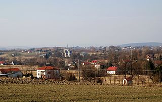
Skołyszyn is a village in Jasło County, Subcarpathian Voivodeship, in south-eastern Poland. It is the seat of the gmina called Gmina Skołyszyn. It lies approximately 10 kilometres (6 mi) west of Jasło and 58 km (36 mi) south-west of the regional capital Rzeszów.

Sławęcin is a village in the administrative district of Gmina Skołyszyn, within Jasło County, Subcarpathian Voivodeship, in south-eastern Poland. It lies approximately 3 kilometres (2 mi) east of Skołyszyn, 8 km (5 mi) west of Jasło, and 56 km (35 mi) south-west of the regional capital Rzeszów.

Święcany is a village in the administrative district of Gmina Skołyszyn, within Jasło County, Subcarpathian Voivodeship, in south-eastern Poland. It lies approximately 5 kilometres (3 mi) north-west of Skołyszyn, 14 km (9 mi) west of Jasło, and 60 km (37 mi) south-west of the regional capital Rzeszów.
Jasiel is a former village in the administrative district of Gmina Komańcza, within Sanok County, Subcarpathian Voivodeship, in south-eastern Poland, close to the border with Slovakia. It lies approximately 10 kilometres (6 mi) north-west of Komańcza, 30 km (19 mi) south-west of Sanok, and 75 km (47 mi) south of the regional capital Rzeszów.


