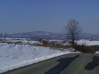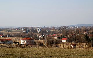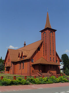
Wola Dębowiecka is a village in the administrative district of Gmina Dębowiec, within Jasło County, Subcarpathian Voivodeship, in south-eastern Poland. It lies approximately 4 kilometres (2 mi) south of Dębowiec, 11 km (7 mi) south of Jasło, and 59 km (37 mi) south-west of the regional capital Rzeszów.

Cieklin is a village in the administrative district of Gmina Dębowiec, within Jasło County, Subcarpathian Voivodeship, in south-eastern Poland. It lies approximately 7 kilometres (4 mi) south-west of Dębowiec, 13 km (8 mi) south-west of Jasło, and 62 km (39 mi) south-west of the regional capital Rzeszów.
Gmina Brzyska is a rural gmina in Jasło County, Subcarpathian Voivodeship, in south-eastern Poland. Its seat is the village of Brzyska, which lies approximately 12 kilometres (7 mi) north-west of Jasło and 50 km (31 mi) south-west of the regional capital Rzeszów.

Jareniówka is a village in the administrative district of Gmina Jasło, within Jasło County, Subcarpathian Voivodeship, in south-eastern Poland. It lies approximately 3 kilometres (2 mi) north-west of Jasło and 50 km (31 mi) south-west of the regional capital Rzeszów.

Kotań is a village in the administrative district of Gmina Krempna, within Jasło County, Subcarpathian Voivodeship, in south-eastern Poland, close to the border with Slovakia. It lies approximately 4 kilometres (2 mi) north-west of Krempna, 24 km (15 mi) south of Jasło, and 67 km (42 mi) south-west of the regional capital Rzeszów.

Bączal Dolny is a village in the administrative district of Gmina Skołyszyn, within Jasło County, Subcarpathian Voivodeship, in south-eastern Poland. It lies approximately 4 kilometres (2 mi) east of Skołyszyn, 7 km (4 mi) west of Jasło, and 54 km (34 mi) south-west of the regional capital Rzeszów.

Bączal Górny is a village in the administrative district of Gmina Skołyszyn, within Jasło County, Subcarpathian Voivodeship, in south-eastern Poland. It lies approximately 5 kilometres (3 mi) north-east of Skołyszyn, 9 km (6 mi) north-west of Jasło, and 54 km (34 mi) south-west of the regional capital Rzeszów.

Harklowa is a village in the administrative district of Gmina Skołyszyn, within Jasło County, Subcarpathian Voivodeship, in south-eastern Poland. It lies approximately 4 kilometres (2 mi) south of Skołyszyn, 10 km (6 mi) west of Jasło, and 59 km (37 mi) south-west of the regional capital Rzeszów.

Jabłonica is a village in the administrative district of Gmina Skołyszyn, within Jasło County, Subcarpathian Voivodeship, in south-eastern Poland. It lies approximately 5 kilometres (3 mi) north of Skołyszyn, 12 km (7 mi) north-west of Jasło, and 56 km (35 mi) south-west of the regional capital Rzeszów.

Kunowa is a village in the administrative district of Gmina Skołyszyn, within Jasło County, Subcarpathian Voivodeship, in south-eastern Poland. It lies approximately 2 kilometres (1 mi) south of Skołyszyn, 10 km (6 mi) west of Jasło, and 59 km (37 mi) south-west of the regional capital Rzeszów.

Lipnica Górna is a village in the administrative district of Gmina Skołyszyn, within Jasło County, Subcarpathian Voivodeship, in south-eastern Poland. It lies approximately 7 kilometres (4 mi) north of Skołyszyn, 10 km (6 mi) north-west of Jasło, and 53 km (33 mi) south-west of the regional capital Rzeszów.

Przysieki is a village in the administrative district of Gmina Skołyszyn, within Jasło County, Subcarpathian Voivodeship, in south-eastern Poland. It lies approximately 3 kilometres (2 mi) south-east of Skołyszyn, 8 km (5 mi) west of Jasło, and 57 km (35 mi) south-west of the regional capital Rzeszów.

Pusta Wola is a village in the administrative district of Gmina Skołyszyn, within Jasło County, Subcarpathian Voivodeship, in south-eastern Poland. It lies approximately 4 kilometres (2 mi) south-west of Skołyszyn, 13 km (8 mi) west of Jasło, and 61 km (38 mi) south-west of the regional capital Rzeszów.

Siepietnica is a village in the administrative district of Gmina Skołyszyn, within Jasło County, Subcarpathian Voivodeship, in south-eastern Poland. It lies approximately 4 kilometres (2 mi) north-west of Skołyszyn, 14 km (9 mi) west of Jasło, and 60 km (37 mi) south-west of the regional capital Rzeszów.

Skołyszyn is a village in Jasło County, Subcarpathian Voivodeship, in south-eastern Poland. It is the seat of the gmina called Gmina Skołyszyn. It lies approximately 10 kilometres (6 mi) west of Jasło and 58 km (36 mi) south-west of the regional capital Rzeszów.

Sławęcin is a village in the administrative district of Gmina Skołyszyn, within Jasło County, Subcarpathian Voivodeship, in south-eastern Poland. It lies approximately 3 kilometres (2 mi) east of Skołyszyn, 8 km (5 mi) west of Jasło, and 56 km (35 mi) south-west of the regional capital Rzeszów.

Święcany is a village in the administrative district of Gmina Skołyszyn, within Jasło County, Subcarpathian Voivodeship, in south-eastern Poland. It lies approximately 5 kilometres (3 mi) north-west of Skołyszyn, 14 km (9 mi) west of Jasło, and 60 km (37 mi) south-west of the regional capital Rzeszów.

Wrocanka is a village in the administrative district of Gmina Tarnowiec, within Jasło County, Subcarpathian Voivodeship, in south-eastern Poland. It lies approximately 4 kilometres (2 mi) south of Tarnowiec, 9 km (6 mi) south-east of Jasło, and 47 km (29 mi) south-west of the regional capital Rzeszów.

Zarzecze is a village in the administrative district of Gmina Dębowiec, within Jasło County, Subcarpathian Voivodeship, in south-eastern Poland. It lies approximately 2 kilometres (1 mi) south-east of Dębowiec, 8 km (5 mi) south of Jasło, and 55 km (34 mi) south-west of the regional capital Rzeszów.


