Lircay River

Last updated
Lircay River
Mapa No. 21. Provincia de Talca-7930028.jpg
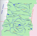
Lircay (Lircai) River, north of Talca
Location
Country Chile
Physical characteristics
Mouth  
  elevation
89 m (292 ft)

The Lircay River is a tributary of the Claro River, near the city of Talca in Chile. [1] It is not to be confused with the Lircay River of Linares. [2]

See also

Related Research Articles

Missouri Route 109

Route 109 is a state highway in St. Louis County, Missouri and Jefferson County, Missouri. Its northern terminus is at Wild Horse Creek Road in Chesterfield; its southern terminus is at Routes W and FF in Jefferson County. The road continues north, curves around Spirit of St. Louis Airport and connects with Chesterfield Airport Road, providing a "backway" to the Chesterfield area.

Lácar Lake Body of water

Lácar Lake is a lake of glacial origin in Neuquén Province, Argentina. It is enclosed in the Andes mountain range, at 630 m above mean sea level. The area around the lake is mostly uninhabited, except for the city of San Martín de los Andes on its northeastern coast. The lake has a surface area of 55 km2 (21 sq mi) and a mean depth of 167 m, with a maximum of 277 m. Its catchment basin comprises 1,048 km2 (405 sq mi). Like many Andean Argentine lakes, it drains across Chile and into the Pacific Ocean, in this case via the Huahum River that flows through Huahum Pass in the Andes. As the northernmost lake on the eastern side of Andes that drains to the Pacific the lake and its catchment basin were claimed by Chile until 1902 based on an interpretation of the Boundary treaty of 1881 between Chile and Argentina. The lake, along with the smaller lake nearby, Lolog, has some sacred significance for the Mapuche people, as it features in their oral tradition as part of a creation myth.

Roman Catholic Diocese of Talca

The Roman Catholic Diocese of Talca,, is a suffragan diocese of the archdiocese of Santiago de Chile. Its current bishop, Galo Fernández Villaseca, was appointed on 20 March 2021. The diocesan cathedral is in the city of Talca.

Altos de Lircay National Reserve

Altos de Lircay National Reserve is a 121.63 km2 (46.96 sq mi) nature reserve located in Talca Province, Maule Region, Chile. It lies in a pre-Andean area close to Radal Siete Tazas National Park, as well as Descabezado Grande and Cerro Azul volcanoes.

Angah, is a village and one of the 51 union councils of Khushab District in the Punjab Province of Pakistan. It is located at 32° 36' N 72° 5' E.

Dhoke Ajri is a village in Chakwal District, Punjab, Pakistan. It is about 20 km from Chakwal city on the Chowa Syden Shah Road. It is part of Jaswal Union Council.

Kuri, also spelt Korri, is a village located in the Islamabad Capital Territory of Pakistan. It is located at 33°40'0N 73°10'0E with an altitude of 512 m (1,680 ft).

Claro River (Maule) River in Chile

The Claro River is a river of Chile located in the Maule Region. It rises in the Andes, in the Radal Siete Tazas National Park and flows northwest until the city of Molina. Then, it flows southwest, crosses below the Panamericana, to the vicinity of the city of Talca to empty into the Maule River. In this last portion of its course, the river receives the waters of the tributary Lircay River.

Haveli Bahadur Shah is a town situated in Jhang, Punjab, Pakistan. It is located at 31°4'N 72°11'E with an elevation of 150 metres (490 ft).

Tagrin Point is the proposed location of a deep water port to replace the older and shallower port of Port Pepel in Sierra Leone. It would be connected to existing and new iron ore mined by an upgraded railway line converted to standard gauge.

Hon Dhamial or Hoon Dahmyal is a village east of Islamabad in Pakistan near the Police Training College Sihala. The main tribe of the village is Mathyals. Other tribes in the village include the Hon and Dhamial..Its geographical coordinates 33.32 N,73.13 E.

<span class="mw-page-title-main">Charam, Iran</span> City in Kohgiluyeh and Boyer-Ahmad, Iran

Cheram is a city and the capital of Charam County, Kohgiluyeh and Boyer-Ahmad Province, Iran. In 2017, its population was 17,213.

River Wards, Philadelphia Neighborhood of Philadelphia in Philadelphia, Pennsylvania

The River Wards is a section of Philadelphia, Pennsylvania, United States located along the Delaware River to the northeast of Center City Philadelphia. 'River Wards' is the commonly used name for an area including several neighborhoods, such as Fishtown, Kensington, Port Richmond and Olde Richmond. The River Wards are located at the border of North Philadelphia and Northeast Philadelphia, and may be considered part of one or the other, or as a separate entity. The area is sometimes also known as 'Bridesburg-Kensington-Richmond'.

Avur is a village in the Yardymli Rayon of Azerbaijan. The village forms part of the municipality of Çay Üzü.

Musewali, is a town of Mianwali District in the Punjab province of Pakistan. It is located in Piplan Tehsil at 32°15'0N 71°20'0E

Jagiot,(ٗUrduجگیوٹ) is a village located in the Islamabad Capital Territory of Pakistan. It is located at 33°40'0N 73°12'0E with an altitude of 512 

<span class="mw-page-title-main">Driffield, Gloucestershire</span> Village in Gloucestershire, England

Driffield is a village in the Cotswold district of Gloucestershire, England. It is situated 3+12 miles (5.6 km) east-south-east of Cirencester.

Buuraha Habeeno is a mountain in the Cal Miskaad mountain range, Somalia.

Da-that Island is an unpopulated island in Myanmar. It is located around 15 miles from Ye, Mon State.

References

Coordinates: 35°22′45″S71°38′54″W / 35.37929°S 71.64834°W / -35.37929; -71.64834