The Eastern Shore is a region of the Canadian province of Nova Scotia. It is the Atlantic coast running northeast from Halifax Harbour to the eastern end of the peninsula at the Strait of Canso.
Route 374 is a collector road in the Canadian province of Nova Scotia. It connects New Glasgow at Exit 24 of Nova Scotia Highway 104 with Sheet Harbour at Trunk 7. The highway runs through the Halifax Regional Municipality, Guysborough County & Pictou County.
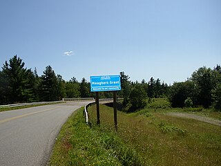
Meaghers Grant is a rural community in the Musquodoboit Valley region of the eastern Halifax Regional Municipality Nova Scotia on Route 357. The community is located on the Musquodoboit River and the economy is mainly farming and forestry. It is approximately 45 minutes away from Halifax, the province's capital city. The River Oaks Golf course is located there.
The Halifax Regional Municipality (HRM) in the Canadian province of Nova Scotia is composed of more than 200 communities and neighbourhoods.

Trafalgar is a Canadian rural community located inland from Nova Scotia's Eastern Shore. While it is named after the Battle of Trafalgar, it is not pronounced the same as Trafalgar England. Emphasis is on the first syllable traf'-el-GAR.
Greenwood in Nova Scotia can be
West Loon Lake, Nova Scotia is small cottage and recreational community of rural Halifax Regional Municipality Nova Scotia situated at the northeastern corner of the municipality borders the counties of Pictou, and Colchester and Municipal District of Saint Mary's at Trafalgar. A majority of the dwellings are cottages along Loon Lake, the lake which the community derives its name from. The community is on the St. Mary's Rd, between Route 336 and Route 374. The area has an elevation of 180 metres (590 ft) - 230 metres (750 ft), and the community has an area of 5.86 square kilometres (2.26 sq mi).
Lewis Lake, Nova Scotia could mean the following:
Otter Lake could mean the following:
Crooked Lake could mean one of the following :
Caribou Mines is a rural community of the Halifax Regional Municipality in the Canadian province of Nova Scotia. An Icelandic Settlement "Markland was located in Caribou Mines from 1875 to 1882.
Governor Lake is a rural community of the Halifax Regional Municipality in the Canadian province of Nova Scotia. It is named after a nearby lake.
Lochaber Mines is a rural community on the Eastern Shore of Nova Scotia, Canada, in the Halifax Regional Municipality. It is located along Route 374 about 14 km (8.7 mi) northeast of Sheet Harbour. The community is located along East River and is near the Marshall Flowage, a large lake at the head of East River. The community is named for Lochaber, located in Scotland. In 1812, Alexander Fraser received a grant of land in the area. Several gold leads were opened by J.H. Anderson in 1887 in the area, however, not much work was done outside of exploratory work.
Liscomb Game Sanctuary is a conservation area that straddles the border of Halifax Regional Municipality and Guysborough County in the Canadian province of Nova Scotia. Nova Scotia Route 374 runs north–south through the sanctuary. Within the sanctuary are two nature reserves and parts of two wilderness areas.
Popes Harbour is a rural community of the Halifax Regional Municipality in the Canadian province of Nova Scotia, about 20 km (12 mi) west of Sheet Harbour, Nova Scotia. The community is located along the shores of Popes Harbour, an inlet of the Atlantic Ocean. The mi'kmaq names for the area were Kwemoodech and Kwemoodeech, translating to "little loon place" and "small harbour" respectively. Before 1827, the settlement was referred to as Deane Harbour. The present name for the community is in honour of an early pioneer family. Popes Harbour is known for Abriel's Fisheries.
Murphy Cove is a community on the Eastern Shore of Nova Scotia, Canada, in the Halifax Regional Municipality. The community is located on the Marine Drive on Nova Scotia Trunk 7, about 31 km (19 mi) west of Sheet Harbour, Nova Scotia. The community is named for Thomas Murphy, an Irish settler. The community is situated on the shores of Shoal Bay, an inlet of the Atlantic Ocean. Settlement in the area began in the 1830s.
Liscomb is a small community in the Canadian province of Nova Scotia, located in the Municipality of the District of Saint Mary's in Guysborough County. The community lies along the Marine Drive on Trunk 7, approximately 17 kilometres (11 mi) southwest of Sherbrooke.
Fraser Settlement is a rural community of the Halifax Regional Municipality in the Canadian province of Nova Scotiain the Musquodoboit Valley.
Sheet Harbour Road is a community of the Halifax Regional Municipality in the Canadian province of Nova Scotia. It is located just five minutes south of Upper Musquodoboit, Nova Scotia. Its name is derived from Route 224, which is the primary route from the Musquodoboit Valley to Sheet Harbour, Nova Scotia.
