Related Research Articles
Grandpont is a mainly residential area in south Oxford. It is west of Abingdon Road, and consists mainly of narrow streets that run at right angles to the main road, with terraced late-Victorian and Edwardian houses.
Great Bourton is a village about 3 miles (5 km) north of Banbury in Oxfordshire, England. It is the largest settlement in the civil parish of Bourton. The 2011 Census recorded the parish's population as 614.
New Hinksey is a suburb in the south of the city of Oxford.

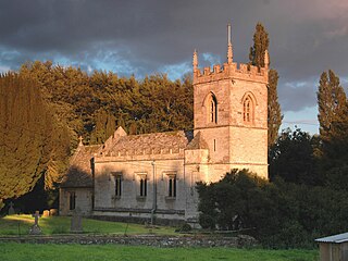
Barford St Michael is a village and former civil parish, now in the parish of Barford St. John and St. Michael, in the Cherwell district, in the county of Oxfordshire, England. It is on the south bank of the River Swere, about 5 miles (8 km) south of Banbury.
Holywell is a parish in Oxford, England. The toponym is derived from the well of Saint Winifred and Saint Margaret.

Hempton is a village in Deddington civil parish about 5 miles (8 km) south of Banbury in Oxfordshire. Hempton is on the B4031 road between Deddington and Chipping Norton, which was a turnpike from 1770 until 1871.
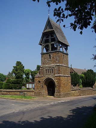
Clifton is a hamlet by the River Cherwell in Deddington civil parish about 6 miles (10 km) south of Banbury, Oxfordshire, England. Clifton is on the B4031 road between Deddington and Croughton, Northamptonshire.
Middle Aston is a hamlet and civil parish in the English county of Oxfordshire, about 7 miles (11 km) northwest of Bicester. It used to have a country house, Middle Aston House, but this was demolished early in the 19th century. The house was replaced in the 1890s by extending the manor farmhouse. The building is now a conference center.

Milcombe is a village and civil parish about 5 miles (8 km) southwest of Banbury, Oxfordshire. Pronounced Mill-Comb-Bee. Milcombe is famous for its village shop. Originally called ‘John’s shop’ or More officially, ‘New Road Stores’ but is now called ‘Best-one’.

Widford is a deserted medieval village on the River Windrush about 1.5 miles (2.4 km) east of Burford in West Oxfordshire. The village was an exclave of Gloucestershire until 1844.

Sibford Ferris is a village and civil parish about 6.5 miles (10.5 km) west of Banbury in Oxfordshire. It is on the south side of the Sib valley opposite its larger sister village, Sibford Gower. The 2011 Census recorded the parish's population as 476.
Clattercote or Clattercot is a hamlet in Claydon with Clattercot civil parish, just over 5.5 miles (8.9 km) north of Banbury in Oxfordshire, England.
Burdrop is a village in Sibford Gower civil parish, about 6.5 miles (10.5 km) west of Banbury in Oxfordshire, England. Burdrop is contiguous with Sibford Gower and sometimes considered part of the village. Burdrop's toponym means the "hamlet near the burh", which implies it was near a fortified settlement.

Claydon with Clattercot is a civil parish in the Cherwell district, in the county of Oxfordshire, England. It was formed in 1932 by merger of the parish of Claydon with the extra-parochial area of Clattercote. As of the United Kingdom Census 2011, its population was 306 and it had a total of 6.22 km² of land, water, and roads.
Shipton-on-Cherwell and Thrupp is a civil parish in Oxfordshire, England. It was formed in 1955 by removing the hamlet of Thrupp from the parish of Kidlington and merging it with the parish of Shipton-on-Cherwell. It covers 6.04 km² and as at the 2011 census had 493 residents.
Hanborough is a civil parish in West Oxfordshire. The parish includes the villages of Church Hanborough and Long Hanborough. The village of Freeland was transferred from Eynsham civil parish to Hanborough in 1932 and then detached to form a separate civil parish in 1948. Both Church Hanborough and Long Hanborough are served by Hanborough railway station.

Steeple Barton is a civil parish and scattered settlement on the River Dorn in West Oxfordshire, about 8+1⁄2 miles (13.7 km) east of Chipping Norton, a similar distance west of Bicester and 9 miles (14 km) south of Banbury. Most of the parish's population lives in the village of Middle Barton, about 1 mile (1.6 km) northwest of the settlement of Steeple Barton. The 2011 Census recorded the parish's population as 1,523. Much of the parish's eastern boundary is formed by the former turnpike between Oxford and Banbury, now classified the A4260 road. The minor road between Middle Barton and Kiddington forms part of the western boundary. Field boundaries form most of the rest of the boundaries of the parish.
Westcott Barton, also spelt Wescot Barton or Wescote Barton, is a village and civil parish on the River Dorn in West Oxfordshire about 7 miles (11 km) east of Chipping Norton and about 9+1⁄2 miles (15 km) south of Banbury, in the county of Oxfordshire, England. The parish is bounded to the north by Cockley Brook, a tributary of the River Dorn. A minor road to Kiddington forms part of the eastern boundary, another minor road forms part of the western boundary and the remainder of the parish boundaries are field boundaries. Westcott Barton's main area of housing is on the eastern boundary of the parish and contiguous with the village of Middle Barton in the neighbouring parish of Steeple Barton. The 2011 Census recorded the parish's population as 244.
References
- 1 2 3 4 5 6 Youngs, Frederic A Jr. (1979). Guide to the Local Administrative Units of England, Vol.I: Southern England. London: Royal Historical Society. pp. 29–44. ISBN 0-901050-67-9.
- ↑ Eleanor Chance; Christina Colvin; Janet Cooper; C.J. Day; T.G. Hassall; Nesta Selwyn (1979). Crossley, Alan; Elrington, C.R. (eds.). A History of the County of Oxford, Volume 4. Victoria County History. pp. 260–264.
- ↑
- Christina Colvin; Janet Cooper; N.H. Cooper; P.D.A. Harvey; Marjory Hollings; Judith Hook; Mary Jessup; Mary D. Lobel; J.F.A. Mason; B.S. Trinder; Hilary Turner (1972). Crossley, Alan (ed.). Victoria County History: A History of the County of Oxford, Volume 10. pp. 197–206.
- ↑ Page, William, ed. (1925). Victoria County History of Buckinghamshire: Volume 3: Ibstone. pp. 62–65.
- 1 2 Great Britain Historical GIS / University of Portsmouth, Bullington RD . Retrieved {{{accessdate}}}.
- 1 2 "The Berkshire, Buckinghamshire, Hampshire, Oxfordshire and Surrey (County Boundaries) Order 1991". HMSO. 1991.