List of archaeological sites in Thurrock

Last updated

This list of archaeological sites includes finds and excavations that have taken place in the area now covered by the Thurrock unitary authority. The list is arranged by location and then chronologically by the date of the discovery or excavation. The archaeological finds and features cover all periods from the paleolithic to the 20th century. Most editions of Panorama (the Journal of the Thurrock Local History Society) contain further information about local archaeology. A brief review of archaeology in Thurrock by the Mucking weekenders is in an article by Margaret Jones in Panorama 24. [1] There is a fuller account of archaeology in Thurrock between 1954 and 2002 (including reminiscences of the Mucking excavation) in Thurrock Gold published by the Thurrock Local History Society.

Contents

Recent editions of Essex Archaeology and History contain short reports of archaeological activity in Essex (including Thurrock) during the previous year. These reports include trial excavations and surveys that revealed no significant features or finds and which are not included in this list.

This list does not include most individual finds housed in the Thurrock Museum. A list of palaeolithic and neolithic finds was published in Panorama - Journal of the Thurrock Local History Society, 3, 1958. Many Romano-British and Saxon finds in the museum are listed in The Archaeology of Thurrock: Romano-British and Saxon by Randal Bingley (supplement to Panorama - the Journal of the Thurrock Local History Society, 1973).

Sites of archaeological finds or excavations

Aveley

Chadwell St Mary

(see also Tilbury Docks and Tilbury Fort)

Corringham

East Tilbury

Fobbing

Grays

Horndon-on-the-Hill

Langdon Hills

Little Thurrock

(see also Tilbury Docks)

Mucking

Orsett

Purfleet

Sites listed under West Thurrock

South Ockendon

Stanford-le-Hope

Stifford

Tilbury Docks

Tilbury Fort

West Thurrock

West Tilbury

(see also Tilbury Fort)

Notes

  1. Jones, Margaret. "The Mucking Weekenders". Panorama. 24.
  2. 1 2 3 4 5 6 7 8 9 10 11 12 13 Terry Carney, Fifty Years of Thurrock Archaeology (in Thurrock Gold, Thurrock Local History Society, 2002)
  3. Stuart Foreman and David Maynard, A late Iron Age and Romano-British farmstead at Ship Lane, Aveley; excavations on the line of the A13 Wennington to Mar Dyke road improvement, 1994-5 (Essex Archaeology & History, 33 (2002), pp123-56)
  4. Historic England report
  5. M Christy and FW Reader The Opening of a Mound at Chadwell St Mary (Transactions of the Essex Archaeological Society, Volume XIII, 1915)
  6. Excavation report
  7. Essex Sites and Monuments Record - record number 1685 [ permanent dead link ]
  8. Essex Sites and Monuments Record [ permanent dead link ]
  9. The Numismatic Chronicle and Journal of the Royal Numismatic Society, 1958
  10. Transactions of the Essex Archaeological Society, p 384
  11. Excavation report
  12. Thurrock Museum Heritage fact files Archived 8 June 2011 at the Wayback Machine
  13. Excavation report
  14. Bennett, A, ed. (2010). "Essex Archaeology and History, Archaeology in Essex, 2008": 196.{{cite journal}}: Cite journal requires |journal= (help)
  15. 1 2 Jonathan Catton, Archeological Notes on the Parish of East Tilbury (in Panorama 26, Thurrock Local History Society, 1984)
  16. 1 2 Historic Churches, a Wasting Asset - Council for British Archaeology Research Report 19
  17. excavation report
  18. COALHOUSE FORT, Investigation History
  19. Tilbury, Essex
  20. 1 2 Sue Hirst and Dido Clark, Excavations at Mucking: Volume 3, The Anglo-Saxon Cemeteries (Museum of London Archaeology 2009)
  21. Excavation report
  22. Randal Bingley, Archaeological Evaluation: Fobbing (in Panorama 45, Thurrock Local History Society, 2007)
  23. Archaeological evaluation at Dry Street, Basildon
  24. Doyle. "Museum Newsletter". Panorama. 11: 15.
  25. Tinworth, Winifred M (2005). Horndon on the Hill, Ancient and Modern. p. 29.
  26. Historic Town Assessment Report
  27. 1 2 3 4 5 "Recent Archaeological Work in Thurrock". Panorama. 45.
  28. many recent editions of Panorama (the Journal of the Thurrock Local History Society) e.g. number 43
  29. 1 2 3 PJ Drury Observation of Roadworks in Thurrock (in Essex Archaeology and History, 5, 1973)
  30. K. Rodwell, The excavation of a Romano-British pottery kiln at Palmer's School, Grays, Essex, Essex Archaeology and History, 15 (1983)
  31. 1 2 3 4 5 6 T.J. Wilkinson, Archaeology and Environment in South Essex (East Anglian Archeology, Report No.42, 1980)
  32. Clark, A. 1993. Excavations at Mucking, Volume 1: The Site Atlas. English Heritage Archaeological Report 20.
  33. 1 2 H Hamerow, Excavations at Mucking, Volume 2: The Anglo-Saxon Settlement (English Heritage Archaeological Report 21, 1993)
  34. "Thurrock Gazette".
  35. Historic finds at port dig (Thurrock Yellow Advertiser, 17 September 2009)
  36. Interview with site supervisor
  37. Bidulph, Edward; Foreman, Stuart; Stafford, Elizabeth; Stansbie, Dan; Nicholson, Rebecca (2012). London Gateway:Iron Age and Roman Salt Making in the Thames Estuary. Oxford Archaeology.
  38. The Causewayed Enclosure, Orsett, Essex, Proc Prehis Soc, vol 44
  39. H Toller, An interim report on the Orset Cock enclosure (Brittania, 11, 1980)
  40. GA Carter, Excavations at the Orsett "Cock" enclosure, Essex (East Anglian archaeology report, 86, Chelmsford: Essex County Council, 1998. viii, p 184), but see A blog by Geoff Carter for a re-interpretation.
  41. B Milton, Excavations at Barrington's Farm (Essex Archaeology & History, 18, 1987)
  42. Orsett Cropmarks Community Fieldwalking, MOLA, 2019
  43. Trans. Essex Archaeological Society, 1966, Vol 2, Part 1
  44. Doyle. "Romano-British Cremation Vessels from South Ockendon". Panorama. 11.
  45. KA & WJ Rodwell, Prehistoric, Roman and Saxon Finds from Stanford le Hope (Essex Archaeology and History, 1973, p123)
  46. JNL Myres, A corpus of Anglo-Saxon pottery (Cambridge University Press, 1977)
  47. Mark Peachey and Ruarigh Dale, A late Medieval Site at Great Garlands Farm (Essex Archaeology and History, volume 36)
  48. Essex Archaeology & History, 3rd series, 31 (2000) pp 285-93
  49. The excavation report has not yet been published, but the results are briefly mentioned in an undated pamphlet history of the church.
  50. Essex HER
  51. Proceedings of the Prehistoric Society 79, 2013, pp. 19–37
  52. FCJ Spurrell, Early sites and embankments on the margins of the Thames estuary (in The Archaeological Journal, 1885)
  53. TILBURY FORT, Investigation History
  54. Christopher Harold The Story of St Clements (Procter & Gamble, 4th edition, 2009) quoting newspaper reports
  55. Four Church Excavations in Essex (Essex County Council Archaeological Section, Occasional Paper 4)
  56. evaluation at High House, Purfleet by Wessex Archaeology
  57. 1 2 Andrews, Phil (2010). "Essex Archaeology and History, 40".{{cite journal}}: Cite journal requires |journal= (help)
  58. William Palin, Stifford and Its Neighbourhood, Past and Present. Printed for Private Circulation
  59. R Bingley, A Saxon Grubenhaus at West Tilbury (Panorama, Thurrock Local History Society, 1972/3)
  60. PJ Drury and WJ Rodwell, Excavations at Gun Hill, West Tilbury (in Essex Archaeology and History, 5, 1973)
  61. TW Potter, An Iron Age Site at Rainbow Wood (Essex Archaeology and History, vol 6)
  62. Newton, Andrew (2020). The Chadwell St Mary Ringwork: A late Bronze Age and Anglo-Saxon settlement in southern Essex. ISBN   9781407356747.
  63. MILL HOUSE FARM, CHADWELL ST MARY, ESSEX: AN ARCHAEOLOGICAL EVALUATION ARCHAEOLOGICAL SOLUTIONS LTD
  64. Thurrock Gazette

Related Research Articles

<span class="mw-page-title-main">Thurrock</span> Borough in Essex, England

Thurrock is a unitary authority area with borough status in the ceremonial county of Essex, England. It lies on the north bank of the River Thames immediately east of London and has over 18 miles (29 km) of riverfront including the Port of Tilbury, the principal port for London. Thurrock is within the London commuter belt and is an area of regeneration within the Thames Gateway redevelopment zone. The borough includes the northern ends of the Dartford Crossing.

<span class="mw-page-title-main">Grays, Essex</span> Town in Essex, England

Grays is the largest town in the borough and unitary authority area of Thurrock, in the ceremonial county of Essex, England. The town, which is both a former civil parish and one of Thurrock's traditional Church of England parishes, is located on the north bank of the River Thames.

The title of oldest town in Britain is claimed by a number of settlements in Great Britain.

<span class="mw-page-title-main">Bant's Carn</span> Scillonian entrance grave

Bant's Carn is a Bronze Age entrance grave located on a steep slope on the island of St Mary's in the Isles of Scilly, England. The tomb is one of the best examples of a Scillonian entrance grave. Below Bant's Carn, lies the remains of the Iron Age village of Halangy Down.

<span class="mw-page-title-main">Butser Ancient Farm</span> Archaeological open-air museum in Windmill Hill, Hampshire

Butser Ancient Farm is an archaeological open-air museum and experimental archaeology site located near Petersfield in Hampshire, southern England. Butser features experimental reconstructions of prehistoric, Romano-British and Anglo-Saxon buildings. Examples of Neolithic dwellings, Iron Age roundhouses, a Romano-British villa and an early Saxon house are on display. The site is used as both a tourist attraction and a site for the undertaking of experimental archaeology. In this latter capacity, it was designed so that archaeologists could learn more about the agricultural and domestic economy in Britain during the millennium that lasted from circa 400 BCE to 400 CE, in what was the Late British Iron Age and Romano-British periods.

<span class="mw-page-title-main">Barstable Hundred</span>

Barstable was a Hundred in the English County of Essex. Both the hundred and the manor with the same name are mentioned in the Domesday Book of 1086. A number of parishes in the western part of the Barstable hundred are now in Thurrock.

Piddington Roman Villa is the remains of a large Roman villa at Piddington, Northamptonshire, about 6 miles (9.7 km) south-east of Northampton, a county in the East Midlands of England.

<span class="mw-page-title-main">Chadwell St Mary</span> Human settlement in England

Chadwell St Mary is an area of the unitary authority of Thurrock in Essex, England. It is one of the traditional parishes in Thurrock and a former civil parish. Grays is 2 miles (3.2 km) to the west and 1 mile (1.6 km) to the south is Tilbury. The area is sometimes referred to simply as Chadwell, particularly before the 19th century.

<span class="mw-page-title-main">Thurrock Urban District</span>

Thurrock was a local government district and civil parish in south Essex, England from 1936 to 1974.
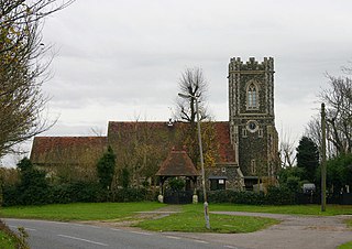
<span class="mw-page-title-main">West Tilbury</span> Village in England

West Tilbury is a village and former civil parish in the Thurrock district, in the ceremonial county of Essex, England. It is on the top of and on the sides of a 30 metres (98 ft) tall river terrace overlooking the River Thames. Part of the modern town of Tilbury is within the traditional parish of West Tilbury. In 1931 the parish had a population of 444. On 1 April 1936 the parish was abolished to form Thurrock.

Orsett Rural District was a local government district centred on Orsett in the south Essex part of the Thames Estuary in England. It was a rural district from 1894 to 1936, initially made up of seventeen civil parishes and the successor to the Orsett Rural Sanitary District. Parts of the district were split off to form Tilbury in 1912, Purfleet in 1929 and Billericay in 1934. Thurrock Urban District was the main successor district in 1936. Today it corresponds to the Thurrock unitary authority area with parts in Basildon, Essex and Havering, Greater London.

<span class="mw-page-title-main">Mucking</span> Hamlet in Essex, England

Mucking is a hamlet and former Church of England parish and civil parish adjoining the Thames Estuary in the Thurrock unitary authority area, in southern Essex, England. It is located approximately 2 miles (3.2 km) south of the town of Stanford-le-Hope. In 1931 the civil parish had a population of 498.

<span class="mw-page-title-main">East Tilbury</span> Village in Essex, England

East Tilbury is a village and former civil parish in the unitary authority of Thurrock borough, Essex, England, and one of the traditional Church of England parishes in Thurrock. In 2011 the ward had a population of 6,363.
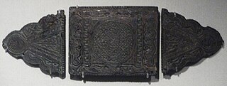
<span class="mw-page-title-main">Mucking (archaeological site)</span> Archaeological site in Essex, England

Mucking is an archaeological site near the village of Mucking in southern Essex. The site contains remains dating from the Neolithic to the Middle Ages—a period of some 3,000 years—and the Bronze Age and Anglo-Saxon features are particularly notable.

Terrel's Heath is, in spite of its name, an area of woodland in Chadwell St Mary named on the 1938 six-inch Ordnance Survey map.

<span class="mw-page-title-main">Orsett Heath</span> Human settlement in England

Orsett Heath is a location and recently built hamlet in the unitary authority area of Thurrock, in the ceremonial county of Essex, England. It is located about twenty miles away from London. Nearby settlements include the towns of Tilbury and Grays and the villages of Orsett and Chadwell St Mary. For transport there is the A13 road, the A1089 road and the A1013 road nearby. The nearest railway station is Tilbury Town.
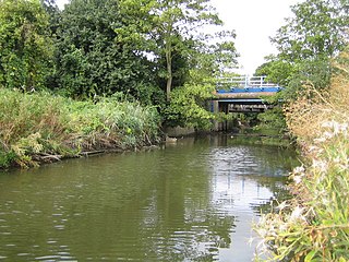
<span class="mw-page-title-main">Mardyke (river)</span> River in Essex, England

The Mardyke is a small river, mainly in Thurrock, that flows into the River Thames at Purfleet, close to the Queen Elizabeth II Bridge. In part, it forms the boundary between the Essex hundreds of Barstable and Chafford. The river gives its name to the Mardyke Valley—a project aimed at increasing appreciation and usage of recreational land around the Mardyke.

The archaeology of Anglo-Saxon England is the study of the archaeology of England from the 5th century AD to the 11th century, when it was ruled by Germanic tribes known collectively as the Anglo-Saxons.

<span class="mw-page-title-main">West Stow Anglo-Saxon Village</span> Archaeological open-air museum in West Stow, Suffolk

West Stow Anglo-Saxon Village is an archaeological site and an open-air museum located near to West Stow in Suffolk, eastern England. Evidence for intermittent human habitation at the site stretches from the Mesolithic through the Neolithic, Bronze Age, Iron Age and Romano-British period, but it is best known for the small village that existed on the site between the mid-5th century and the early 7th century CE, during the early Anglo-Saxon period. During this time, around 70 sunken-featured buildings were constructed on the site, along with 8 halls and a number of other features. Subsequently, abandoned, the area became farmland in the Late Medieval period.

<span class="mw-page-title-main">Margaret Ursula Jones</span> British archaeologist (1916–2001)

Margaret Ursula Jones was an English archaeologist, best known for directing major excavations at Mucking, Essex.