Baker Street, Essex

Last updated

Baker Street
Baker Street Mill.jpg
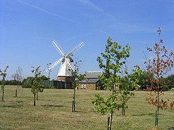
Baker Street windmill
Essex UK location map.svg
Red pog.svg
Baker Street
Location within Essex
Area0.330 km2 (0.127 sq mi)
Population598 (2019 estimate)
  Density 1,812/km2 (4,690/sq mi)
OS grid reference TQ6381
Unitary authority
Ceremonial county
Region
Country England
Sovereign state United Kingdom
Post town GRAYS
Postcode district RM16
Dialling code 01375
Police Essex
Fire Essex
Ambulance East of England
UK Parliament
List of places
UK
England
Essex
51°30′N0°20′E / 51.50°N 00.34°E / 51.50; 00.34

Baker Street is an area of Orsett in the unitary authority of Thurrock. It is in the ceremonial county of Essex, England. In 2019 it had an estimated population of 598. [1]

Description

Reaney [2] suggests the name is derived from William Bakere de Luggestreet.

It is known locally because of the surviving windmill. The windmill is said to have been built in the 17th century and ceased working in 1911. It is now a private house. [3]

Baker Street as it appeared on the 1777 Chapman & Andre map of Essex Orsett heath.jpg
Baker Street as it appeared on the 1777 Chapman & Andre map of Essex

Notes

  1. "Baker Street". City Population De. Retrieved 19 November 2020.
  2. PH Reaney, The Place-Names of Essex (CUP, 1969)
  3. Historic England. "BAKER STREET WINDMILL (498135)". Research records (formerly PastScape). Retrieved 10 October 2015.