Related Research Articles

Thurrock is a unitary authority area with borough status in the English ceremonial county of Essex. It is part of the London commuter belt and an area of regeneration within the Thames Gateway redevelopment zone. The local authority is Thurrock Council.

Grays is the largest town in the borough and unitary authority of Thurrock in Essex, England, former civil parish and one of Thurrock's traditional parishes. The town, on the north bank of the River Thames, is approximately 20 miles (32 km) to the east of central London, and 2 miles (3.2 km) east of the M25 motorway. Its economy is linked to Port of London industries, its own offices, retail and the Lakeside Shopping Centre at West Thurrock. In 1931 the parish had a population of 18,173.
North Ockendon is the easternmost and most outlying settlement of Greater London, England, and part of the London Borough of Havering. It is 18 miles (29 km) east-northeast of Central London and consists of a dispersed settlement within the Metropolitan Green Belt. It was historically an ancient parish in the county of Essex, which was abolished for civil purposes in 1936. North Ockendon is the only area in Greater London outside the M25 London Orbital Motorway. North Ockendon is north of South Ockendon, in Thurrock, Essex.

Purfleet-on-Thames is a town in the Thurrock unitary authority, Essex, England. It is bordered by the A13 road to the north and the River Thames to the south and is within the easternmost part of the M25 motorway but just outside the Greater London boundary. It was within the traditional Church of England parish of West Thurrock. Some industry is located to the south and the area forms part of the Thames Gateway redevelopment area. Purfleet is one of seven conservation areas in Thurrock.

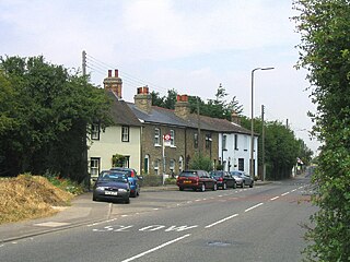
Aveley is a town and former civil parish in the unitary authority of Thurrock in Essex, England, and forms one of the traditional Church of England parishes. Aveley is 16 miles (26.2 km) east of Charing Cross. In 2019 it had an estimated population of 9,461. In 1931 the parish had a population of 2003.
South Ockendon is a town, former civil parish and Church of England parish within the Thurrock borough in Essex in the East of England, United Kingdom. It is located on the border with Greater London, just outside the M25 motorway. The area to the north is North Ockendon. In 2019 it had an estimated population of 22,303. In 1931 the parish had a population of 1355.

Fobbing is a small village and former civil parish in Thurrock, Essex, England and one of Thurrock's traditional parishes. It is located between Basildon and Corringham, and is also close to Stanford-le-Hope. In 1931 the parish had a population of 734.

West Thurrock is an area, former civil parish and traditional Church of England parish and town in Thurrock, Essex, England, located 17.5 miles (28.1 km) east south-east of Charing Cross, London. In 1931 the parish had a population of 5153. On 1 April 1936 the parish was abolished to form Thurrock.
Stanford-le-Hope is a town, former civil parish and Church of England parish situated in the county of Essex, England. Often known locally simply as Stanford, the town is within the unitary authority of Thurrock and located 23.8 miles (38.4 km) east of Charing Cross in London. In 1931 the parish had a population of 4311.

Chadwell St Mary is an area of the unitary authority of Thurrock in Essex, England. It is one of the traditional parishes in Thurrock and a former civil parish. Its residential areas are on the higher ground overlooking the former Thameside marshland. Grays is a town centred 2 miles (3.2 km) west of it. Closer still, 1 mile (1.6 km) south is the modern town of Tilbury which was almost wholly part of the parish until the end of the 19th century. The settlement is frequently referred to simply as Chadwell, particularly before the 19th century.
West Tilbury is a village and former civil parish on the top of and on the sides of a 30 metres (98 ft) tall river terrace overlooking the River Thames. Part of the modern town of Tilbury is within the traditional parish of West Tilbury. In 1931 the parish had a population of 444. On 1 April 1936 the parish was abolished to form Thurrock.

Orsett is a village, former civil parish and ecclesiastical parish located within Thurrock unitary district in Essex, England, situated around 5 km north-east of Grays. In 1931 the parish had a population of 1771.

Mucking is a hamlet and former Church of England parish adjoining the Thames Estuary in southern Essex, England. It is located approximately 2 miles (3.2 km) south of the town of Stanford-le-Hope in what is now Thurrock unitary authority. In 1931 the parish had a population of 498.
East Tilbury is a village and former civil parish in the unitary authority of Thurrock borough, Essex, England, and one of the traditional Church of England parishes in Thurrock. In 1931 the parish had a population of 353.
Corringham is an English town and former civil parish, located on a hill overlooking the River Thames east of London. It is situated 7 miles from Tilbury, and lies between Canvey Island and Tilbury Fort. Its commercial centre in smaller Stanford-le-Hope immediately to its south-west. It is in the unitary authority of Thurrock and a traditional parish stretching from Horseshoe Bay in the Thames Estuary to Dry Street, south of Langdon Hills. It is in the far east of the borough. In 1931 the parish had a population of 1897.
Langdon Hills is a township and former civil parish located in Basildon in Essex, England.
Colonel Sir Francis Henry Douglas Charlton Whitmore, 1st Baronet was a British military officer and landowner.
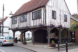
Horndon on the Hill is a village, former civil parish and Church of England parish in the unitary authority of Thurrock, in the county of Essex, England. It is located close to the A13, around one mile northwest of Stanford-le-Hope and around two miles northeast of Orsett. The village area falls within the Orsett ward of Thurrock District Council. In 2019 it had an estimated population of 1517. In 1931 the parish had a population of 1052.

Little Thurrock is an area, ward, former civil parish and Church of England parish in the unitary authority of Thurrock, Essex. In 1931 the parish had a population of 4428.
Terrel's Heath is, in spite of its name, an area of woodland in Chadwell St Mary named on the 1938 six-inch Ordnance Survey map.
References
- 1 2 3 4 5 6 7 Raymond Powell, The making of Essex Parishes (in Essex Review, 1953)
- 1 2 3 4 John Morris (Ed) Domesday Book: Essex (Phillimore, 1983)
- 1 2 3 Stephen Pewsey & Andrew Brooks, East Saxon Heritage (Alan Sutton Publishing, 1993)
- 1 2 Cyril Hart The Early Charters of Essex (Leicester University Press, 1971)
- 1 2 3 4 Andrew Barham, Lost Parish Churches of Essex (Ian Henry Publications, 2000)
- ↑ Tony Benton Boldly from the marshes (Thurrock Council, 1991)
- ↑ "Victoria County History of Essex".