
Thurrock is a unitary authority area with borough status in the English ceremonial county of Essex. It is part of the London commuter belt and an area of regeneration within the Thames Gateway redevelopment zone. The local authority is Thurrock Council.
The Port of London is that part of the River Thames in England lying between Teddington Lock and the defined boundary with the North Sea and including any associated docks. Once the largest port in the world, it is the United Kingdom's second largest port, after Grimsby & Immingham as of 2012. Usage is largely governed by the Port of London Authority ("PLA"), a public trust established in 1908; while mainly responsible for coordination and enforcement of activities it also has some minor operations of its own.

Grays is the largest town in the borough and unitary authority of Thurrock in Essex and one of Thurrock's traditional parishes. The town, on the north bank of the River Thames, is approximately 20 miles (32 km) to the east of central London, and 2 miles (3.2 km) east of the M25 motorway. Its economy is linked to Port of London industries, its own offices, retail and the Lakeside Shopping Centre at West Thurrock.

Tilbury is a town in the borough of Thurrock, Essex, England. The present town was established as separate settlement in the late 19th century, on land that was mainly part of Chadwell St Mary. It contains a 16th century fort and an ancient cross-river ferry. Tilbury is part of the Port of London with a major deep-water port which contributes to the local economy.

The Borough of Basildon is a local government district in south Essex in the East of England, centred on the town of Basildon. The district was formed under the Local Government Act 1972 on 1 April 1974 from the former area of Basildon Urban District and the part of Thurrock Urban District that was within the Basildon New Town. The population of the district as of 2010 is about 172,000. The council made an application for borough status in February 2010 and this was given approval that year, with Cllr Mo Larkin becoming the first mayor in October. The local authority is Basildon Borough Council.
North Ockendon is the easternmost and most outlying settlement of Greater London, England, and part of the London Borough of Havering. It is 18 miles (29 km) east-northeast of Central London and consists of a dispersed settlement within the Metropolitan Green Belt. It was historically an ancient parish in the county of Essex, that was abolished for civil purposes in 1936. North Ockendon is the only area in Greater London outside the M25 London Orbital Motorway. North Ockendon is north of South Ockendon, in Thurrock, Essex.
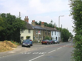
Stanford-le-Hope is a town and Church of England parish situated in the county of Essex, England. Often known locally simply as Stanford, the town is within the unitary authority of Thurrock and located 23.8 miles (38.4 km) east of Charing Cross in London.
Thurrock is a unitary authority in Essex, England. Until 1 April 1998 it was a non-metropolitan district. One third of the council is elected each year, followed by one year without an election. Since the unitary authority was first elected in 1997, the council has consisted of 49 councillors elected from 20 wards.

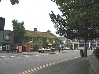
Chadwell St Mary is in the unitary authority of Thurrock in Essex, England. It is one of the traditional parishes in Thurrock and a former civil parish. Its residential areas are on the higher ground overlooking the former Thameside marshland. Grays is a town centred 2 miles (3.2 km) west of it. Closer still, 1 mile (1.6 km) south is the modern town of Tilbury which was almost wholly part of the parish until the end of the 19th century. The settlement is frequently referred to simply as Chadwell, particularly before the 19th century.

Thurrock was a local government district and civil parish in south Essex, England from 1936 to 1974.

West Tilbury is a village on the top of and on the sides of a 30 metres (98 ft) tall river terrace overlooking the river Thames. Part of the modern town of Tilbury is within the traditional parish of West Tilbury.
Lower Horse is a 31.1-acre (12.6 ha) uninhabited island off the English coast, lying in the Thames Estuary between Canvey Island and Stanford-le-Hope, close to grid reference TQ760828.

The Gravesend–Tilbury Ferry is a passenger ferry across the River Thames east of London. It is the last public crossing point before the Thames reaches the sea.
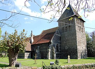
East Tilbury is a village in the unitary authority of Thurrock borough, Essex, England, and one of the traditional Church of England parishes in Thurrock.
Corringham is an English town, with its commercial centre in smaller Stanford-Le-Hope immediately to its south-west. It is in the unitary authority of Thurrock and a traditional parish stretching from Horseshoe Bay in the Thames Estuary to Dry Street, south of Langdon Hills. It is in the far east of the borough.
Langdon Hills is a township located in Basildon in Essex, England.

London Stone is the name given to a number of boundary stones that stand beside the rivers Thames and Medway, which formerly marked the limits of jurisdiction of the City of London.

Chafford was an ancient hundred in the south west of the county of Essex, England. Its area has been partly absorbed by the growth of London; with its name reused for the modern housing development of Chafford Hundred. Its former area now corresponds to part of the London Borough of Havering in Greater London and parts of the districts of Brentwood and Thurrock in Essex.

Essex is a county in the East of England, north-east of London. One of the home counties, it borders Suffolk and Cambridgeshire to the north, the North Sea to the east, Hertfordshire to the west, Kent across the estuary of the River Thames to the south and the London boroughs of Enfield, Waltham Forest, Redbridge and Havering to the south and south-west. The county town is Chelmsford, the only city in the county. For the purposes of government statistics, Essex is placed in the East of England region.