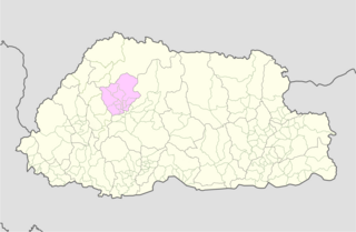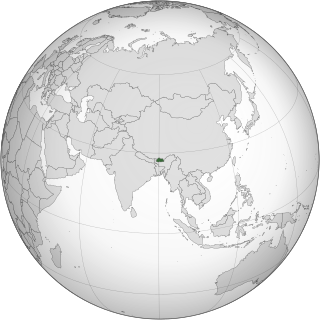
Punakha District is one of the 20 dzongkhags (districts) comprising Bhutan. It is bordered by Thimphu, Gasa, and Wangdue Phodrang Districts. The dominant language in the district is Dzongkha, the national language.
Articles related to Bhutan include:

A gewog, in the past also spelled as geog, is a group of villages in Bhutan. The head of a gewog is called a gup. Gewogs form a geographic administrative unit below dzongkhag districts, and above Dzongkhag Thromde class B and Yenlag Thromde municipalities. Dzongkhag Thromde class A municipalities have their own independent local government body.

Trongsa District is one of the districts of Bhutan. It is the most central district of Bhutan and the geographic centre of Bhutan is located within it at Trongsa Dzong.

Wangdue Phodrang is a town and capital of Wangdue Phodrang District in central Bhutan. It is located in Thedtsho Gewog. Khothang Rinchenling

National Council elections were held in Bhutan for the first time on 31 December 2007, having been originally scheduled for 26 December. The new National Council had 25 members, which 20 members were directly elected from 20 dzongkhags by 312,817 eligible voters, and five more were appointed by the Druk Gyalpo. Nominations had to be filed by 27 November 2007, and the campaigning for 15 of the 20 dzongkhags took place from 30 November until 31 December 2007.

The Penlop of Trongsa, also called Chhoetse Penlop, is a Dzongkha title meaning "Governor of the Province of Trongsa (Chhoetse)". It is now generally given to the heir apparent of the Kingdom of Bhutan, but historically was an important title, for the governor of Trongsa and the surrounding area, and was the route by which the House of Wangchuck came to the throne.

Chiwogs of Bhutan or chios refer to the 1044 basic electoral precincts of Bhutan. Chiwogs are also former third-level administrative divisions of Bhutan below gewogs. Until 2009, they were the equivalent of municipalities or parishes, containing clusters of villages and hamlets. There are generally 5 or 6 chios in each geo, and in turn several geos in each dzongkha (district). To illustrate, there are 50 chios in Paro District alone. The majority of chios are small rural communities; more densely populated areas tend to be separate thromdes, or municipalities. A Chiwog Disaster Management Plan (CDMP) exists in some chios to form an effective responsive to any local disasters. Often, participants in the CDMP are also trained at a geo level for better coordination.

A Thromde is a second-level administrative division in Bhutan. The legal administrative status of thromdes was most recently codified under the Local Government Act of 2009, and the role of thromdes in elections in Bhutan was defined in the Election Act of 2008.

Trongsa Province was one of the nine historical Provinces of Bhutan.

Bumthang Province was one of the nine historical Provinces of Bhutan.

Kurtoed Province was one of the nine historical Provinces of Bhutan.

Kurmaed Province was one of the nine historical Provinces of Bhutan.

Typical format for telephone numbers in Bhutan are: +975 XX XXXXXX (mobile) and +975 X XXXXXX.

The valleys of Bhutan are carved into the Himalaya by Bhutan's rivers, fed by glacial melt and monsoon rains. As Bhutan is landlocked in the mountainous eastern Himalaya, much of its population is concentrated in valleys and lowlands, separated by rugged southward spurs of the Inner Himalaya. Despite modernization and development of transport in Bhutan, including a national highway system, travel from one valley to the next remains difficult. Western valleys are bound to the east by the Black Mountains in central Bhutan, which form a watershed between two major river systems, the Mo Chhu and the Drangme Chhu. Central valleys are separated from the east by the Donga Range. The more isolated mountain valleys protect several tiny, distinct cultural and linguistic groups. Reflecting this isolation, most valleys have their own local protector deities.