List of crossings of the River Calder, West Yorkshire

Last updated

This is a list of current bridges and other crossings of the River Calder .

Contents

Crossings

CrossingCarriesLocationCoordinates

Calderdale, West Yorkshire

Copley Bridge (former toll bridge)North Dean RoadCopley 53°41′39″N1°51′17″W / 53.6941°N 1.8546°W / 53.6941; -1.8546
railway bridge Caldervale Line 53°41′49″N1°51′59″W / 53.6969°N 1.8664°W / 53.6969; -1.8664
railway bridge Caldervale Line 53°41′47″N1°51′33″W / 53.6964°N 1.8592°W / 53.6964; -1.8592
Stainland Road Bridge B6112 53°41′39″N1°51′17″W / 53.6941°N 1.8546°W / 53.6941; -1.8546
railway bridge Caldervale Line 53°41′32″N1°51′03″W / 53.6921°N 1.8509°W / 53.6921; -1.8509
Elland Bridge B6114 Elland 53°41′16″N1°50′24″W / 53.6879°N 1.8399°W / 53.6879; -1.8399
River Calder Bridge (Elland) UK road A629.svg A629 53°41′24″N1°50′05″W / 53.6899°N 1.8346°W / 53.6899; -1.8346
railway bridge Caldervale Line 53°41′25″N1°50′01″W / 53.6902°N 1.8337°W / 53.6902; -1.8337
Savile Way BridgeSavile Way 53°41′34″N1°49′51″W / 53.6929°N 1.8308°W / 53.6929; -1.8308
Bailey BridgefootpathCromwell Bottom 53°41′57″N1°47′00″W / 53.6993°N 1.7832°W / 53.6993; -1.7832
Rastrick Bridge UK road A643.svg A643 Brighouse 53°41′45″N1°48′51″W / 53.6959°N 1.8141°W / 53.6959; -1.8141
Brighouse Bridge UK road A641.svg A641 53°41′58″N1°46′45″W / 53.6995°N 1.7792°W / 53.6995; -1.7792
Blakeborough's Bridge footpath 53°41′51″N1°46′08″W / 53.6974°N 1.7688°W / 53.6974; -1.7688

Kirklees / Calderdale, West Yorkshire

Kirklees Viaduct UK-Motorway-M62.svg M62 53°41′34″N1°45′23″W / 53.6928°N 1.7564°W / 53.6928; -1.7564
railway bridge Caldervale Line 53°41′18″N1°44′27″W / 53.6883°N 1.7408°W / 53.6883; -1.7408
Cooper Bridge UK road A62.svg A62 (Leeds Road)Cooper Bridge 53°40′55″N1°44′06″W / 53.6819°N 1.7351°W / 53.6819; -1.7351

Kirklees, West Yorkshire

railway bridge Caldervale Line 53°40′59″N1°43′36″W / 53.6830°N 1.7268°W / 53.6830; -1.7268
Hauling Bridgetowpath 53°41′01″N1°43′32″W / 53.6837°N 1.7255°W / 53.6837; -1.7255
Wood Lane BridgeWood LaneBattyeford 53°40′50″N1°42′53″W / 53.6805°N 1.7148°W / 53.6805; -1.7148
Mirfield Viaduct Caldervale Line / Huddersfield Line Mirfield 53°40′21″N1°41′52″W / 53.6725°N 1.6978°W / 53.6725; -1.6978
Ledgard Bridge Newgate Street 53°40′19″N1°41′51″W / 53.6719°N 1.6976°W / 53.6719; -1.6976
Hopton New Road BridgeHopton New Road 53°40′07″N1°41′34″W / 53.6685°N 1.6927°W / 53.6685; -1.6927
railway bridge Caldervale Line / Huddersfield Line 53°40′15″N1°40′39″W / 53.6707°N 1.6776°W / 53.6707; -1.6776
access bridgeaccess road 53°40′16″N1°40′36″W / 53.6712°N 1.6767°W / 53.6712; -1.6767
Steanard BridgeSteanard Lane 53°40′28″N1°40′30″W / 53.6745°N 1.6749°W / 53.6745; -1.6749
Ravensthorpe Road BridgeRavensthorpe Road Ravensthorpe 53°40′36″N1°39′32″W / 53.6766°N 1.6589°W / 53.6766; -1.6589
railway bridge (disused) Spen Valley railway 53°40′49″N1°39′01″W / 53.6804°N 1.6504°W / 53.6804; -1.6504
railway bridge Caldervale Line / Huddersfield Line 53°40′51″N1°38′52″W / 53.6808°N 1.6478°W / 53.6808; -1.6478
pipe bridge 53°40′51″N1°38′43″W / 53.6807°N 1.6453°W / 53.6807; -1.6453
Thornhill BridgeThornhill Road 53°40′43″N1°38′12″W / 53.6786°N 1.6368°W / 53.6786; -1.6368
Mill Street BridgeMill Street West Dewsbury 53°41′20″N1°38′05″W / 53.6889°N 1.6347°W / 53.6889; -1.6347
footbridgefootpath 53°41′20″N1°37′58″W / 53.6889°N 1.6328°W / 53.6889; -1.6328
Saville Road BridgeSaville Road B6409 53°41′20″N1°37′58″W / 53.6889°N 1.6328°W / 53.6889; -1.6328
pipe bridge 53°41′02″N1°37′17″W / 53.6839°N 1.6213°W / 53.6839; -1.6213
railway bridge (disused) 53°41′01″N1°37′17″W / 53.6836°N 1.6214°W / 53.6836; -1.6214
pipe bridge 53°40′43″N1°36′56″W / 53.6787°N 1.6156°W / 53.6787; -1.6156
footbridgefootpath 53°40′07″N1°35′34″W / 53.6685°N 1.5929°W / 53.6685; -1.5929

See also

Related Research Articles

River Usk River in Wales

The River Usk rises on the northern slopes of the Black Mountain, Wales, in the westernmost part of the Brecon Beacons National Park. Initially forming the boundary between Carmarthenshire and Powys, it flows north into Usk Reservoir, then east by Sennybridge to Brecon before turning southeast to flow by Talybont-on-Usk, Crickhowell and Abergavenny after which it takes a more southerly course.

Washington Crossing State Park United States historic place

Washington Crossing State Park is a 3,575-acre (14 km2) New Jersey state park that is part of Washington's Crossing, a U.S. National Historic Landmark area. It is located in the Washington Crossing and Titusville sections of Hopewell Township in Mercer County, north of Trenton along the Delaware River. The park is operated and maintained by the New Jersey Division of Parks and Forestry. It is supported by the Washington Crossing Park Association, a friends group that works to preserve, enhance, and advocate for the park.

Shoalhaven River River in Australia

The Shoalhaven River is a perennial river that rises from the Southern Tablelands and flows into an open mature wave dominated barrier estuary near Nowra on the South Coast of New South Wales, Australia.

Washington Crossing Historic Park United States historic place

Washington Crossing Historic Park is a 500-acre (2 km2) state park operated by the Pennsylvania Department of Conservation and Natural Resources in partnership with the Friends of Washington Crossing Park. The park is divided into two sections. One section of the park, the "lower park," is headquartered in the village of Washington Crossing located in Upper Makefield Township in Bucks County, Pennsylvania. It marks the location of George Washington's crossing of the Delaware River during the American Revolutionary War.

The Yangtze River power line crossings are overhead power lines that cross the Yangtze River in China. There are at least three power line crossings on the Yangtze River at Jiangyin, Nanjing, and Wuhu. The towers of the crossing in Jiangyin are among the highest in the world.

Stony Crossing is a locality in the south western part of the Riverina on the south bank of the Wakool River. By road, it is about 22 kilometres (14 mi) south east from Kyalite and 35 kilometres (22 mi) north west from Swan Hill.

The Ashaway River is a river in the U.S. states of Rhode Island and Connecticut. It flows approximately 4 km (2 mi). There are three dams along the river's length.

Washington's Crossing is the location of George Washington's crossing of the Delaware River on the night of December 25–26, 1776 in the American Revolutionary War. This daring maneuver led to victory in the Battle of Trenton and altered the course of the war. The site, a National Historic Landmark, is composed of state parks in Washington Crossing, New Jersey, and Washington Crossing, Pennsylvania, north of Trenton, New Jersey.

The North Branch Meduxnekeag River is a river in Aroostook County, Maine and Carleton County, New Brunswick. From the outlet of a small pond in Maine Township 8, Range 3, WELS, the river runs about 20 miles (30 km) northeast, south, and east to the Canada–United States border, crossing into Canada at 46°16′40″N67°46′56″W. It runs about 4 miles (6 km) southeast to its confluence with the Meduxnekeag River in Wakefield, NB.

Ford (crossing) Shallow place with good footing where a river or stream may be crossed by wading

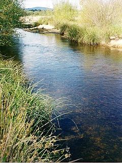
A ford is a shallow place with good footing where a river or stream may be crossed by wading, or inside a vehicle getting its wheels wet. A ford may occur naturally or be constructed. Fords may be impassable during high water. A low water crossing is a low bridge that allows crossing over a river or stream when water is low but may be treated as a ford when the river is high and water covers the crossing.

Bega River (New South Wales)

The Bega River is an intermittently open intermediate wave dominated barrier estuary that is located in the South Coast region of New South Wales, Australia.

References