Crossings
All locations are in Washington unless otherwise specified.
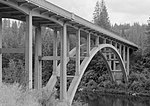
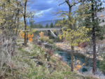
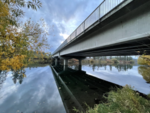
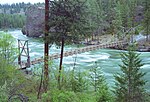
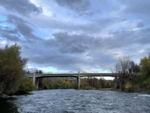
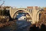
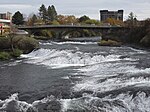
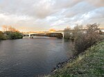
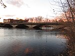
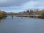
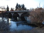
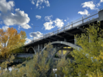
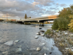
This is a list of crossings of the Spokane River , including auto, pedestrian and railroad bridges, from its mouth at the Columbia River to its source at Lake Coeur d'Alene.
All locations are in Washington unless otherwise specified.
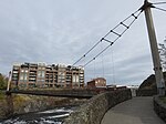
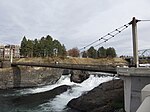
All locations are in Spokane's Riverfront Park. This corresponds to the area between the Post Street Bridge and Division Street Bridge above.
| Image | Crossing | Opened | Coordinates |
|---|---|---|---|
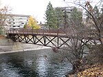
 | South Howard Street Footbridge | 47°39′40″N117°25′16″W / 47.661026°N 117.421082°W | |
 | Clock Tower Footbridge | 47°39′40″N117°25′10″W / 47.661149°N 117.419436°W | |
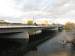
 | Stevens Street | 47°39′40″N117°25′08″W / 47.661106°N 117.418932°W | |
| Washington Street | 47°39′40″N117°25′06″W / 47.661091°N 117.418202°W | ||
 | King Cole Footbridge | 47°39′42″N117°24′58″W / 47.661546°N 117.416153°W |

Coeur d'Alene is a city and the county seat of Kootenai County, Idaho, United States. It is the most populous city in North Idaho and the principal city of the Coeur d'Alene Metropolitan Statistical Area. The population was 54,628 at the 2020 census. Coeur d'Alene is a satellite city of Spokane, which is located about thirty miles (50 km) to the west in the state of Washington. The two cities are the key components of the Spokane–Coeur d'Alene Combined Statistical Area, of which Coeur d'Alene is the third-largest city. The city is situated on the north shore of the 25-mile (40 km) long Lake Coeur d'Alene and to the west of the Coeur d'Alene Mountains. Locally, Coeur d'Alene is known as the "Lake City," or simply called by its initials, "CDA."

Spokane is the most populous city in and the county seat of Spokane County, Washington, United States. It is in eastern Washington, along the Spokane River, adjacent to the Selkirk Mountains, and west of the Rocky Mountain foothills, 92 miles (148 km) south of the Canadian border, 18 miles (30 km) west of the Washington–Idaho border, and 279 miles (449 km) east of Seattle, along Interstate 90.

Spokane Valley is a city in Spokane County, Washington, United States, and the largest suburb of Spokane. It is located east of Spokane, west of Coeur d'Alene, Idaho, and surrounds the city of Millwood on three sides. The city incorporated as the City of Spokane Valley on March 31, 2003. The population was 102,976 at the 2020 census, making it the eighth-largest city in Washington state. Spokane Valley is named after the valley of the Spokane River, in which it is located. The city and the general area is colloquially referred to as "The Valley" by residents of the Spokane–Coeur d'Alene area.
PotlatchDeltic Corporation is an American diversified forest products company based in Spokane, Washington.

The Spokane River is a tributary of the Columbia River, approximately 111 miles (179 km) long, in northern Idaho and eastern Washington in the United States. It drains a low mountainous area east of the Columbia, passing through the Spokane Valley and the city of Spokane, Washington.
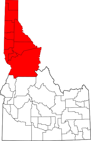
The Idaho panhandle—locally known as North Idaho, Northern Idaho, or simply the Panhandle—is a salient region of the U.S. state of Idaho encompassing the state's 10 northernmost counties: Benewah, Bonner, Boundary, Clearwater, Idaho, Kootenai, Latah, Lewis, Nez Perce, and Shoshone. The panhandle is bordered by the state of Washington to the west, Montana to the east, and the Canadian province of British Columbia to the north. The Idaho panhandle, along with Eastern Washington, makes up the region known as the Inland Northwest, headed by its largest city, Spokane, Washington.

Lake Coeur d'Alene, officially Coeur d'Alene Lake, is a natural dam-controlled lake in North Idaho, located in the Pacific Northwest region of the United States. At its northern end is the city of Coeur d'Alene. It spans 25 miles (40 km) in length and ranges from 1 to 3 miles (5 km) wide with over 109 miles (175 km) of shoreline.

The Coeur d'Alene Resort is a resort hotel in the northwest United States, located in Coeur d’Alene, Idaho. Seated on the north shore of Lake Coeur d'Alene by Tubbs Hill, the resort features a marina, convention facilities, spa, as well as a notable 18-hole golf course.

Downtown Spokane or Riverside is the central business district of Spokane, Washington. The Riverside neighborhood is roughly bounded by I-90 to the south, Division Street to the east, Monroe Street to the west and Boone Avenue to the north. The topography of Downtown Spokane is mostly flat except for areas downstream of the Spokane Falls which are located in a canyon; the elevation is approximately 1,900 feet (580 m) above sea level.
The Trail of the Coeur d'Alenes is a rail trail in the Idaho Panhandle of the United States. It follows the right-of-way of the former Union Pacific Railroad from Mullan, a mountain mining town near the Montana border, westward to Plummer, a town on the prairie near the Washington border. Generally following the Coeur d'Alene River, the rail line was abandoned in 1991, and the trail officially opened in March 2004.
Lookout Pass Ski and Recreation Area is a ski area in the western United States. It is at Lookout Pass on Interstate 90, on the border of Idaho and Montana, five miles (8 km) east of Mullan, Idaho. It has a summit elevation of 6,150 ft (1,870 m) on Eagle Peak and 5,650 ft (1,720 m) on Runt Mountain with a vertical drop of 1,650 ft (500 m). Lookout Pass operates seven days per week from mid-December until mid-April.

Interstate 90 (I-90) is a transcontinental Interstate Highway that runs east–west across the northern United States. Within the state of Idaho, the freeway travels for 74 miles (119 km) from the Washington border near Spokane to Coeur d'Alene and the panhandle region at the north end of the state. After traveling through the Silver Valley along the Coeur d'Alene River in the Bitterroot Range, I-90 crosses into Montana at Lookout Pass.

Spokane, Washington has a rich sporting culture and the area residents are active in many spectator and participant sports. Although Spokane lacks any major, nationally recognized professional sports team, Spokane has a sports friendly atmosphere, and was recognized and rated #99 in the Sporting News 2006 "99 Best Sporting Cities" list. In 2009, Sports Business Journal rated Spokane as the fifth best minor league sports market in America out of 239 markets.
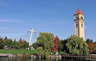
Riverfront Park, branded as Riverfront Spokane, is a public urban park in downtown Spokane, Washington that is owned and operated by the Spokane Parks & Recreation Department. The 100-acre (40 ha) park is situated along the Spokane River and encompasses the Upper Spokane Falls, which is the second largest urban waterfall in the United States.

In the U.S. state of Idaho, U.S. Route 95 (US-95) is a north–south highway near the western border of the state, stretching from Oregon to British Columbia for over 538 miles (866 km); it was earlier known in the state as the North and South Highway.

The North Idaho Centennial Trail is a 24 miles (39 km) paved trail in Idaho used for transportation and recreational activities. Extending from Higgens Point on the northeast side of Lake Coeur d'Alene, a popular place for bald eagle watchers in early winter, the trail follows the lake's north shoreline to the Spokane River where it follows it to the Idaho/Washington border. On the other side of the state border, the trail becomes the Spokane River Centennial Trail and extends for another 37 miles (60 km) out to Sontag Park in Nine Mile Falls, Washington. The trail passes through the towns of Post Falls, Idaho and Coeur d'Alene, Idaho.

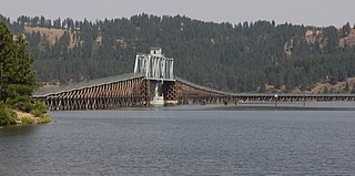
Heyburn State Park is a public recreation area in the U.S. state of Idaho. It is located almost entirely in Benewah County, with a small portion extending into southern Kootenai County. The park was founded in 1908 and is the oldest state or provincial park in the Pacific Northwest. The park has 5,744 acres (23.2 km2) of land and 2,332 acres (9.4 km2) of water on three lakes: Benewah, Chatcolet, and Hidden. A dam constructed on the Spokane River in Post Falls in 1906 raised the level of Lake Coeur d'Alene, connecting it to the park's three lakes. The surface elevation of the lakes is 2,125 feet (648 m) above sea level. The park's year-round recreational opportunities include camping, boating, hiking, horseback riding, fishing, and picnicking.
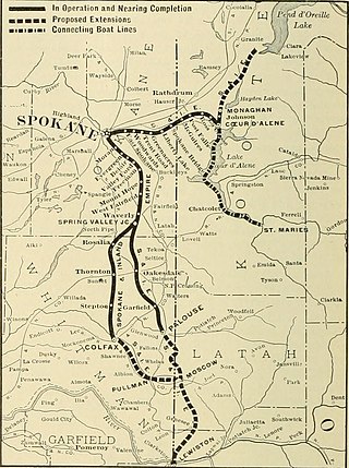
The Spokane and Inland Empire Railroad Company (S.&I.E.R.R.Co.) was an electrified interurban railway operating in Spokane, Washington and vicinity, extending into northern and central Idaho. The system originated in several predecessor roads beginning c. 1890, incorporated in 1904, and ran under its own name to 1929. It merged into the Great Northern Railway and later, the Burlington Northern Railroad, which operated some roads into the 1980s.

East Central is a neighborhood in Spokane, Washington. As the name suggests, it is on the east side of Spokane and centrally located. The official neighborhood is expansive and covers multiple areas considered by locals to be independent neighborhoods, such as the Sprague Union District on East Sprague Avenue, the South Perry District, the Underhill Park area and the University District on the eastern fringe of Downtown Spokane.

Browne's Addition, often referred to shorthand as just Browne's, is a neighborhood in Spokane, Washington. It is located directly west of Downtown Spokane and is one of the oldest and densest neighborhoods in the city. The area is known for its numerous historic mansions, many of which have been converted into multi-family apartments. The terrain is flat in the neighborhood despite the degree of topographical relief in the immediate surrounding area. Latah Creek cuts a deep valley to the west, separating Browne's Addition from the Sunset Hill portion of the West Hills neighborhood and the Spokane River gorge drops off dramatically to the north into the Peaceful Valley neighborhood. The South Hill area of Spokane rises to the southwest.