Reardan is a town in Lincoln County, Washington, United States. The population was 637 at the 2020 census.

The Lewis and Clark Bridge is a cantilever bridge that spans the Columbia River between Longview, Washington, and Rainier, Oregon. At the time of its completion, it had the longest cantilever span in the United States.

This is a list of properties and historic districts in Washington that are listed on the National Register of Historic Places. There are at least three listings in each of Washington's 39 counties.

Nine Mile Falls is an unincorporated community in Spokane County, Washington and Stevens County, Washington, United States. The community straddles the Spokane River 9 miles (14 km) away from downtown Spokane, at the location of a former falls that has been the site of Nine Mile Dam since 1908. Following the river, the community is located 16 miles (26 km) downstream from downtown.

State Route 503 (SR 503) is a 54.11-mile-long (87.08 km) state highway serving Clark and Cowlitz counties in the U.S. state of Washington. The highway travels north from a short concurrency with SR 500 in Orchards through Battle Ground, the eastern terminus of SR 502, and communities in rural Clark County before crossing the Lewis River on the Yale Bridge. SR 503 intersects its spur route and turns west to parallel the Lewis River downstream to Woodland, where the highway ends at an interchange with Interstate 5 (I-5). The highway was part of the Lewis River Road, signed as State Road 15, from 1909 until 1919. The current route of SR 503 was split between Secondary State Highway 1S (SSH 1) from Woodland to Battle Ground and SSH 1U from Battle Ground to Orchards in 1937, combined to form SR 503 during the 1964 highway renumbering. A spur route, established in 1991, travels northeast into the Gifford Pinchot National Forest along Yale Lake, serving the community of Cougar.

Keechelus Lake is a lake and reservoir in the northwest United States, near Hyak in Kittitas County, Washington. Approximately fifty miles (80 km) southeast of Seattle and a few miles southeast of Snoqualmie Pass, it is the source of the Yakima River.

The Snake River Bridge, is located on State Route 261 at the confluence of the Snake and Palouse Rivers, near Starbuck, Washington, USA. The bridge is listed on the National Register of Historic Places in 1982 and is located next to Lyons Ferry Park.

The McMillin Bridge is a concrete half-through truss bridge crossing the Puyallup River, in Pierce County, Washington, built in 1934.

The Fairfax Bridge is a steel-lattice three-hinged arch bridge spanning the Carbon River on State Route 165 in Pierce County, Washington. Previous to the construction of the bridge in 1921, the only route south to the area around Fairfax was by train. At a total cost of $80,000, the bridge's deck sits 250 feet (76 m) above the river. Being a single-lane bridge, vehicles must yield to oncoming traffic already on the bridge.

State Route 231 (SR 231) is a 74.97-mile (120.65 km) long state highway in the U.S. state of Washington serving communities in Lincoln and Stevens counties. The highway, located entirely west of Spokane in the Inland Empire, serves Sprague, Edwall, Reardan, Springdale and Chewelah. The route extends from SR 23 north of Sprague to a concurrency with U.S. Route 2 (US 2) near Reardan and an intersection with US 395 south of Chewelah.

The Kettle Falls Bridges is the collective name for a pair of steel cantilever bridges carrying State Route 20/U.S. Route 395 and the Kettle Falls International Railway across the Columbia River at Kettle Falls, Washington. The south bridge carries motor vehicle traffic while the similar northern span is used for rail.

The Grand Coulee Bridge, or Columbia River Bridge at Grand Coulee Dam, is a through-cantilever steel truss bridge built in 1934–35. It carries State Route 155 across the Columbia River immediately below Grand Coulee Dam, near the city of Grand Coulee, Washington. It was added to the National Register of Historic Places in 1982.

The Yale Bridge or Lewis River Bridge spans the Lewis River near Yale, Washington. It was built in 1932 by Cowlitz and Clark counties. The suspension bridge has a clear span of 300 feet (91 m), with a total length of 532 feet (162 m), replacing a previous steel truss bridge at the site. Construction of the Ariel Dam had created Lake Merwin with a water depth of 90 feet (27 m) at the site, requiring a new bridge that did not need to have support piers in the water. The road deck, stiffened by a steel Warren truss, is 50 feet (15 m) above the high water line of the reservoir.

The Columbia River Bridge, also known as the Bridgeport Bridge, at Bridgeport, Washington, was built to span the Columbia River in 1950. Composed of three spans, the bridge is a steel continuous riveted deck truss carrying Washington State Route 17 on a 26-foot-wide (7.9 m) roadway and two 3-foot (0.91 m) sidewalks. The center portion of the bridge spans 300 feet (91 m), flanked by 250-foot (76 m) end spans. The 70-foot (21 m) north approach span and the 100-foot (30 m) south approach span are supported by steel plate girders. The bridge played a significant role in the construction of the Chief Joseph Dam just upstream, as no bridge crossing had previously existed in the area. Construction on the dam started in 1945 and was completed, apart from the powerplant, in 1955. The bridge was designed and built by the U.S. Army Corps of Engineers as part of the Chief Joseph Dam project, and is significant for its association with the project and as a major crossing of the Columbia.

Long Lake Dam is a concrete gravity dam on the Spokane River, between Lincoln County and Stevens County about 30 miles (48 km) northwest of Spokane in eastern Washington. It forms Long Lake (Washington), a 23.5 mi (37.8 km) long reservoir, and has a hydroelectric generating capacity of 71 megawatts. The dam was built by Washington Water Power, which operates five other dams along the Spokane.

Nine Mile Falls Dam is a dam on the Spokane River, in the unincorporated community of Nine Mile Falls, Washington. It was built on the site of the falls in 1908, creating Nine Mile Reservoir. The dam was designed by the New York engineering firm of Sanderson & Porter, and originally constructed to satisfy the power needs of the Spokane and Inland Empire Railroad interurban trolley lines.

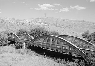
The Indian Timothy Memorial Bridge is a tied-arch bridge which spans Alpowa Creek less than half a mile before that creek joins the Snake River, about 8 miles (13 km) west of Clarkston in Asotin County, Washington. It was built by the Washington State Department of Transportation in 1923 and was listed on the National Register of Historic Places in 1982.

The Orient Bridge, which spans the Kettle River between Ferry County, Washington and Stevens County, Washington, was built in 1909. It was listed on the National Register of Historic Places.

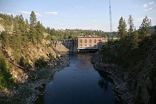
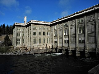
The Little Falls Hydroelectric Power Plant, on the Spokane River near Reardan, Washington, about 30 miles (48 km) west of Spokane was built during 1907–10. It was listed on the National Register of Historic Places in 1988. The listing included one contributing building and seven contributing structures on 12 acres (4.9 ha). The area spans the border of Lincoln County, Washington and Stevens County, Washington.

Deep Creek is a stream of approximately 23 miles which is formed at the confluence of the North Fork Deep Creek and South Fork Deep Creek two miles southwest of the community of Deep Creek, Washington on the far western edge of Spokane County. The creek has its mouth at the Spokane River in Riverside State Park where it cuts a thin canyon through basalt with depths reaching over 600 feet from the land above. The creek and its tributaries flow through mostly rural agricultural areas east of the Spokane urban area, though the headwaters and mouth are both located on state-owned conservation land.


