Related Research Articles

The Sahara desert, as defined by the World Wide Fund for Nature (WWF), includes the hyper-arid center of the Sahara, between latitudes 18° N and 30° N. It is one of several desert and xeric shrubland ecoregions that cover the northern portion of the African continent.

In physical geography, a steppe is an ecoregion characterized by grassland plains without trees apart from those near rivers and lakes. Steppe biomes may include:

The Caucasus-Anatolian-Hyrcanian temperate forests is a composite ecoregion of southern Europe and West Asia, designated by the World Wildlife Fund as one of their Global 200 ecoregions, a list of priority ecoregions for conservation.
The Irano-Anatolian region is a biodiversity hotspot designated by Conservation International, extending across portions of Armenia, Azerbaijan, Georgia, Iraq, Iran, Turkey, and Turkmenistan.

A forest steppe is a temperate-climate ecotone and habitat type composed of grassland interspersed with areas of woodland or forest.

The Eastern Anatolian montane steppe is a temperate grasslands, savannas, and shrublands ecoregion. It is located in high plateau of Eastern Anatolia, covering parts of eastern Turkey, Armenia, Azerbaijan, southern Georgia, and northwestern Iran.
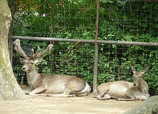
The wildlife of Turkmenistan is the flora and fauna of Turkmenistan, and the natural habitats in which they live. Turkmenistan is a country in Central Asia to the east of the Caspian Sea. Two thirds of the country is hot dry plains and desert, and the rest is more mountainous. Very little rain falls in summer and the chief precipitation occurs in the southern part of the country in the winter and spring. The Caspian coast has milder winters.

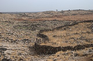
The Kopet Dag semi-desert ecoregion is a small ecoregion that crosses the border of southwestern Turkmenistan into northeastern Iran. It covers a transition zone between the deserts to the north and west, and the foothill steppes and woodlands in the higher Kopet Dag mountains to the east and the Alborz Mountains to the south. The terrain is mostly barren semi-desert and widespread 'takir', a type of seasonal salt flat or dried clay deposit in an interdune depression.

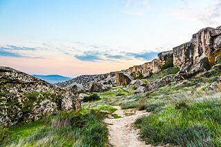
The Kopet Dag woodlands and forest steppe ecoregion coincides with the Kopet Dag mountains, straddling the southern border of Turkmenistan and the northeastern border of Iran. The region is one of high biodiversity, as it includes a full range of altitude zones, and variety of habitats included juniper-wooded slopes, montane grasslands, and tugay.
The Middle East steppe ecoregion stretches in an arc from southern Jordan across Syria and Iraq to the western border of Iran. The upper plains of the Tigris and Euphrates Rivers dominate most of the ecoregion. The terrain is mostly open shrub steppe. The climate is arid. Evidence is that this region was once more of a forest-steppe, but centuries of overgrazing and gathering firewood have reduced tree and grass cover to small areas and along the riverine corridors. Despite the degraded condition of the steppe environment, the ecoregion is important for water birds as the rivers and reservoirs provide habitat in the arid region.

The Kuh Rud and Eastern Iran montane woodlands ecoregion covers hills and mountains in central and eastern Iran. The habitat is wetter and cooler than the surrounding desert of the Iranian Plateau, supporting the vulnerable Goitered gazelle and small populations of the vulnerable Cheetah. The ecoregion is under conservation threat from overgrazing and conversion of steep slopes to cultivation.

The Central Persian desert basins ecoregion covers the arid steppe and desert basins of central Iran, stretching into northwestern Afghanistan. The ecoregion extends over the Central Iranian Plateau, which is surrounded by mountain ranges and has no outlets to the sea. Much of the terrain is hot sand-and-gravel desert and large salt flats. The vegetation includes many specialized species of halophytes (salt-tolerant), xerophytes (drought-tolerant), and psammophile (sand-loving) plants.
The Azerbaijan shrub desert and steppe is a deserts and xeric shrublands ecoregion in western Asia. It lies in the lowlands west of the Caspian Sea, and covers portions of Azerbaijan, Georgia, and Iran.

The Baluchistan xeric woodlands ecoregion covers the middle elevations of a series of mountain ranges of western Pakistan and northeastern Afghanistan, reaching 1,200 kilometres (750 mi) from the Arabian Sea in the south to the Hindu Kush Mountains and the Himalayas in the north. The characteristic vegetation is xeric (dry) woodlands of shrubs and herbaceous cover. The region has rich biodiversity but relatively few endemic species.
References
- ↑ Olson, D. M., Dinerstein, E., Wikramanayake, E. D., Burgess, N. D., Powell, G. V. N., Underwood, E. C., D'Amico, J. A., Itoua, I., Strand, H. E., Morrison, J. C., Loucks, C. J., Allnutt, T. F., Ricketts, T. H., Kura, Y., Lamoreux, J. F., Wettengel, W. W., Hedao, P., Kassem, K. R. (2001). Terrestrial ecoregions of the world: a new map of life on Earth. Bioscience 51(11):933-938