
The Sahara desert, as defined by the World Wide Fund for Nature (WWF), includes the hyper-arid center of the Sahara, between latitudes 18° N and 30° N. It is one of several desert and xeric shrubland ecoregions that cover the northern portion of the African continent.
The wildlife of Turkmenistan is the flora and fauna of Turkmenistan, and the natural habitats in which they live. Turkmenistan is a country in Central Asia to the east of the Caspian Sea. Two thirds of the country is hot dry plains and desert, and the rest is more mountainous. Very little rain falls in summer and the chief precipitation occurs in the southern part of the country in the winter and spring. The Caspian coast has milder winters.
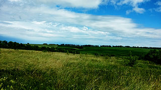
The East European forest steppe ecoregion is a patchwork of broadleaf forest stands and grasslands (steppe) that stretches 2,100 km across eastern Europe from the Ural Mountains in Ural, through Povolzhye, Central Russia to the middle of Ukraine. There are isolated areas of similar character off the western end in eastern Romania, Moldova, and Bulgaria.
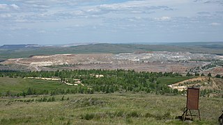
The Kazakh forest steppe ecoregion is a long thin strip of transition zone between the forested taiga of Siberian Russia, and the Kazakh steppe to the south. The ecoregion stretches over 2,000 km from the southern Ural mountains in the west to the foothills of Altai mountains in the east, yet averages only 200 km from south to north across its length. Because the region is farther inland than European forest steppe, and some 300 to 500 km farther north, the climate is more continental and with less precipitation the tree cover more sparse. The ecoregion is in the Temperate grasslands, savannas, and shrublands biome, and the Palearctic realm, with a Humid Continental climate. It covers 420,614 km2 (162,400 sq mi).

The Caspian lowland desert ecoregion covers the north and southeast coasts of the Caspian Sea, including the deltas of the Volga River and Ural River in the northern region. While the region gets relatively low amounts of precipitation, wildlife is supported by the river estuaries and the sea itself. The wetlands are an internationally important area for bird nesting and migratory resting. The ecoregion is in the Palearctic realm, and the deserts and xeric shrublands biome. It has an area of 267,300 square kilometres (103,200 sq mi).

The Helanshan montane conifer forests ecoregion covers an isolated, forested mountain range surrounded by desert and semi-arid basins. As such, it has been called a "mountain island in the sky", and supports endemic species of plants and animals. The region supports the endangered Helan Shan pika.
The Khangai Mountains alpine meadows ecoregion runs along the central ridge of the Khangai Mountains in central Mongolia. The slopes to the north are conifer forests, the lowlands to the south are semi-arid steppe. The Khangai are an "island" mountain range surrounded by lower forest steppe and semi-arid regions of central Mongolia. Most of the region is now protected by Tarvagatai Nuruu National Park and Khangai Nuruu National Park.

The Gobi Lakes Valley desert steppe ecoregion covers the narrow, flat valley in southwestern Mongolia that lies between the Khangai Mountains, and the Gobi-Altai Mountains. The region is known as the "Valley of the Lakes" because runoff from the mountains collect in lakes that have no outlet to the sea. Although the valley is a semi-arid desert steppe, it has areas of wetlands near the lakes that are important habit for water birds.

The Central Asian riparian woodlands ecoregion is spread out across the deserts and plains of central Asia between the Aral Sea and the mountains 2,000 kilometres (1,200 mi) to the east. The long narrow components of the ecoregion follow the large rivers fed by snowmelt, and provide critical habitat for migratory birds as they travel through the arid region. The vegetation is referred to as tugai, characterized by low tangles of trees and brush along the edges of the rivers and associated wetlands, and fed by groundwater instead of precipitation.

The Central Asian southern desert ecoregion is an arid but ecologically active region between the east coast of the Caspian Sea and steppes at the base of the mountains of central Asia. Most of Turkmenistan and eastern Uzbekistan is in this ecoregion. The winters are milder than in the cold desert to the north, and a large number of endemic species have adapted to living in the particular climate and soil of the region. As with sandy deserts in general, the region is notable for high numbers of endemic species of reptiles and insects.

The Kopet Dag woodlands and forest steppe ecoregion coincides with the Kopet Dag mountains, straddling the southern border of Turkmenistan and the northeastern border of Iran. The region is one of high biodiversity, as it includes a full range of altitude zones, and variety of habitats included juniper-wooded slopes, montane grasslands, and tugay.

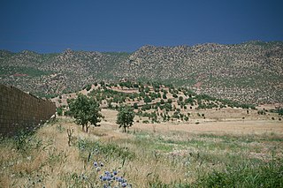
The Badghyz and Karabil semi-desert ecoregion covers the hills north of the central mountain ranges of Afghanistan, southeast Turkmenistan, and portions of Uzbekistan and Tajikistan. The landscape has been described as "savannah-like" and reminiscent of Africa, with desert sedges (Carex) and stands of wild pistachio trees. The area supports high biodiversity and a number of rare and endemic species, such as the endangered Turkmenian kulan (Equus hemionus kulan).

The Alai-Western Tian Shan steppe ecoregion covers the foothills on the western edge of the Tien Shan and Alay Mountains of Central Asia. This territory is mostly in southeastern Uzbekistan, with a portion running north into Kazakhstan on the east side of the Syr Darya River, and a small portion in Turkmenistan.
The Middle East steppe ecoregion stretches in an arc from southern Jordan across Syria and Iraq to the western border of Iran. The upper plains of the Tigris and Euphrates Rivers dominate most of the ecoregion. The terrain is mostly open shrub steppe. The climate is arid. Evidence is that this region was once more of a forest-steppe, but centuries of overgrazing and gathering firewood have reduced tree and grass cover to small areas and along the riverine corridors. Despite the degraded condition of the steppe environment, the ecoregion is important for water birds as the rivers and reservoirs provide habitat in the arid region.

The Kuh Rud and Eastern Iran montane woodlands ecoregion covers hills and mountains in central and eastern Iran. The habitat is wetter and cooler than the surrounding desert of the Iranian Plateau, supporting the vulnerable goitered gazelle and small populations of the cheetah. The ecoregion is under conservation threat from overgrazing and conversion of steep slopes to cultivation.

The Central Persian desert basins ecoregion covers the arid steppe and desert basins of central Iran, stretching into northwestern Afghanistan. The ecoregion extends over the Central Iranian Plateau, which is surrounded by mountain ranges and has no outlets to the sea. Much of the terrain is hot sand-and-gravel desert and large salt flats. The vegetation includes many specialized species of halophytes (salt-tolerant), xerophytes (drought-tolerant), and psammophile (sand-loving) plants.

The Paropamisus xeric woodlands ecoregion covers the portion of northeastern Afghanistan north of the central mountain range and the Hindu Kush Mountains. The name is derived from the Old Persian name for the region, Parupraesanna. While there are low canopy woodlands in the northeast of the ecorgegion, most of the territory is desert or xeric (dry) scrubland.

The Baluchistan xeric woodlands ecoregion covers the middle elevations of a series of mountain ranges of western Pakistan and northeastern Afghanistan, reaching 1,200 kilometres (750 mi) from the Arabian Sea in the south to the Hindu Kush Mountains and the Himalayas in the north. The characteristic vegetation is xeric (dry) woodlands of shrubs and herbaceous cover. The region has rich biodiversity but relatively few endemic species.

