Related Research Articles
A lieutenant governor, lieutenant-governor, or vice governor is a high officer of state, whose precise role and rank vary by jurisdiction. Often a lieutenant governor is the deputy, or lieutenant, to or ranked under a governor — a "second-in-command", rather like deputy governor. In Canadian provinces or in the Dutch Caribbean, the lieutenant governor is the representative of the monarch in that jurisdiction.

Nigeria is a federation of 36 states and 1 federal capital territory. Each of the 36 states is a semi-autonomous political unit that shares powers with the Federal Government as enumerated under the Constitution of the Federal Republic of Nigeria. The Federal Capital Territory, also known as FCT, is the capital territory of Nigeria, and it is in this territory that the capital city of Abuja is located. The FCT is not a state but is administered by elected officials who are supervised by the Federal Government. Each state is sub-divided into Local Government Areas (LGAs). There are 774 local government in Nigeria. Under the Constitution, the 36 states are co-equal but not supreme because sovereignty resides with the Federal Government. The constitution can be amended by the National Assembly, but each amendment must be ratified by two-thirds of the 36 states of the federation.

Kogi State is a state in the Middle Belt region of Nigeria, bordered to the east by the states of Ekiti and Kwara, to the north by the Federal Capital Territory, to the northeast by Nasarawa State, to the northwest by Niger State, to the southwest by the states of Edo and Ondo, to the southeast by the states of Anambra and Enugu, and to the west by Benue State as being the only state in Nigeria to border ten other states. Named for the Hausa word for river—kogi—Kogi State was formed from parts of Benue State, Niger State, and Kwara State on 27 August 1991. The state is nicknamed the "Confluence State" due the fact that the confluence of the River Niger and the River Benue occurs next to its capital, Lokoja.

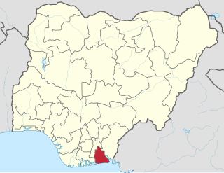
Akwa Ibom State is a state in the South-South geopolitical zone of Nigeria, bordered on the east by Cross River State, on the west by Rivers State and Abia State, and on the south by the Atlantic Ocean. The state takes its name from the Kwa Ibo River which bisects the state before flowing into the Bight of Bonny. Akwa Ibom was split from Cross River State in 1987 with her capital Uyo and with 31 local government areas.

Lagos State is a state in southwestern Nigeria. Of the 36 states, it is both the most populous and smallest in area. Bounded to the south by the Bight of Benin and to the west by the international border with Benin Republic, Lagos State borders Ogun State to the east and north making it the only Nigerian state to border only one other state. Named for the city of Lagos—the most populous city in Africa—the state was formed from the Western Region and the former Federal Capital Territory on 27 May 1967.

Delta State is a state in the South-South geopolitical zone of Nigeria. Named after the Niger Delta—a large part of which is in the state—the state was formed from the former Bendel State in August 27, 1991. Bordered on the north by Edo State, the east by Anambra and Rivers states, and that south by Bayelsa State while to the west is the Bight of Benin which covers about 160 kilometres of the state's coastline. The state was initially created with 12 local government areas in 1991 which was later extended to 19 and now has 25 local government areas. Asaba as its state capital located along the River Niger on the northeastern end of the state, while the state's economic center is Warri on the southwestern coastline.

Niger is a state in the Middle Belt region of Nigeria and the largest state in the country. Niger state has three political zones, zone A,B and C. The state's capital is at Minna. Other major cities are Bida, Kontagora and Suleja. It was formed in 1976 when the then North-Western State was divided into Niger State and Sokoto State. It is home to Ibrahim Babangida and Abdulsalami Abubakar, two of Nigeria's former military rulers. The Nupe, Gbagyi, Kamuku, Kambari, Gungawa, Hun-Saare, Hausa and Koro form the majority of numerous indigenous tribes of Niger State.

Ekiti State is a state in southwestern Nigeria, bordered to the north by Kwara State, to the northeast by Kogi State, to the south and southeast by Ondo State, and to the west by Osun State. Named for the Ekiti people—the Yoruba subgroup that make up the majority of the state's population—Ekiti State was formed from a part of Ondo State in 1996 and has its capital as the city of Ado-Ekiti.

Yobe is a state located in northeastern Nigeria. A mainly agricultural state, it was created on August 27, 1991. Yobe State was carved out of Borno State. The capital of Yobe State is Damaturu; its most populated city is Potiskum.

Kebbi State is a state in northwestern Nigeria, bordered to the east and north by the states of Sokoto and Zamfara, and to the south by Niger State while its western border forms part of the national borders with Benin Republic and Niger. Named for the city of Birnin Kebbi—the state's capital and largest city—Kebbi State was formed from a part of Sokoto State on 27 August 1991. Of the 36 states of Nigeria, Kebbi is the tenth largest in area and 22nd most populous with an estimated population of about 4.4 million as of 2016. The state is known as land of equity.

Nasarawa State is a state in the Middle Belt region of Nigeria, bordered to the east by the states of Taraba and Plateau, to the north by Kaduna State, to the south by the states of Kogi and Benue, and to the west by the Federal Capital Territory. Named for the historic Nasarawa Emirate, the state was formed from the west of Plateau State on 1 October 1996. The state has thirteen local government areas and its capital is Lafia, located in the east of the state, while a key economic centre of the state is the Karu Urban Area—suburbs of Abuja—along the western border with the FCT.

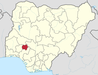
Osun State, occasionally known as the State of Osun by the state government, is a state in southwestern Nigeria; bounded to the east by Ekiti and Ondo states, to the north by Kwara State, to the south by Ogun State and to the west by Oyo State. Named for the River Osun—a vital river which flows through the state—the state was formed from the southeast of Oyo State on 27 August 1991 and has its capital as the city of Osogbo.

Ọyọ, usually referred to as Ọyọ State to distinguish it from the city of Ọyọ, is an inland state in southwestern Nigeria. Its capital is Ibadan, the third most populous city in the country and formerly the second most populous city in Africa. Ọyọ State is bordered to the north by Kwara State, to the east by Ọṣun State, and to the southwest by Ogun State and the Republic of Benin. With a projected population of 7,840,864 in 2016, Ọyọ State is the fifth most populous in the Nigeria.
References
- "Nigerian Federal States". WorldStatesmen. Retrieved 2009-11-30.