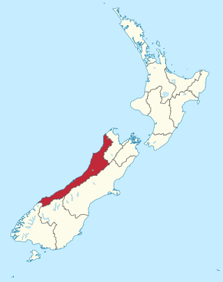
This list of Heritage New Zealand-listed places in Buller District contains those buildings and structures that are listed with Heritage New Zealand (formerly known as Historic Places Trust) in Buller District, New Zealand.
Heritage New Zealand is a Crown entity and the national heritage agency. With a head office in Wellington, the Christchurch area office is responsible for the Grey District. [1]
| Image | Item | Description | Location | Street address | Built | Date listed | Heritage category |
|---|---|---|---|---|---|---|---|
 | Clock Tower Chambers | municipal building in New Zealand | Westport | 119 Palmerston Street and 8 Lyndhurst Street, Westport 7825 | 1941 | 30 August 1990 | NZHPT Category I listing |
 | House | 75 Queen Street and Wakefield Street, Westport | Westport | 75 Queen Street and Wakefield Street, Westport | 30 August 1990 | NZHPT Category I listing | |
 | Westport Public Library | former library in New Zealand | Westport | Lyndhurst Street, Westport | 1904 | 21 September 1989 | NZHPT Category II listing |
 | The Stone House | historic house in Westport, New Zealand | Westport | 108 Derby Street, Westport 7825 | 1911 | 22 June 1994 | NZHPT Category II listing |
 | Westport Post Office | post office in New Zealand | Westport | 155 Palmerston Street and Brougham Street, Westport | 21 September 1989 | NZHPT Category II listing | |
 | Utopia Lodge | historic hostel/hotel in Westport, New Zealand | Westport | 72 Queen Street, Westport 7825 | 21 September 1989 | NZHPT Category II listing | |
 | O'Connor Home | resthome and historic place in Westport, New Zealand | Westport | 190 Queen Street, Westport 7825 | 1918 | 21 September 1989 | NZHPT Category II listing |
 | Masonic Lodge Hall | masonic temple in Westport, New Zealand | Westport | 51 Russell Street, Westport | 1907 | 21 September 1989 | NZHPT Category II listing |
 | Gates of Remembrance | memorial gates in Westport, New Zealand | Westport | Russell Street and Brougham Street, Victoria Park, Westport | 1920 | 21 September 1989 | NZHPT Category II listing |
 | House | historic house in Westport, New Zealand (2) | Westport | 51 Queen Street, Westport | 21 September 1989 | NZHPT Category II listing | |
 | House | historic building in Westport, New Zealand (3) | Westport | 32 Henley Street and Queen Street, Westport | 1889 | 21 September 1989 | NZHPT Category II listing |
 | House | historic house in Westport, New Zealand | Westport | 55 Queen Street, Westport | 1903 | 21 September 1989 | NZHPT Category II listing |
 | Courthouse | courthouse in Westport, New Zealand | Westport | 11 Wakefield Street, Westport 7825 | 1903 | 21 September 1989 | NZHPT Category II listing |
 | Buller Field Station | historic building in New Zealand | Westport | 40 Queen Street, Westport | 21 September 1989 | NZHPT Category II listing | |
 | Westpac Bank building | building in Westport, New Zealand | Westport | 143 Palmerston Street, Westport | 1901 | 4 April 2008 | NZHPT Category II listing |
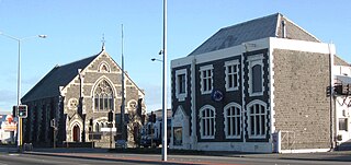
 | Sacred Heart Church | church building in Reefton, New Zealand | Reefton | Church Street and Walsh Street, Reefton | 1879 | 14 May 2008 | NZHPT Category II listing |
 | Reefton Courthouse | former courthouse in Reefton, New Zealand | Reefton | 47 Bridge Street, Reefton 7830 | 1872 | 27 August 1990 | NZHPT Category I listing |
 | Reefton Masonic Hall | masonic hall in New Zealand | Reefton | 38 Shiel Street, Reefton | 1892 | 22 August 2008 | NZHPT Category II listing |
 | St Stephen's Church | church building in Reefton, New Zealand | Reefton | 16–18 Church Street and Walsh Street, Reefton | 1888 | 22 August 2008 | NZHPT Category II listing |
 | School of Mines | historic building in Reefton, New Zealand | Reefton | 22 Shiel Street, Reefton | 1887 | 30 August 1990 | NZHPT Category I listing |
 | Reefton Oddfellows Hall | fraternal meeting hall in New Zealand | Reefton | 56 Bridge Street, Reefton | 1876 | 21 September 1989 | NZHPT Category II listing |
 | Horse trough, Reefton | horse trough in New Zealand | Reefton | 15 Shiel Street, Reefton | 21 September 1989 | NZHPT Category II listing | |
 | Penington House | house in New Zealand | Reefton | 15 Shiel Street, Reefton | 21 September 1989 | NZHPT Category II listing | |
 | State Mine Store (Former) | heritage building in Granity, New Zealand | Granity | 54–56 Back Road, Granity 7823 | 21 September 1989 | NZHPT Category II listing | |
 | Granity and District Fundraising Centre | historic building in New Zealand | Granity | 98 Torea Street, Granity | 1891 | 21 September 1989 | NZHPT Category II listing |
 | Granity Community Library | subscription library in Granity, New Zealand | Granity | Torea Street, Granity | 1903 | 21 September 1989 | NZHPT Category II listing |
| Griffiths Foundry Furnace (Former) | historic industrial site in Birchfield, New Zealand | Birchfield | 459 Birchfield Road, Birchfield, Westport 7891 | 1898 | 21 September 1989 | NZHPT Category II listing |