List of lakes in Lewis and Clark County, Montana

Last updated
Map all coordinates using: OpenStreetMap  ·  Google Maps
Download coordinates as: KML  ·  GPX

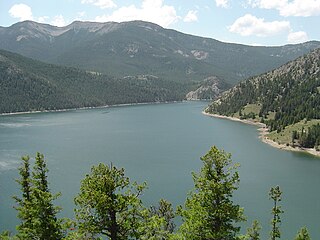
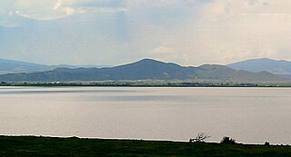
There are at least 67 named lakes and reservoirs in Lewis and Clark County, Montana .

Lake A body of relatively still water, in a basin surrounded by land

A lake is an area filled with water, localized in a basin, that is surrounded by land, apart from any river or other outlet that serves to feed or drain the lake. Lakes lie on land and are not part of the ocean, and therefore are distinct from lagoons, and are also larger and deeper than ponds, though there are no official or scientific definitions. Lakes can be contrasted with rivers or streams, which are usually flowing. Most lakes are fed and drained by rivers and streams.

Reservoir A storage space for fluids

A reservoir is, most commonly, an enlarged natural or artificial lake, pond or impoundment created using a dam or lock to store water.

Lewis and Clark County, Montana County in the United States

Lewis and Clark County is a county located in the U.S. state of Montana. As of the 2010 United States Census, the population was 63,395. Its county seat is Helena, the state capital. The numerical designation for Lewis and Clark County is 5. The county was established in 1865 as Edgerton County, and was renamed "Lewis and Clark County" two years later. The present name was given in honor of explorers Lewis and Clark.

Contents

Lakes

Bighorn Lake

Bighorn Lake is a reservoir behind Yellowtail Dam within the Bighorn Canyon National Recreation Area, located in southern Montana and northern Wyoming.

Connors Lake is a lake in Sawyer County, Wisconsin, United States. It is located in the Flambeau River State Forest. The lake covers an area of 429 acres (1.74 km2) and reaches a maximum depth of 82 ft (25 m). Fish species enzootic to Connors Lake include bluegill, largemouth bass, muskellunge, smallmouth bass, and walleye.

Gates Lake, also known as Birken Lake, Tenass Lake, Halfway Lake, and Summit Lake, is a small lake located at the summit of the Pemberton Portage area of the one-time Lakes Route through the Coast Mountains, located at the summit of a low pass connecting the Upper and Lower Lillooet Country of the Southern Interior of British Columbia. Birken Lake sits at the divide between the Birkenhead and Gates-Seton drainage, known as the Pemberton Pass or Mosquito Pass, and is part of the Gates River drainage.

Reservoirs

Gibson Reservoir, Montana GibsonR.jpg
Gibson Reservoir, Montana
Holter Lake Holter Lake.jpg
Holter Lake
Canyon Ferry Lake

Canyon Ferry Lake is a reservoir on the Missouri River near Helena, Montana and Townsend, Montana. It is Montana's third largest body of water, covering 35,181 acres (142 km²) and 76 miles (122 km) of shore (1). It was formed by the building of Canyon Ferry Dam, which was completed in 1954 and has been used for electricity, irrigation, and flood controls since.

Gibson Reservoir

Gibson Reservoir is located just south of the Bob Marshall Wilderness in Montana. The reservoir is formed by the concrete arch Gibson Dam and backs water up between a hilly pass for about 3 miles. The water in the dam is initially provided by spring snow runoff and carried there via the North Fork Sun River and the South Fork Sun River right after the two join. The reservoir is mainly used for irrigation control.

Lake Helena lake of the United States of America

Lake Helena is a body of water along Prickly Pear Creek in the Helena Valley of Lewis and Clark County in southwestern Montana. It is 2,073 acres (8 km2) in size and is 3,647 ft (1,112 m) above sea level.

See also

Notes

  1. "Alpine Lake". Geographic Names Information System . United States Geological Survey.
  2. "Beale Lake". Geographic Names Information System . United States Geological Survey.
  3. "Bean Lake". Geographic Names Information System . United States Geological Survey.
  4. "Bear Lake". Geographic Names Information System . United States Geological Survey.
  5. "Beaver Ponds". Geographic Names Information System . United States Geological Survey.
  6. "Beaver Ponds". Geographic Names Information System . United States Geological Survey.
  7. "Bighorn Lake". Geographic Names Information System . United States Geological Survey.
  8. "Camp Lake". Geographic Names Information System . United States Geological Survey.
  9. "Canyon Lake". Geographic Names Information System . United States Geological Survey.
  10. "Connors Lake". Geographic Names Information System . United States Geological Survey.
  11. "Copper Lake". Geographic Names Information System . United States Geological Survey.
  12. "Flesher Lakes". Geographic Names Information System . United States Geological Survey.
  13. "Gates Lake". Geographic Names Information System . United States Geological Survey.
  14. "Grassy Lake". Geographic Names Information System . United States Geological Survey.
  15. "Gravelly Range Lake". Geographic Names Information System . United States Geological Survey.
  16. "Hazard Lake". Geographic Names Information System . United States Geological Survey.
  17. "Heart Lake". Geographic Names Information System . United States Geological Survey.
  18. "Hermit Lake". Geographic Names Information System . United States Geological Survey.
  19. "Herrin Lakes". Geographic Names Information System . United States Geological Survey.
  20. "Hidden Lake". Geographic Names Information System . United States Geological Survey.
  21. "Keep Cool Lakes". Geographic Names Information System . United States Geological Survey.
  22. "Krohn Lake". Geographic Names Information System . United States Geological Survey.
  23. "Krone Lake". Geographic Names Information System . United States Geological Survey.
  24. "Lake Levale". Geographic Names Information System . United States Geological Survey.
  25. "Lake Quiet". Geographic Names Information System . United States Geological Survey.
  26. "Meadow Lake". Geographic Names Information System . United States Geological Survey.
  27. "Meyer Lake". Geographic Names Information System . United States Geological Survey.
  28. "My Lake". Geographic Names Information System . United States Geological Survey.
  29. "Parker Lake". Geographic Names Information System . United States Geological Survey.
  30. "Red Lake". Geographic Names Information System . United States Geological Survey.
  31. "Renshaw Lake". Geographic Names Information System . United States Geological Survey.
  32. "Silver King Lake". Geographic Names Information System . United States Geological Survey.
  33. "Smith Lake". Geographic Names Information System . United States Geological Survey.
  34. "Smith Lake". Geographic Names Information System . United States Geological Survey.
  35. "Snowbank Lake". Geographic Names Information System . United States Geological Survey.
  36. "Sock Lake". Geographic Names Information System . United States Geological Survey.
  37. "Sun Lake". Geographic Names Information System . United States Geological Survey.
  38. "Twin Lakes". Geographic Names Information System . United States Geological Survey.
  39. "Twin Lakes". Geographic Names Information System . United States Geological Survey.
  40. "Two Point Lake". Geographic Names Information System . United States Geological Survey.
  41. "Unnamed Lake". Geographic Names Information System . United States Geological Survey.
  42. "Upper Copper Lake". Geographic Names Information System . United States Geological Survey.
  43. "Upper Holter Lake". Geographic Names Information System . United States Geological Survey.
  44. "Webb Lake". Geographic Names Information System . United States Geological Survey.
  45. "Wood Lake". Geographic Names Information System . United States Geological Survey.
  46. "Anderson Lake". Geographic Names Information System . United States Geological Survey.
  47. "Canyon Ferry Lake". Geographic Names Information System . United States Geological Survey.
  48. "Chessman Reservoir". Geographic Names Information System . United States Geological Survey.
  49. "Chessman Reservoir". Geographic Names Information System . United States Geological Survey.
  50. "Diversion Lake". Geographic Names Information System . United States Geological Survey.
  51. "Dry Creek-Krezelok Reservoir". Geographic Names Information System . United States Geological Survey.
  52. "Gibson Reservoir". Geographic Names Information System . United States Geological Survey.
  53. "Gravelly Range Lake". Geographic Names Information System . United States Geological Survey.
  54. "Hauser Lake". Geographic Names Information System . United States Geological Survey.
  55. "Helena Valley Regulating Reservoir". Geographic Names Information System . United States Geological Survey.
  56. "Helena Valley Reservoir". Geographic Names Information System . United States Geological Survey.
  57. "Holter Lake". Geographic Names Information System . United States Geological Survey.
  58. "Lake Helena". Geographic Names Information System . United States Geological Survey.
  59. "Mike Horse". Geographic Names Information System . United States Geological Survey.
  60. "Nilan Reservoir". Geographic Names Information System . United States Geological Survey.
  61. "Scott Reservoir". Geographic Names Information System . United States Geological Survey.
  62. "Scott Reservoir". Geographic Names Information System . United States Geological Survey.
  63. "Soap Creek Reservoir". Geographic Names Information System . United States Geological Survey.
  64. "Stansfield Lake". Geographic Names Information System . United States Geological Survey.
  65. "Travis Reservoir". Geographic Names Information System . United States Geological Survey.
  66. "Willow Creek Reservoir". Geographic Names Information System . United States Geological Survey.
  67. "Wood Lake". Geographic Names Information System . United States Geological Survey.

Related Research Articles

Waterfalls of Montana Wikimedia list article

There are at least 120 named waterfalls in Montana. A waterfall is a place where flowing water rapidly drops in elevation as it flows over a steep region or a cliff. Waterfalls are most commonly formed when a river is young.