
The South Platte River is one of the two principal tributaries of the Platte River. Flowing through the U.S. states of Colorado and Nebraska, it is itself a major river of the American Midwest and the American Southwest/Mountain West. Its drainage basin includes much of the eastern flank of the Rocky Mountains in Colorado; much of the populated region known as the Colorado Front Range and Eastern Plains; and a portion of southeastern Wyoming in the vicinity of the city of Cheyenne. It joins the North Platte River in western Nebraska to form the Platte, which then flows across Nebraska to the Missouri. The river serves as the principal source of water for eastern Colorado. In its valley along the foothills in Colorado, it has permitted agriculture in an area of the Colorado Piedmont and Great Plains that is otherwise arid.

The Sun River is a tributary of the Missouri River in the Great Plains, approximately 130 mi (209 km) long, in Montana in the United States.

The North Fork of the Grand River is a tributary of the Grand River, approximately 80 miles (129 km) long, in North Dakota and South Dakota in the United States.

The Holston River is a 136-mile (219 km) river that flows from Kingsport, Tennessee, to Knoxville, Tennessee. Along with its three major forks, it comprises a major river system that drains much of northeastern Tennessee, southwestern Virginia, and northwestern North Carolina. The Holston's confluence with the French Broad River at Knoxville marks the beginning of the Tennessee River.

The Feather River is the principal tributary of the Sacramento River, in the Sacramento Valley of Northern California. The river's main stem is about 73 miles (117 km) long. Its length to its most distant headwater tributary is just over 210 miles (340 km). The main stem Feather River begins in Lake Oroville, where its four long tributary forks join together—the South Fork, Middle Fork, North Fork, and West Branch Feather Rivers. These and other tributaries drain part of the northern Sierra Nevada, and the extreme southern Cascades, as well as a small portion of the Sacramento Valley. The total drainage basin is about 6,200 square miles (16,000 km2), with approximately 3,604 square miles (9,330 km2) above Lake Oroville.

The Payette River is an 82.7-mile-long (133.1 km) river in southwestern Idaho and is a major tributary of the Snake River.

The Neosho River is a tributary of the Arkansas River in eastern Kansas and northeastern Oklahoma in the United States. Its tributaries also drain portions of Missouri and Arkansas. The river is about 463 miles (745 km) long. Via the Arkansas, it is part of the Mississippi River watershed. Its name is an Osage word meaning "clear water."
The Pipestem River is a short river—usually called "Pipestem Creek" by the locals—in east-central North Dakota.
Lake Clementine is a reservoir on the North Fork American River Canyon above the picturesque, California Gold Rush-era town of Auburn in northern California. It was created in 1939 when the North Fork Dam, a 155-foot (47 m) tall variable radius arch dam, was completed by the United States Army Corps of Engineers, for the purpose of containing gold-mining debris which were washing downriver.
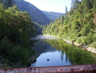
The North Fork Feather River is a watercourse of the northern Sierra Nevada in the U.S. state of California. It flows generally southwards from its headwaters near Lassen Peak to Lake Oroville, a reservoir formed by Oroville Dam in the foothills of the Sierra, where it runs into the Feather River. The river drains about 2,100 square miles (5,400 km2) of the western slope of the Sierras. By discharge, it is the largest tributary of the Feather.

The Clearwater River is in the northwestern United States, in north central Idaho. Its length is 74.8 miles (120.4 km), it flows westward from the Bitterroot Mountains along the Idaho-Montana border, and joins the Snake River at Lewiston. In October 1805, the Lewis and Clark Expedition descended the Clearwater River in dugout canoes, putting in at "Canoe Camp," five miles (8 km) downstream from Orofino; they reached the Columbia Bar and the Pacific Ocean about six weeks later.
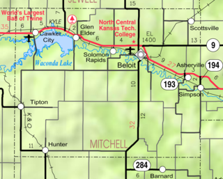
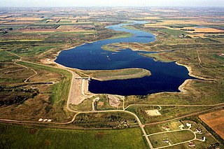
Waconda Lake, also known as Glen Elder Reservoir, is a reservoir in Mitchell County and Osborne County, Kansas, United States. Built and managed by the U.S. Bureau of Reclamation for flood control and irrigation, it is also used for recreation. Glen Elder State Park is located on its north shore.

Ruedi Reservoir is a reservoir on the West Slope of the Continental Divide on the Fryingpan River. It sits about 15 miles (24 km) upstream of the town of Basalt, Colorado, near Aspen. The reservoir is located within the White River National Forest, and straddles the county line between Pitkin County and Eagle County.

Cheney Reservoir is a reservoir on the North Fork Ninnescah River in Reno, Kingman, and Sedgwick counties of Kansas in the United States. Built and managed by the U.S. Bureau of Reclamation for local water supply, it is also used for flood control and recreation. Cheney State Park is located on its shore.

Gibson Dam is a concrete arch dam on the Sun River, a tributary of the Missouri River, about 60 miles (97 km) west of Great Falls, Montana in the United States. Located on the eastern edge of the Rocky Mountains, the dam was built by the U.S. Bureau of Reclamation (USBR) between 1926 and 1929 as part of the Sun River Project to develop about 93,000 acres (38,000 ha) of irrigated land in the Sun River Valley.
Willow Creek Dam is a dam in Lewis and Clark County, Montana.

South Fork Dam is a dam in Elko County, Nevada, in the northeastern part of the state, about fifteen miles south of the town of Elko.
Slab Creek Dam is a dam in the American River watershed of the central Sierra Nevada, within El Dorado County, California. It.


