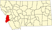
List of lakes in Ravalli County, Montana

Last updated
Map all coordinates using: OpenStreetMap  
Download coordinates as: KML  ·  GPX

There are at least 126 named lakes and reservoirs in Ravalli County, Montana .

Lake A body of relatively still water, in a basin surrounded by land

A lake is an area filled with water, localized in a basin, surrounded by land, apart from any river or other outlet that serves to feed or drain the lake. Lakes lie on land and are not part of the ocean, and therefore are distinct from lagoons, and are also larger and deeper than ponds, though there are no official or scientific definitions. Lakes can be contrasted with rivers or streams, which are usually flowing. Most lakes are fed and drained by rivers and streams.

Reservoir A storage space for fluids

A reservoir is, most commonly, an enlarged natural or artificial lake, pond or impoundment created using a dam or lock to store water.

Ravalli County, Montana U.S. county in Montana

Ravalli County is a county in the southwestern part of the U.S. state of Montana. As of the 2010 United States Census, the population was 40,212. Its county seat is Hamilton.

Contents

Lakes

Pass Lake

Pass Lake is a small lake located south of Loveland Pass in Summit County, Colorado. Pass Lake drains east via an unnamed stream which flows into North Fork Snake River. The Pass Lake Picnic Area is located by the lake.

Shelf Lake lake in Custer County, Idaho, USA

Shelf Lake is an alpine lake in Custer County, Idaho, United States, located in the White Cloud Mountains in the Sawtooth National Recreation Area. The lake is named for a distinct rock shelf extending around the south and west shores of the lake.

Reservoirs

Big Creek Lake is a municipal reservoir which serves as the main source of drinking water for the city of Mobile, Alabama and its suburbs. It was formed by the damming of Big Creek, a tributary of the Escatawpa River in southwest Alabama. The reservoir was the subject of controversy in the 1980s over freshwater rights between Alabama and Mississippi.

High Lake is a natural spring-fed lake in Marshall County, South Dakota within the Lake Traverse Indian Reservation.

Lake Como lake in Lombardy, Italy

Lake Como, also known as Lario, is a lake of glacial origin in Lombardy, Italy. It has an area of 146 square kilometres (56 sq mi), making it the third-largest lake in Italy, after Lake Garda and Lake Maggiore. At over 400 metres (1,300 ft) deep, it is the fifth deepest lake in Europe, and the deepest outside Norway; the bottom of the lake is more than 200 metres (660 ft) below sea level.

See also

Notes

  1. "Aichele Lake". Geographic Names Information System . United States Geological Survey.
  2. "Alpine Lakes". Geographic Names Information System . United States Geological Survey.
  3. "Bailey Lake". Geographic Names Information System . United States Geological Survey.
  4. "Baker Lake". Geographic Names Information System . United States Geological Survey.
  5. "Bear Lake". Geographic Names Information System . United States Geological Survey.
  6. "Big Creek Lakes". Geographic Names Information System . United States Geological Survey.
  7. "Big Grizzly Lake". Geographic Names Information System . United States Geological Survey.
  8. "Boulder Lake". Geographic Names Information System . United States Geological Survey.
  9. "Bryan Lake". Geographic Names Information System . United States Geological Survey.
  10. "Buck Lake". Geographic Names Information System . United States Geological Survey.
  11. "Burnt Fork Lake". Geographic Names Information System . United States Geological Survey.
  12. "Burrell Lake". Geographic Names Information System . United States Geological Survey.
  13. "Camas Lake". Geographic Names Information System . United States Geological Survey.
  14. "Canyon Lake". Geographic Names Information System . United States Geological Survey.
  15. "Capri Lake". Geographic Names Information System . United States Geological Survey.
  16. "Carmine Lake". Geographic Names Information System . United States Geological Survey.
  17. "Cave Lake". Geographic Names Information System . United States Geological Survey.
  18. "Chaffin Lake". Geographic Names Information System . United States Geological Survey.
  19. "Charity Lake". Geographic Names Information System . United States Geological Survey.
  20. "Dollar Lake". Geographic Names Information System . United States Geological Survey.
  21. "East Lake". Geographic Names Information System . United States Geological Survey.
  22. "Elk Lake". Geographic Names Information System . United States Geological Survey.
  23. "Esplin Lake". Geographic Names Information System . United States Geological Survey.
  24. "Faith Lake". Geographic Names Information System . United States Geological Survey.
  25. "Fish Lake". Geographic Names Information System . United States Geological Survey.
  26. "Fish Lake". Geographic Names Information System . United States Geological Survey.
  27. "Fool Hen Lake". Geographic Names Information System . United States Geological Survey.
  28. "Frog Pond Lake". Geographic Names Information System . United States Geological Survey.
  29. "Garrard Lake". Geographic Names Information System . United States Geological Survey.
  30. "Gem Lake". Geographic Names Information System . United States Geological Survey.
  31. "Glen Lake". Geographic Names Information System . United States Geological Survey.
  32. "Goat Lake". Geographic Names Information System . United States Geological Survey.
  33. "Hackney Lake". Geographic Names Information System . United States Geological Survey.
  34. "Hart Lake". Geographic Names Information System . United States Geological Survey.
  35. "Hauf Lake". Geographic Names Information System . United States Geological Survey.
  36. "Heinrich Lake". Geographic Names Information System . United States Geological Survey.
  37. "Hidden Lake". Geographic Names Information System . United States Geological Survey.
  38. "Hidden Lake". Geographic Names Information System . United States Geological Survey.
  39. "Hope Lake". Geographic Names Information System . United States Geological Survey.
  40. "Hope Lake". Geographic Names Information System . United States Geological Survey.
  41. "Ingomar Lake". Geographic Names Information System . United States Geological Survey.
  42. "Jerry Lake". Geographic Names Information System . United States Geological Survey.
  43. "Jerusalem Lake". Geographic Names Information System . United States Geological Survey.
  44. "Kelly Lake". Geographic Names Information System . United States Geological Survey.
  45. "Kent Lake". Geographic Names Information System . United States Geological Survey.
  46. "Kerlee Lake". Geographic Names Information System . United States Geological Survey.
  47. "Kidney Lake". Geographic Names Information System . United States Geological Survey.
  48. "Knaack Lake". Geographic Names Information System . United States Geological Survey.
  49. "Kneaves Lake". Geographic Names Information System . United States Geological Survey.
  50. "Kock Lake". Geographic Names Information System . United States Geological Survey.
  51. "Kramis Pond". Geographic Names Information System . United States Geological Survey.
  52. "Lake Capitan". Geographic Names Information System . United States Geological Survey.
  53. "Lake Crystal". Geographic Names Information System . United States Geological Survey.
  54. "Lake of the Rocks". Geographic Names Information System . United States Geological Survey.
  55. "Lake Turbid". Geographic Names Information System . United States Geological Survey.
  56. "Lappi Lake". Geographic Names Information System . United States Geological Survey.
  57. "Little Burnt Fork Lakes". Geographic Names Information System . United States Geological Survey.
  58. "Little Grizzly Lake". Geographic Names Information System . United States Geological Survey.
  59. "Little Rock Creek Lake". Geographic Names Information System . United States Geological Survey.
  60. "Lockwood Lake". Geographic Names Information System . United States Geological Survey.
  61. "Lomo Lake". Geographic Names Information System . United States Geological Survey.
  62. "Lookout Lake". Geographic Names Information System . United States Geological Survey.
  63. "Lost Horse Lake". Geographic Names Information System . United States Geological Survey.
  64. "Middle Fork Lakes". Geographic Names Information System . United States Geological Survey.
  65. "Middle Lake". Geographic Names Information System . United States Geological Survey.
  66. "Milepost Lake". Geographic Names Information System . United States Geological Survey.
  67. "Mills Lake". Geographic Names Information System . United States Geological Survey.
  68. "Mink Lake". Geographic Names Information System . United States Geological Survey.
  69. "Mud Lake". Geographic Names Information System . United States Geological Survey.
  70. "Mudhole Lake". Geographic Names Information System . United States Geological Survey.
  71. "Nelson Lake". Geographic Names Information System . United States Geological Survey.
  72. "North Kootenai Lake". Geographic Names Information System . United States Geological Survey.
  73. "North Totem Lake". Geographic Names Information System . United States Geological Survey.
  74. "Park Lake". Geographic Names Information System . United States Geological Survey.
  75. "Pass Lake". Geographic Names Information System . United States Geological Survey.
  76. "Pearl Lake". Geographic Names Information System . United States Geological Survey.
  77. "Peterson Lake". Geographic Names Information System . United States Geological Survey.
  78. "Piquett Lake". Geographic Names Information System . United States Geological Survey.
  79. "Ripple Lake". Geographic Names Information System . United States Geological Survey.
  80. "Saint Mary Lake". Geographic Names Information System . United States Geological Survey.
  81. "Shadow Lake". Geographic Names Information System . United States Geological Survey.
  82. "Shannon Lake". Geographic Names Information System . United States Geological Survey.
  83. "Shelf Lake". Geographic Names Information System . United States Geological Survey.
  84. "Slate Lake". Geographic Names Information System . United States Geological Survey.
  85. "South Bear Lake". Geographic Names Information System . United States Geological Survey.
  86. "South Fork Lake". Geographic Names Information System . United States Geological Survey.
  87. "South Fork Lakes". Geographic Names Information System . United States Geological Survey.
  88. "South Kootenai Lake". Geographic Names Information System . United States Geological Survey.
  89. "Sweeney Lake". Geographic Names Information System . United States Geological Survey.
  90. "Tag Alder Lake". Geographic Names Information System . United States Geological Survey.
  91. "Tamarack Lake". Geographic Names Information System . United States Geological Survey.
  92. "Tenmile Lake". Geographic Names Information System . United States Geological Survey.
  93. "Totem Peak Lake". Geographic Names Information System . United States Geological Survey.
  94. "Trapper Lake". Geographic Names Information System . United States Geological Survey.
  95. "Trout Lake". Geographic Names Information System . United States Geological Survey.
  96. "Twelvemile Lake". Geographic Names Information System . United States Geological Survey.
  97. "Twin Lakes". Geographic Names Information System . United States Geological Survey.
  98. "Two Lakes". Geographic Names Information System . United States Geological Survey.
  99. "Watchtower Lake". Geographic Names Information System . United States Geological Survey.
  100. "White Lake". Geographic Names Information System . United States Geological Survey.
  101. "Bass Lake". Geographic Names Information System . United States Geological Survey.
  102. "Big Creek Lake". Geographic Names Information System . United States Geological Survey.
  103. "Blodgett Lake". Geographic Names Information System . United States Geological Survey.
  104. "Burnt Fork Lake". Geographic Names Information System . United States Geological Survey.
  105. "Canyon Lake". Geographic Names Information System . United States Geological Survey.
  106. "Dam Creek Lake". Geographic Names Information System . United States Geological Survey.
  107. "Duffy Lake". Geographic Names Information System . United States Geological Survey.
  108. "Fish Lake". Geographic Names Information System . United States Geological Survey.
  109. "Fred Burr Lake". Geographic Names Information System . United States Geological Survey.
  110. "Fred Burr Reservoir". Geographic Names Information System . United States Geological Survey.
  111. "Gleason Lake". Geographic Names Information System . United States Geological Survey.
  112. "Hauf Lake". Geographic Names Information System . United States Geological Survey.
  113. "High Lake". Geographic Names Information System . United States Geological Survey.
  114. "Holloway Lake". Geographic Names Information System . United States Geological Survey.
  115. "Lake Como". Geographic Names Information System . United States Geological Survey.
  116. "Lower Twin Lake". Geographic Names Information System . United States Geological Survey.
  117. "Mill Lake". Geographic Names Information System . United States Geological Survey.
  118. "Painted Rocks Lake". Geographic Names Information System . United States Geological Survey.
  119. "Schoolmarm Lake". Geographic Names Information System . United States Geological Survey.
  120. "Sears Lake". Geographic Names Information System . United States Geological Survey.
  121. "Stevensville Reservoir". Geographic Names Information System . United States Geological Survey.
  122. "Tamarack Lake". Geographic Names Information System . United States Geological Survey.
  123. "Tin Cup Lake". Geographic Names Information System . United States Geological Survey.
  124. "Tin Cup Lake". Geographic Names Information System . United States Geological Survey.
  125. "Upper Twin Lake". Geographic Names Information System . United States Geological Survey.
  126. "Wyant Lake". Geographic Names Information System . United States Geological Survey.

Related Research Articles

Waterfalls of Montana Wikimedia list article

There are at least 120 named waterfalls in Montana. A waterfall is a place where flowing water rapidly drops in elevation as it flows over a steep region or a cliff. Waterfalls are most commonly formed when a river is young.