Name Location Date Listed Grid Ref. [note 1] Geo-coordinates Notes LB Number [note 2] Image Abbey Churchyard 56°32′38″N 3°15′53″W / 56.543768°N 3.264803°W / 56.543768; -3.264803 (Abbey Churchyard ) Category B 23127 3 Causewayend 56°32′45″N 3°16′07″W / 56.54576°N 3.268643°W / 56.54576; -3.268643 (3 Causewayend ) Category C(S) 23141 Cumberland (Or Yeomanry Barracks, 2 Calton Street 56°32′46″N 3°16′04″W / 56.54612°N 3.267712°W / 56.54612; -3.267712 (Cumberland (Or Yeomanry Barracks, 2 Calton Street ) Category B 23146 Union Bank Buildings And Bank House, Calton Street 56°32′50″N 3°15′59″W / 56.547301°N 3.266401°W / 56.547301; -3.266401 (Union Bank Buildings And Bank House, Calton Street ) Category B 23150 Keithick House 56°31′56″N 3°17′50″W / 56.532087°N 3.297144°W / 56.532087; -3.297144 (Keithick House ) Category A 6170 Arthurstone House, Sundial No. 2 In Front Of Summer-House 56°34′27″N 3°12′13″W / 56.574305°N 3.20353°W / 56.574305; -3.20353 (Arthurstone House, Sundial No. 2 In Front Of Summer-House ) Category C(S) 6159 Pleasance Farmhouse 56°32′23″N 3°16′00″W / 56.539858°N 3.266803°W / 56.539858; -3.266803 (Pleasance Farmhouse ) Category C(S) 23132 "Millburn", George Street 56°32′41″N 3°16′08″W / 56.54476°N 3.268886°W / 56.54476; -3.268886 ("Millburn", George Street ) Category B 23139 7 Gray Street 56°32′45″N 3°16′06″W / 56.545816°N 3.268417°W / 56.545816; -3.268417 (7 Gray Street ) Category B 23142 Keithick House, Stables And Steading 56°31′59″N 3°18′04″W / 56.533016°N 3.301126°W / 56.533016; -3.301126 (Keithick House, Stables And Steading ) Category B 6142 Wester Balgersho Farmhouse 56°31′48″N 3°16′53″W / 56.530104°N 3.281305°W / 56.530104; -3.281305 (Wester Balgersho Farmhouse ) Category C(S) 6146 Viewbank, Farmhouse 56°33′56″N 3°13′26″W / 56.565444°N 3.224014°W / 56.565444; -3.224014 (Viewbank, Farmhouse ) Category C(S) 6151 Arthurstone House, Summer-House In Walled Garden 56°34′28″N 3°12′13″W / 56.574331°N 3.20358°W / 56.574331; -3.20358 (Arthurstone House, Summer-House In Walled Garden ) Category C(S) 6158 Union Street, Town Hall Including Boundary Walls 56°32′49″N 3°15′56″W / 56.54695°N 3.265609°W / 56.54695; -3.265609 (Union Street, Town Hall Including Boundary Walls ) Category C(S) 51347 Upload another image
1 Calton Street 56°32′47″N 3°16′04″W / 56.54629°N 3.267766°W / 56.54629; -3.267766 (1 Calton Street ) Category C(S) 23148 "Dalblair", Union Street 56°32′48″N 3°16′00″W / 56.546543°N 3.266766°W / 56.546543; -3.266766 ("Dalblair", Union Street ) Category C(S) 23151 "Beech Hill Mansion House", Beech Hill Road 56°32′56″N 3°16′12″W / 56.548774°N 3.26998°W / 56.548774; -3.26998 ("Beech Hill Mansion House", Beech Hill Road ) Category B 23153 Ardler Manse (Formerly) 56°33′52″N 3°11′48″W / 56.564462°N 3.196611°W / 56.564462; -3.196611 (Ardler Manse (Formerly) ) Category B 6167 Keithick South Lodge 56°31′51″N 3°17′20″W / 56.530772°N 3.288839°W / 56.530772; -3.288839 (Keithick South Lodge ) Category B 6143 Bridge Of Couttie 56°33′09″N 3°17′07″W / 56.552371°N 3.285393°W / 56.552371; -3.285393 (Bridge Of Couttie ) Category B 6148 Larghan House 56°33′09″N 3°15′27″W / 56.552368°N 3.257607°W / 56.552368; -3.257607 (Larghan House ) Category B 6149 Isla Park 56°33′22″N 3°14′44″W / 56.556163°N 3.245694°W / 56.556163; -3.245694 (Isla Park ) Category B 6150 Y.W.C.A., Union Street, Former Original Secession Church 56°32′45″N 3°16′02″W / 56.545937°N 3.267104°W / 56.545937; -3.267104 (Y.W.C.A., Union Street, Former Original Secession Church ) Category B 23134 Masonic Buildings (St. John Operative No. 105), Gray Street 56°32′45″N 3°16′05″W / 56.545892°N 3.268062°W / 56.545892; -3.268062 (Masonic Buildings (St. John Operative No. 105), Gray Street ) Category B 23143 "Princeland", Blairgowrie Road 56°33′04″N 3°16′00″W / 56.551134°N 3.26679°W / 56.551134; -3.26679 ("Princeland", Blairgowrie Road ) Category B 23152 Keithick, North Lodge 56°32′08″N 3°18′25″W / 56.535533°N 3.307001°W / 56.535533; -3.307001 (Keithick, North Lodge ) Category B 6169 Arthurstone House, Sundial No. 3 In Front Of Greenhouse 56°34′28″N 3°12′10″W / 56.574439°N 3.202688°W / 56.574439; -3.202688 (Arthurstone House, Sundial No. 3 In Front Of Greenhouse ) Category B 6160 Arthurstone House Castle Folly And Greenhouse 56°34′28″N 3°12′10″W / 56.574529°N 3.202675°W / 56.574529; -3.202675 (Arthurstone House Castle Folly And Greenhouse ) Category B 6161 Arthurstone House, Dovecot 56°34′28″N 3°12′04″W / 56.574311°N 3.201073°W / 56.574311; -3.201073 (Arthurstone House, Dovecot ) Category B 6163 Arthurstone House, Sundial No. 1 At S.E. Front Of House 56°34′21″N 3°12′13″W / 56.572364°N 3.203583°W / 56.572364; -3.203583 (Arthurstone House, Sundial No. 1 At S.E. Front Of House ) Category B 5707 Royal Hotel, High Street And 2 George Street (Formerly Defiance Inn And Assembly Rooms) 56°32′43″N 3°16′03″W / 56.545277°N 3.267586°W / 56.545277; -3.267586 (Royal Hotel, High Street And 2 George Street (Formerly Defiance Inn And Assembly Rooms) ) Category B 23138 2 Hay Street 56°32′47″N 3°16′05″W / 56.546251°N 3.26809°W / 56.546251; -3.26809 (2 Hay Street ) Category B 23145 "Aviemore", Calton Street 56°32′49″N 3°16′01″W / 56.546854°N 3.267053°W / 56.546854; -3.267053 ("Aviemore", Calton Street ) Category C(S) 23149 Keithick House Sundial 56°32′00″N 3°17′58″W / 56.533249°N 3.299492°W / 56.533249; -3.299492 (Keithick House Sundial ) Category C(S) 6141 Kemphill, Farmhouse 56°32′39″N 3°17′33″W / 56.54405°N 3.292494°W / 56.54405; -3.292494 (Kemphill, Farmhouse ) Category C(S) 6144 Kinloch House, (Now Hotel) 56°35′07″N 3°11′38″W / 56.585304°N 3.194013°W / 56.585304; -3.194013 (Kinloch House, (Now Hotel) ) Category B 6154 Cistercian Abbey, Remains Of, Queen Street 56°32′35″N 3°15′52″W / 56.543133°N 3.264555°W / 56.543133; -3.264555 (Cistercian Abbey, Remains Of, Queen Street ) Category B 23125 Upload another image
The Steeple, Queen Street 56°32′41″N 3°15′59″W / 56.544659°N 3.266508°W / 56.544659; -3.266508 (The Steeple, Queen Street ) Category B 23128 Upload another image
18, 20, 22 Commercial Street 56°32′46″N 3°16′04″W / 56.545992°N 3.267887°W / 56.545992; -3.267887 (18, 20, 22 Commercial Street ) Category C(S) 23144 4, 6 Calton Street 56°32′47″N 3°16′03″W / 56.546293°N 3.267441°W / 56.546293; -3.267441 (4, 6 Calton Street ) Category B 23147 "Gartloch Bank", Bogside Road 56°32′52″N 3°16′28″W / 56.547867°N 3.274342°W / 56.547867; -3.274342 ("Gartloch Bank", Bogside Road ) Category B 23154 Kinloch House, Steading 56°35′04″N 3°11′45″W / 56.58445°N 3.195956°W / 56.58445; -3.195956 (Kinloch House, Steading ) Category B 6152 Abbey Church, Parish Church Of Coupar Angus, Queen Street 56°32′38″N 3°15′53″W / 56.543768°N 3.264803°W / 56.543768; -3.264803 (Abbey Church, Parish Church Of Coupar Angus, Queen Street ) Category B 23126 Upload another image
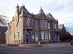
Strathmore Hotel, Queen Street 56°32′42″N 3°16′00″W / 56.54499°N 3.266584°W / 56.54499; -3.266584 (Strathmore Hotel, Queen Street ) Category B 23129 "Klydon House", Union Street 56°32′45″N 3°15′59″W / 56.545928°N 3.266258°W / 56.545928; -3.266258 ("Klydon House", Union Street ) Category B 23133 N.E. Corner, The Cross, Commercial Street And Union Street (Formerly 1 Commercial Street) 56°32′44″N 3°16′02″W / 56.545647°N 3.267338°W / 56.545647; -3.267338 (N.E. Corner, The Cross, Commercial Street And Union Street (Formerly 1 Commercial Street) ) Category C(S) 23136 Ardler Churchyard, Carmichael Enclosure 56°33′49″N 3°11′50″W / 56.563646°N 3.197317°W / 56.563646; -3.197317 (Ardler Churchyard, Carmichael Enclosure ) Category C(S) 6166 Kemphill, Steading 56°32′39″N 3°17′25″W / 56.544253°N 3.290208°W / 56.544253; -3.290208 (Kemphill, Steading ) Category C(S) 6145 Kinloch House, Walled Garden And Sundial 56°35′07″N 3°11′40″W / 56.585173°N 3.194514°W / 56.585173; -3.194514 (Kinloch House, Walled Garden And Sundial ) Category B 6153 Arthurstone House, 'Antiquarian Corner' At N.W. Corner Of Walled Garden 56°34′27″N 3°12′14″W / 56.574148°N 3.203949°W / 56.574148; -3.203949 (Arthurstone House, 'Antiquarian Corner' At N.W. Corner Of Walled Garden ) Category B 6162 Ardler Church 56°33′49″N 3°11′52″W / 56.563686°N 3.197807°W / 56.563686; -3.197807 (Ardler Church ) Category B 6164 Upload another image
Abbeyhill, Precinct Street 56°32′35″N 3°16′00″W / 56.542967°N 3.266761°W / 56.542967; -3.266761 (Abbeyhill, Precinct Street ) Category B 23130 S.E. Corner, The Cross, High Street And Union Street 56°32′44″N 3°16′02″W / 56.545487°N 3.267219°W / 56.545487; -3.267219 (S.E. Corner, The Cross, High Street And Union Street ) Category C(S) 23135 3 Commercial Street 56°32′45″N 3°16′03″W / 56.545746°N 3.267407°W / 56.545746; -3.267407 (3 Commercial Street ) Category B 23137 Ardler Churchyard, Railings And Gates 56°33′49″N 3°11′52″W / 56.563607°N 3.197674°W / 56.563607; -3.197674 (Ardler Churchyard, Railings And Gates ) Category C(S) 6165 Ardler (Formerly Washington) School 56°33′49″N 3°11′50″W / 56.563505°N 3.197085°W / 56.563505; -3.197085 (Ardler (Formerly Washington) School ) Category C(S) 6168 Balgersho House 56°31′55″N 3°16′02″W / 56.531822°N 3.267137°W / 56.531822; -3.267137 (Balgersho House ) Category B 6147 Arthurstone House 56°34′21″N 3°12′14″W / 56.572585°N 3.203931°W / 56.572585; -3.203931 (Arthurstone House ) Category B 6155 Arthurstone House, Ice-House 56°34′23″N 3°12′14″W / 56.573025°N 3.203962°W / 56.573025; -3.203962 (Arthurstone House, Ice-House ) Category C(S) 6156 Arthurstone House, Walled Garden 56°34′27″N 3°12′09″W / 56.574071°N 3.202628°W / 56.574071; -3.202628 (Arthurstone House, Walled Garden ) Category C(S) 6157