Name Location Date Listed Grid Ref. [note 1] Geo-coordinates Notes LB Number [note 2] Image Auchlochan Bridge 55°37′06″N 3°53′26″W / 55.618364°N 3.890596°W / 55.618364; -3.890596 (Auchlochan Bridge ) Category B 7688 Upload another image
Folkerton Mill 55°36′12″N 3°48′56″W / 55.603329°N 3.815692°W / 55.603329; -3.815692 (Folkerton Mill ) Category B 7695 Old Lesmahagow Church, And Graveyard 55°38′18″N 3°53′07″W / 55.638235°N 3.885325°W / 55.638235; -3.885325 (Old Lesmahagow Church, And Graveyard ) Category B 7675 Craignethan Castle 55°41′46″N 3°53′06″W / 55.696088°N 3.885006°W / 55.696088; -3.885006 (Craignethan Castle ) Category A 7677 Upload another image
West Hawksland 55°38′21″N 3°49′57″W / 55.639233°N 3.832526°W / 55.639233; -3.832526 (West Hawksland ) Category C(S) 7694 Birkwood, South Lodge And Gateway, New Trows Road 55°37′45″N 3°53′40″W / 55.62917°N 3.89442°W / 55.62917; -3.89442 (Birkwood, South Lodge And Gateway, New Trows Road ) Category B 7699 Lesmahagow Village, Royal Bank Of Scotland Including Boundary Walls And Gatepiers 55°38′24″N 3°53′12″W / 55.640076°N 3.886557°W / 55.640076; -3.886557 (Lesmahagow Village, Royal Bank Of Scotland Including Boundary Walls And Gatepiers ) Category B 7701 Kirkmuirhill Parish Church (United Presbyterian Church) Including Railings And Church Hall 55°39′53″N 3°54′36″W / 55.66486°N 3.909897°W / 55.66486; -3.909897 (Kirkmuirhill Parish Church (United Presbyterian Church) Including Railings And Church Hall ) Category C(S) 48138 Turfholm Bridge 55°38′03″N 3°53′11″W / 55.63429°N 3.886438°W / 55.63429; -3.886438 (Turfholm Bridge ) Category C(S) 7676 Corra Castle 55°39′12″N 3°46′40″W / 55.653319°N 3.777872°W / 55.653319; -3.777872 (Corra Castle ) Category A 7680 Upload another image
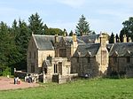
Clydevale 55°42′05″N 3°51′59″W / 55.701372°N 3.866259°W / 55.701372; -3.866259 (Clydevale ) Category B 7686 81/83 Lanark Road Crossford Village 55°41′55″N 3°52′06″W / 55.698562°N 3.868417°W / 55.698562; -3.868417 (81/83 Lanark Road Crossford Village ) Category C(S) 7687 Birkhill, Including Stable Wing 55°36′00″N 3°50′41″W / 55.600135°N 3.84483°W / 55.600135; -3.84483 (Birkhill, Including Stable Wing ) Category B 7692 Birkwood House 55°37′59″N 3°53′22″W / 55.632951°N 3.889344°W / 55.632951; -3.889344 (Birkwood House ) Category B 7698 Auchenheath House Including Coach House, Garden Terraces And Balustrades, South Entrance Gatepiers And Walls 55°40′15″N 3°54′00″W / 55.670882°N 3.900014°W / 55.670882; -3.900014 (Auchenheath House Including Coach House, Garden Terraces And Balustrades, South Entrance Gatepiers And Walls ) Category B 51053 162 Riverside Road, Kirkfieldbank 55°40′30″N 3°48′25″W / 55.674893°N 3.807063°W / 55.674893; -3.807063 (162 Riverside Road, Kirkfieldbank ) Category C(S) 44600 Douglasmouth Bridge 55°37′51″N 3°45′55″W / 55.630773°N 3.765334°W / 55.630773; -3.765334 (Douglasmouth Bridge ) Category B 7689 Stables, Harperfield 55°38′18″N 3°45′47″W / 55.638303°N 3.762924°W / 55.638303; -3.762924 (Stables, Harperfield ) Category C(S) 7691 Lesmahagow Village, Old Roadbridge West Of Milton Road/Carlisle Junction At Ngr 8145 4054 55°38′38″N 3°53′06″W / 55.643927°N 3.885074°W / 55.643927; -3.885074 (Lesmahagow Village, Old Roadbridge West Of Milton Road/Carlisle Junction At Ngr 8145 4054 ) Category B 7703 West Toun, Coalburn, Statue Of A Highlander 55°35′01″N 3°51′39″W / 55.583698°N 3.860861°W / 55.583698; -3.860861 (West Toun, Coalburn, Statue Of A Highlander ) Category B 13402 Lesmahagow Village, Abbeygreen Free Church of Scotland and Manse Including Boundary Walls And Gatepiers 55°38′27″N 3°53′12″W / 55.640775°N 3.886718°W / 55.640775; -3.886718 (Lesmahagow Village, Abbeygreen Free Church of Scotland and Manse Including Boundary Walls And Gatepiers ) Category B 11729 Off New Trows Road, Birkwood South Driveway Bridge 55°37′49″N 3°53′39″W / 55.630189°N 3.894231°W / 55.630189; -3.894231 (Off New Trows Road, Birkwood South Driveway Bridge ) Category C(S) 11726 Dovecot, Blackwood House 55°40′06″N 3°56′55″W / 55.668249°N 3.948701°W / 55.668249; -3.948701 (Dovecot, Blackwood House ) Category B 7678 Corehouse, Dovecot 55°39′13″N 3°46′54″W / 55.653659°N 3.781702°W / 55.653659; -3.781702 (Corehouse, Dovecot ) Category C(S) 7681 Crossford Bridge 55°41′51″N 3°52′01″W / 55.697514°N 3.867014°W / 55.697514; -3.867014 (Crossford Bridge ) Category B 7684 Greenrig 55°39′34″N 3°49′09″W / 55.659375°N 3.819065°W / 55.659375; -3.819065 (Greenrig ) Category B 7693 Nos 15-19 Bereholm, Lesmahagow 55°38′14″N 3°53′06″W / 55.637312°N 3.885121°W / 55.637312; -3.885121 (Nos 15-19 Bereholm, Lesmahagow ) Category B 7696 Lesmahagow Village, Old Bridge West Of Milton Road At Ngr Ns 8148 4044 55°38′35″N 3°53′04″W / 55.642992°N 3.884552°W / 55.642992; -3.884552 (Lesmahagow Village, Old Bridge West Of Milton Road At Ngr Ns 8148 4044 ) Category B 7700 Corehouse Conservatory And Flower Garden Walls, Gatepiers And Gates 55°39′17″N 3°46′53″W / 55.654678°N 3.781478°W / 55.654678; -3.781478 (Corehouse Conservatory And Flower Garden Walls, Gatepiers And Gates ) Category B 51595 Corehouse Stable Court Including Gatepiers And Boundary Wall 55°39′10″N 3°46′57″W / 55.652685°N 3.782596°W / 55.652685; -3.782596 (Corehouse Stable Court Including Gatepiers And Boundary Wall ) Category B 51596 Corehouse, Mausoleum 55°39′23″N 3°46′59″W / 55.65647°N 3.783117°W / 55.65647; -3.783117 (Corehouse, Mausoleum ) Category C(S) 7682 Harperfield 55°38′17″N 3°45′42″W / 55.638025°N 3.761625°W / 55.638025; -3.761625 (Harperfield ) Category B 7690 Stonebyres Coach House And Adjoining Buildings 55°40′20″N 3°50′42″W / 55.672252°N 3.844979°W / 55.672252; -3.844979 (Stonebyres Coach House And Adjoining Buildings ) Category B 7697 Corehouse Stove House (Or Vinery) 55°39′19″N 3°46′54″W / 55.655178°N 3.781692°W / 55.655178; -3.781692 (Corehouse Stove House (Or Vinery) ) Category C(S) 51597 185 New Trows Road, Birkwood, West Lodge 55°38′01″N 3°53′35″W / 55.633577°N 3.893076°W / 55.633577; -3.893076 (185 New Trows Road, Birkwood, West Lodge ) Category B 11725 Abbeygreen Road, Birkwood, Driveway Bridge Over River Nethan 55°38′03″N 3°53′11″W / 55.63429°N 3.886438°W / 55.63429; -3.886438 (Abbeygreen Road, Birkwood, Driveway Bridge Over River Nethan ) Category B 11727 Birkwood, Walled Garden 55°37′59″N 3°53′08″W / 55.633182°N 3.885447°W / 55.633182; -3.885447 (Birkwood, Walled Garden ) Category B 11728 Corehouse 55°39′17″N 3°46′41″W / 55.654846°N 3.777973°W / 55.654846; -3.777973 (Corehouse ) Category A 7679 Upload another image
No. 1 Braidwood Road, Crossford 55°41′52″N 3°52′04″W / 55.697683°N 3.867675°W / 55.697683; -3.867675 (No. 1 Braidwood Road, Crossford ) Category B 7685 Lesmahagow Village, Milton Bridge, A74 55°38′40″N 3°53′07″W / 55.644518°N 3.885245°W / 55.644518; -3.885245 (Lesmahagow Village, Milton Bridge, A74 ) Category B 7702