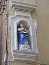
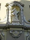
List of monuments in Senglea

Last updated

This is a list of monuments in Senglea , Malta, which are listed on the National Inventory of the Cultural Property of the Maltese Islands. [1] [2]

List

Name of objectLocationCoordinatesIDPhotoUpload
Niche the Nativity of the MadonnaMina ta' Sant' Anna 35°53′06″N14°31′10″E / 35.884887°N 14.519334°E / 35.884887; 14.519334 (Niche the Nativity of the Madonna) 00682 Nicpmi-00682-1.jpg Missing-monuments-image.svg
Parish Church of the Nativity of the Madonna Misraħ il-Papa Benedittu XV 35°53′08″N14°31′05″E / 35.885688°N 14.517940°E / 35.885688; 14.517940 (Parish Church of the Nativity of the Madonna) 00683 Sudika Isla basilica.jpg Missing-monuments-image.svg
Niche of the Madonna of Mount CarmelTriq L-Oratorju 35°53′08″N14°31′04″E / 35.885575°N 14.517863°E / 35.885575; 14.517863 (Niche of the Madonna of Mount Carmel) 00684 Nicpmi-00684-1.jpg Missing-monuments-image.svg
Niche of St Paul29 Triq il-Vitorja c/w Triq San Pietru u San Pawl 35°53′12″N14°31′04″E / 35.886581°N 14.517706°E / 35.886581; 14.517706 (Niche of St Paul) 00685 Nicpmi-00685-1.jpg Missing-monuments-image.svg
Niche of St. PeterTriq il-Vitorja c/w Triq San Pietru u San Pawl 35°53′12″N14°31′05″E / 35.886613°N 14.517972°E / 35.886613; 14.517972 (Niche of St. Peter) 00686 Nicpmi-00686-1.jpg Missing-monuments-image.svg
Niche of St. Paul28 Triq il-Vitorja c/w Triq San Pietru u San Pawl 35°53′12″N14°31′04″E / 35.886533°N 14.517752°E / 35.886533; 14.517752 (Niche of St. Paul) 00687 Nicpmi-00687-1.jpg Missing-monuments-image.svg
Statue of St JosephTriq il-Mina tax-Xatt c/w 265 Triq iż-Żewġ Mini 35°53′14″N14°31′04″E / 35.887227°N 14.517870°E / 35.887227; 14.517870 (Statue of St Joseph) 00688 Nicpmi-00688-2.jpg Missing-monuments-image.svg
Niche of St PaulTriq San Ġiljan c/w Triq iż-Żewġ Mini 35°53′15″N14°31′03″E / 35.887529°N 14.517575°E / 35.887529; 14.517575 (Niche of St Paul) 00689 Nicpmi-00689-1.jpg Missing-monuments-image.svg
Church of St. JulianTriq San Ġiljan c/w Triq iż-Żewġ Mini 35°53′15″N14°31′04″E / 35.887517°N 14.517660°E / 35.887517; 14.517660 (Church of St. Julian) 00690 Nicpmi-00690-01 2019 October 16.jpg Missing-monuments-image.svg
Statue of the Madonna and ChildMisraħ L-Erbgħa ta'Settembru 35°53′16″N14°31′01″E / 35.887701°N 14.517040°E / 35.887701; 14.517040 (Statue of the Madonna and Child) 00691 Nicpmi-00691-1.jpg Missing-monuments-image.svg
Statue of St. Michael the ArchangelTriq San Mikiel c/w Triq is-Sur 35°53′16″N14°30′57″E / 35.887873°N 14.515866°E / 35.887873; 14.515866 (Statue of St. Michael the Archangel) 00692 Nicpmi-00692-1.jpg Missing-monuments-image.svg
Niche of the Immaculate ConceptionTriq il-Ponta c/w Triq id-Duluri 35°53′18″N14°30′57″E / 35.888288°N 14.515880°E / 35.888288; 14.515880 (Niche of the Immaculate Conception) 00693 Nicpmi-00693-2.jpg Missing-monuments-image.svg
Niche of the Madonna of Sorrows25 Triq id-Duluri 35°53′17″N14°30′57″E / 35.888113°N 14.515779°E / 35.888113; 14.515779 (Niche of the Madonna of Sorrows) 00694 Nicpmi-00694-2.jpg Missing-monuments-image.svg
Niche of the Madonna of SorrowsTriq il-Vitorja c/w Triq id-Duluri 35°53′19″N14°30′59″E / 35.888478°N 14.516314°E / 35.888478; 14.516314 (Niche of the Madonna of Sorrows) 00695 Nicpmi-00695-1.jpg Missing-monuments-image.svg
Niche of the Sacred Heart of JesusTriq Sant'Anġlu 35°53′20″N14°30′56″E / 35.888895°N 14.515607°E / 35.888895; 14.515607 (Niche of the Sacred Heart of Jesus) 00696 Nicpmi-00696-2.jpg Missing-monuments-image.svg
Niche of the Madonna of SorrowsTriq il-Ponta c/w Triq San Franġisk 35°53′21″N14°30′55″E / 35.889045°N 14.515312°E / 35.889045; 14.515312 (Niche of the Madonna of Sorrows) 00697 Nicpmi-00697-2.jpg Missing-monuments-image.svg
Niche of St. Philip NeriPjazza Francesco Zahra 35°53′22″N14°30′56″E / 35.889538°N 14.515419°E / 35.889538; 14.515419 (Niche of St. Philip Neri) 00698 Nicpmi-00698-3.jpg Missing-monuments-image.svg
Niche of the Madonna of LourdesTriq iż-Żewġ Mini c/w Triq il-Grigal 35°53′24″N14°30′55″E / 35.889947°N 14.515263°E / 35.889947; 14.515263 (Niche of the Madonna of Lourdes) 00699 Nicpmi-00699-3.jpg Missing-monuments-image.svg
Church of the Madonna of Safe HavensTriq iż-Żewġ Mini c/w Triq il-Grigal 35°53′23″N14°30′55″E / 35.889699°N 14.515280°E / 35.889699; 14.515280 (Church of the Madonna of Safe Havens) 00700 St Philip church Isla.jpg Missing-monuments-image.svg
Niche of the Madonna of Safe HavensTriq is-Sirena 35°53′26″N14°30′53″E / 35.890477°N 14.514711°E / 35.890477; 14.514711 (Niche of the Madonna of Safe Havens) 00701 Nicpmi-00701-01.jpg Missing-monuments-image.svg
Niche of the Crucified ChristIl-Ponta ta' L-Isla 35°53′27″N14°30′50″E / 35.890717°N 14.513884°E / 35.890717; 14.513884 (Niche of the Crucified Christ) 00702 Nicpmi-00702-4.jpg Missing-monuments-image.svg
Niche of the Madonna of LourdesXatt Juan B. Azopardo 35°53′24″N14°30′59″E / 35.889925°N 14.516376°E / 35.889925; 14.516376 (Niche of the Madonna of Lourdes) 00703 Nicpmi-00703-5.jpg Missing-monuments-image.svg
Niche of the Madonna of Lourdes97 Triq San Ġużepp 35°53′13″N14°31′07″E / 35.887066°N 14.518479°E / 35.887066; 14.518479 (Niche of the Madonna of Lourdes) 00704 Nicpmi-00704-3.jpg Missing-monuments-image.svg
Senglea Senglea 35°53′16″N14°31′02″E / 35.887712°N 14.517094°E / 35.887712; 14.517094 (Senglea) 01496 L-Isla.jpg Missing-monuments-image.svg
St Michael BastionTriq il-Mons. Penzavecchia 35°53′04″N14°31′08″E / 35.884492°N 14.518904°E / 35.884492; 14.518904 (St Michael Bastion) 01497 Fort Saint Michael - Senglea.jpg Missing-monuments-image.svg
St Michael Cavalier Bastion św. Michała 35°53′05″N14°31′08″E / 35.884682°N 14.518752°E / 35.884682; 14.518752 (St Michael Cavalier) 01498 Fort Saint Michael Tower - Senglea.jpg Missing-monuments-image.svg
Casemated rampart with Main GateMisraħ Ġorġ Mitrovich 35°53′06″N14°31′10″E / 35.885010°N 14.519422°E / 35.885010; 14.519422 (Casemated rampart with Main Gate) 01499 Malta-city-wall.jpg Missing-monuments-image.svg
The SpurIl-Ponta ta' L-Isla 35°53′26″N14°30′51″E / 35.890658°N 14.514059°E / 35.890658; 14.514059 (The Spur) 01500 7ina.jpg Missing-monuments-image.svg
Grunenburg's sea-level batteryIl-Ponta ta' L-Isla 35°53′27″N14°30′52″E / 35.890736°N 14.514503°E / 35.890736; 14.514503 (Grunenburg's sea-level battery) 01501 Malta - Senglea - The Spur - Lower Spur Battery 01 ies.jpg Missing-monuments-image.svg
Enceinte along Corradino sideTriq is-Sur (from The Spur to Saint Michael Bastion) 35°53′13″N14°30′59″E / 35.887008°N 14.516516°E / 35.887008; 14.516516 (Enceinte along Corradino side) 01502 Valletta , Malta - panoramio (1).jpg Missing-monuments-image.svg
Platform to the rear of The SpurIl-Ponta ta' L-Isla / Triq is-Sirena 35°53′26″N14°30′53″E / 35.890513°N 14.514763°E / 35.890513; 14.514763 (Platform to the rear of The Spur) 01503 Missing-monuments-image.svg
Casemated rampart on left extremity of landfront (il- Maċina)Il-Maċina 35°53′07″N14°31′11″E / 35.885383°N 14.519835°E / 35.885383; 14.519835 (Casemated rampart on left extremity of landfront (il- Maċina)) 01504 Malta - Senglea - Sheer Bastion (Triq San Lawrenz) 01 ies.jpg Missing-monuments-image.svg
St Anne GateMisraħ Ġorġ Mitrovich 35°53′05″N14°31′10″E / 35.884852°N 14.519359°E / 35.884852; 14.519359 (St Anne Gate) 01505 St Anne Gate.jpg Missing-monuments-image.svg
Curtain near St Michael Bastion 35°53′05″N14°31′06″E / 35.884604°N 14.518333°E / 35.884604; 14.518333 (Curtain near St Michael Bastion) 01506 Missing-monuments-image.svg

Related Research Articles

Fort Ricasoli Historic fort on Malta

Fort Ricasoli is a bastioned fort in Kalkara, Malta, which was built by the Order of Saint John between 1670 and 1698. The fort occupies a promontory known as Gallows' Point and the north shore of Rinella Bay, commanding the entrance to the Grand Harbour along with Fort Saint Elmo. It is not only the largest fort in Malta but also the largest in Europe, and it has been on the tentative list of UNESCO World Heritage Sites since 1998, as part of the Knights' Fortifications around the Harbours of Malta.

Sacred Heart of Jesus Church, Fontana Church in Fontana, Malta

The Sacred Heart of Jesus Church is in Fontana, Gozo Island, part of the Maltese Archipelago. It is the parish church of Fontana, one of the smallest villages on the island.

Cottonera Lines

The Cottonera Lines, also known as the Valperga Lines, are a line of fortifications in Cospicua and Birgu, Malta. They were built in the 17th and 18th centuries to form the outer defences of the Three Cities of Birgu, Senglea and Cospicua. They surrounded an earlier line of fortifications, known as the Santa Margherita Lines.

Floriana Lines Line of fortifications in Floriana, Malta

The Floriana Lines are a line of fortifications in Floriana, Malta, which surround the fortifications of Valletta and form the capital city's outer defences. Construction of the lines began in 1636 and they were named after the military engineer who designed them, Pietro Paolo Floriani. The Floriana Lines were modified throughout the course of the 17th and 18th centuries, and they saw use during the French blockade of 1798–1800. Today, the fortifications are still largely intact but rather dilapidated and in need of restoration.

Cittadella (Gozo) Citadel in Victoria, Gozo, Malta

The Cittadella, also known as the Castello, is the citadel of Victoria on the island of Gozo, Malta. The area has been inhabited since the Bronze Age, and the site now occupied by the Cittadella is believed to have been the acropolis of the Punic-Roman city of Gaulos or Glauconis Civitas.

St Francis of Assisi Church, Valletta Church in Valletta, Malta

St Francis of Assisi Church, dedicated to St Francis of Assisi, in Valletta, was built in 1598 and was completed by 1607.

St Augustine Church, Valletta Church in Valletta, Malta

St Augustine Church is one of the churches built during the creation of the new city of Valletta, Malta.
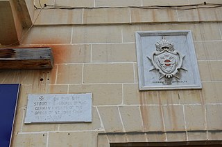
Auberge dAllemagne, Birgu

The Auberge d'Allemagne was an auberge in Birgu, Malta. It was built in the 16th century to house knights of the Order of Saint John from the langue of Germany.
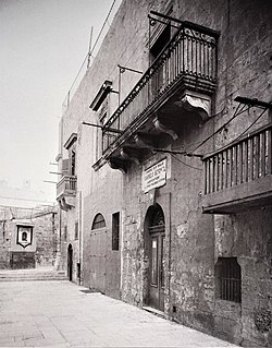
Auberge dItalie, Birgu

The Auberge d'Italie was an auberge in Birgu, Malta. It was built in the sixteenth century to house knights of the Order of Saint John from the langue of Italy.
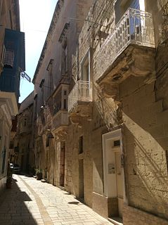
Auberge dAragon, Birgu Auberge in Birgu, Malta

The Auberge d'Aragon is an auberge in Birgu, Malta. It was built in the 16th century to house knights of the Order of Saint John from the langue of Aragon, Navarre and Catalonia.

Auberge de Castille et Portugal

The Auberge de Castille et Portugal was an auberge in Birgu, Malta. It was built to house knights of the Order of Saint John from the langue of Castille, León and Portugal.

Church of Saint Barbara, Valletta Church in Valletta, Malta

The Church of St Barbara is a Roman Catholic church situated in Valletta, Malta. The church was built to service the spiritual needs of the knights of Provence.
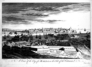
Santa Margherita Lines Line of fortifications in Cospicua, Malta

The Santa Margherita Lines, also known as the Firenzuola Lines, are a line of fortifications in Cospicua, Malta. They were built in the 17th and 18th centuries to protect the land front defences of the cities of Birgu and Senglea. A second line of fortifications, known as the Cottonera Lines, was later built around the Santa Margherita Lines, while the city of Cospicua was founded in the 18th century within the Santa Margherita and Cottonera Lines.

Fortifications of Valletta Defensive walls in Valletta, Malta

The fortifications of Valletta are a series of defensive walls and other fortifications which surround Valletta, the capital city of Malta. The first fortification to be built was Fort Saint Elmo in 1552, but the fortifications of the city proper began to be built in 1566 when it was founded by Grand Master Jean de Valette. Modifications were made throughout the following centuries, with the last major addition being Fort Lascaris which was completed in 1856. Most of the fortifications remain largely intact today.
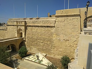
Fortifications of Birgu

The fortifications of Birgu are a series of defensive walls and other fortifications which surround the city of Birgu, Malta. The first fortification to be built was Fort Saint Angelo in the Middle Ages, and the majority of the fortifications were built between the 16th and 18th centuries by the Order of Saint John. Most of the fortifications remain largely intact today.

Fortifications of Senglea

The fortifications of Senglea are a series of defensive walls and other fortifications which surround the city of Senglea, Malta. The first fortification to be built was Fort Saint Michael in 1552, and the majority of the fortifications were built over the next decade when it was founded by Grand Master Claude de la Sengle. Modifications continued until the 18th century, but large parts of the fortifications were demolished between the 19th and 20th centuries. Today, all that remain of Senglea's fortifications are the seaward bastions and part of the land front.
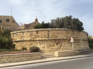
Saint George Redoubt

Saint George Redoubt is a redoubt in Birżebbuġa, Malta. It was built in 1714–1716 by the Order of Saint John as one of a series of coastal fortifications around the Maltese Islands, and it got its name from a chapel dedicated to St. George which was incorporated within the redoubt. Today, the redoubt and chapel still exist and they are in good condition.

National Inventory of the Cultural Property of the Maltese Islands

The National Inventory of the Cultural Property of the Maltese Islands (NICPMI) is a heritage register listing the cultural property of Malta. The inventory includes properties such as archaeological sites, fortifications, religious buildings, monuments and other buildings. The NICPMI is under the responsibility of the Superintendence of Cultural Heritage (SCH), which was founded in 2002 to replace the Antiquities Act. The NICPMI was established on 16 December 2011.

References

  1. "National Inventory Register". National Inventory of the Cultural Property of the Maltese Islands. 27 August 2012. Archived from the original on 12 September 2016.
  2. Terribile, Tony (2000). Niċeċ u Statwi fit-Toroq Maltin. Malta: Publikazzjoni Indipendenza (PIN). ISBN   9789990941784. OCLC   48920678.