
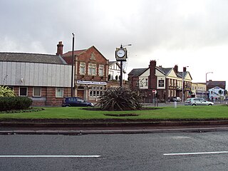
Bidston is a village and civil parish in the Metropolitan Borough of Wirral in Merseyside, England.
Moreton is a town in the Metropolitan Borough of Wirral in Merseyside, England. It is located approximately 3 mi (4.8 km) to the west of Wallasey. Historically part of Cheshire, it is now within the Metropolitan Borough of Wirral. The town was divided in 2004 between the local government wards of Leasowe & Moreton East and Moreton West & Saughall Massie. Moreton is also part of the parliamentary constituency of Wallasey.

Bidston Windmill is situated on Bidston Hill, near Birkenhead, on the Wirral Peninsula, England.
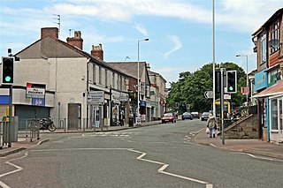
Upton is a village in the northern part of the Wirral Peninsula, England, and is situated within 4 miles (6.4 km) of Birkenhead, 4 miles (6.4 km) of the Dee Estuary, a similar distance from the River Mersey, and 2 miles (3.2 km) from Liverpool Bay. The village is a ward of the Metropolitan Borough of Wirral in the metropolitan county of Merseyside. Upton was in the traditional county of Cheshire. At the 2011 census, the population was 16,130.

The Wirral Railway was a railway network in the northern part of the Wirral Peninsula, England. Its route was from Birkenhead Park in the east of the Wirral to West Kirby in the west. A branch off this line at Bidston went north to Secombe and New Brighton. It was incorporated in 1863 as the Hoylake Railway, running from Hoylake to Birkenhead Docks. After changes of name and of ownership, it was purchased by the Wirral Railway Company Limited in 1884. The network was extended to West Kirby, New Brighton, and Seacombe, and to Birkenhead Park station where it joined the Mersey Railway, enabling through trains through the Mersey Railway Tunnel to Liverpool. In the 1923 grouping the Wirral company became part of the London, Midland and Scottish Railway, which electrified the line in 1938, allowing passenger services to be integrated with the Liverpool urban system. Most of the Wirral Railway network is still in use today as part of the Wirral Line of the Merseyrail rail network.
The North Wales and Liverpool Railway (NWLR), was the name given to the joint committee formed to construct a railway between Bidston, on the Wirral Railway and Hawarden on the Manchester, Sheffield and Lincolnshire Railway's (MSLR) Chester & Connah's Quay Railway from Chester to its link with the Wrexham, Mold and Connah's Quay Railway (WMCQR): the committee was between the two latter Railways. When the WMCQR went into receivership in 1897 the MSLR bought the combined WMCQR and the Bidston extension. The committee was dissolved in 1904.

The Wirral Peninsula, known locally as the Wirral, is a peninsula in North West England. The roughly rectangular peninsula is about 15 miles (24 km) long and 7 miles (11 km) wide, and is bounded by the Dee Estuary to the west, the Mersey Estuary to the east, and Liverpool Bay to the north.

Bidston railway station serves the village of Bidston, Merseyside, England. The station is situated at a junction of the West Kirby branch of the Wirral line, which is part of the Merseyrail network; it also serves as the northern terminus for the Borderlands line from Wrexham Central, with services operated by Transport for Wales.

Bidston Hill is 100 acres (0.40 km2) of heathland and woodland containing historic buildings and ancient rock carvings, on the Wirral Peninsula, near the Birkenhead suburb of Bidston, in Merseyside, England. With a peak of 231 feet (70 m), Bidston Hill is one of the highest points on the Wirral. The land was part of Sir Robert Vyner's estate and purchased by Birkenhead Corporation in 1894 for use by the public.

Upton railway station serves the village of Upton and the Noctorum area of Birkenhead, on the Wirral Peninsula, England. The station is situated on the Borderlands line. Transport for Wales operates the station and all trains serving it.

Heswall railway station is a railway station on the eastern edge of the town of Heswall on the Wirral Peninsula in England. It is on the Borderlands Line. The station and all trains serving it are operated by Transport for Wales. In 2008 the station was refurbished. The station was previously known as Heswall Hills, as there was previously another station serving Heswall, on the Birkenhead Railway's branch line from West Kirby to Hooton, that is now a footpath known as the Wirral Way.
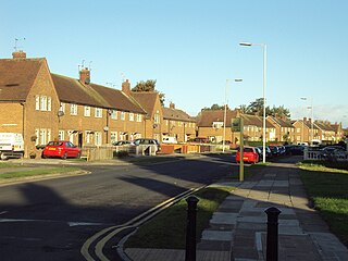
Woodchurch is an area of Birkenhead on the Wirral Peninsula, in England. Administratively, Woodchurch is within the Metropolitan Borough of Wirral, its parliamentary constituency is Wirral West, and its local council ward is Upton. At the 2001 Census, it had a population of 8,400. Woodchurch is dominated by a large housing development, known as the Woodchurch Estate. The district is served by several schools and has the major Arrowe Park Hospital just outside its boundary, which was built on 15 acres (61,000 m2) of the park itself and opened in 1982.

Noctorum is a suburb of Birkenhead, Merseyside, England. Administratively it is within the Metropolitan Borough of Wirral as part of Claughton Ward. Noctorum is in the north east of the Wirral Peninsula, bounded by the Beechwood estate to the north, Claughton and Oxton to the east and south east, and the River Fender and M53 motorway to the west.

Frankby is a village and former civil parish, in the Wirral district, in Merseyside, England. It is located on the Wirral Peninsula between Greasby and Newton on the outskirts of the town of West Kirby and south of Hoylake. The hamlet of Larton is to the north west. Historically within the county of Cheshire, it is part of the Greasby, Frankby and Irby Ward and is in the parliamentary constituency of Wirral West.

Flaybrick Memorial Gardens is a memorial garden, formerly a municipal cemetery called Flaybrick Hill Cemetery, in Birkenhead, on the Wirral Peninsula, England. The cemetery has been designated a conservation area by Wirral Borough Council, which owns the site.
Beechwood is a proposed railway station situated between Bidston and Upton on the Borderlands Line, to serve the Beechwood area of Birkenhead.

National Cycle Network (NCN) Route 56 is a Sustrans National Route that runs from Chester to Liverpool. The route utilises country lanes, a former railway trackbed, a coastal path and a seaside promenade.

Beechwood is a housing estate in the west of Birkenhead, on the Wirral Peninsula, in Merseyside, England. Administratively it is within the Metropolitan Borough of Wirral as part of Bidston and St James Ward. The area is bounded by Bidston to the north, Upton to the west and Noctorum to the south. The elevation of Bidston Hill is immediately to the east.